1980s Maps of Blaine County, Montana
Explore 58 historic maps of Blaine County from the 1980s. These maps offer a rare glimpse into what life looked like during the 1980s — showing old roads, neighborhoods, homes, and landmarks that have changed or disappeared over time.
Whether you're researching your family's past, planning a metal detecting trip, or studying how Blaine County's landscape evolved across the 1980s, these high-resolution maps are a powerful tool for exploring the history of this region.
- Focus on a specific era: All maps on this page are from the 1980s, giving you a focused view of this time period.
- See what’s changed: Compare century-old streets, trails, and buildings to today's modern landscape using overlays and satellite layers.
- Research with precision: Use these maps for genealogy, historical research, land use analysis, or educational projects.
- View, download, or print: Maps are fully viewable online in high resolution, and can be downloaded or printed for your own records.
Start exploring Blaine County's history through authentic maps from the 1980s. This is your window into the past.
Blaine County, MT maps
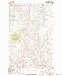
(58)- 1984 Map of Richmond Reservoir
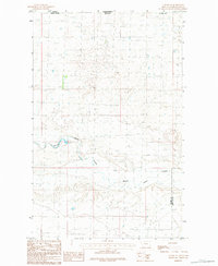
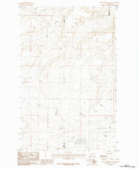
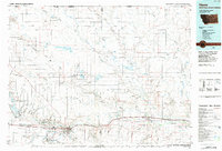
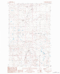
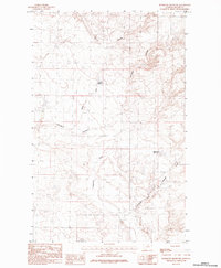 1984 Richmond Reservoir1984 Print · USGSBlaine County ranchlands come into focus during the early eighties, showcasing a remote landscape shaped by essential water and transit infrastructure. Researchers can trace the drainages of Chouteau Coulee while locating the landing strip and Richmond Reservoir.
 - 1984 Map of Hogeland SE
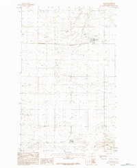
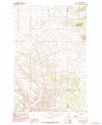
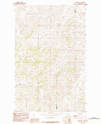
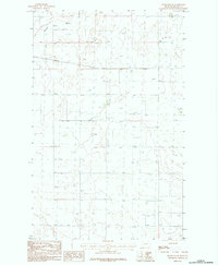 1984 Hogeland SE1984 Print · USGSBlaine County's high plains are captured in the mid-1980s, showing a landscape shaped by rural utility and agriculture. Researchers can locate infrastructure such as the Sub Sta and trace the drainage of Murray Coulee or find local Gravel Pits.
 - 1984 Map of Chapman NW
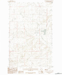
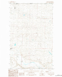 1984 Chapman NW1984 Print · USGSNorthern Phillips County meets the international border in the early eighties, showcasing a vast prairie landscape defined by its waterways and boundaries. Researchers can trace the path of Woody Island Coulee and locate the exact corner where Blaine Co and Phillips Co meet the United States-Canada line.
 - 1984 Map of Richmond Reservoir SW
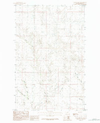
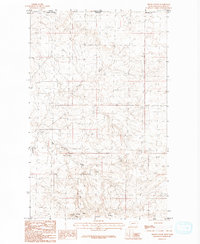
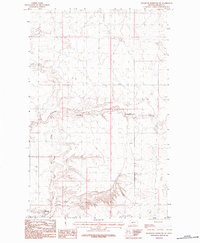 1984 Richmond Reservoir SW1984 Print · USGSThe northern Montana plains of Blaine County appear here in the late seventies, showing a landscape defined by ranching and resource transport. Researchers can trace the path of the Pipeline across the coulees and locate agricultural infrastructure like Storage Bins and Twin Reservoir.
 - 1984 Map of Shambo NE
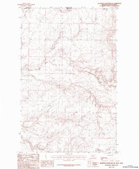
 1984 Shambo NE1984 Print · USGSThe northern Montana plains at the border of Hill and Blaine counties are captured here in the mid-1980s. Researchers can trace the rugged topography around Squaw Butte and follow the seasonal drainages of Bullhook Creek and Boxelder Creek.
 - 1984 Map of Harlem NW
 1984 Harlem NW1984 Print · USGSUpper Blaine County in the early eighties was a landscape of intermittent waterways and expansive ranchland. Researchers and collectors can trace the specific courses of Thirtymile Creek, its East Branch, and West Forgey Creek.
 - 1984 Map of Turner
 1984 Turner1984 Print · USGSBig Flat country near the Canadian border comes into focus in the mid-1980s, showcasing a remote agricultural landscape. Genealogists and historians can trace the development of the Turner town site, the communal lands of Turner Colony, and several rural Landing Strips.
 - 1984 Map of Silver Bow Lake
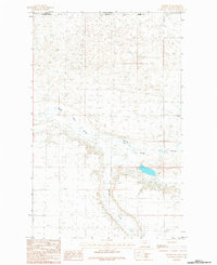
 1984 Silver Bow Lake1984 Print · USGSBlaine County in the late seventies and early eighties shows a landscape of high buttes and isolated water sources. Researchers can trace the drainage of Thirtymile Creek and locate historic watering points like Silver Bow Lake and Gidley Spring.
 - 1984 Map of Mc Laren Reservoir
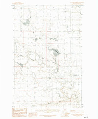 1984 Mc Laren Reservoir1984 Print · USGSHigh plains ranching and water management in Blaine County are meticulously detailed during the mid-eighties. Trace the vital irrigation infrastructure of the North Chinook Irrigation Canal and the waters of Mc Laren Reservoir and Lodge Creek.
 - 1984 Map of Turner NE
 1984 Turner NE1984 Print · USGSThe northern reaches of Blaine County meet the international border in the early 1980s. Researchers can trace the path of Woody Island Coulee and locate the county line at Blaine Co Phillips Co.
 - 1984 Map of Eskay NE
 1984 Eskay NE1984 Print · USGSNorth Central Montana's high-country terrain is captured here in the mid-1980s, tracing the boundary between Chouteau and Blaine counties. Researchers can locate distinctive landmarks like Blue Stone Peak, Tiger Butte, and the drainage of Sand Creek.
 - 1984 Map of Down Reservoir NW
 1984 Down Reservoir NW1984 Print · USGSBlaine County was characterized by vast conservation areas and prairie drainages during the early eighties. Researchers can trace the protected boundaries of the Black Coulee National Wildlife Refuge and locate seasonal water features like Duck Lake and Black Creek.
 - 1984 Map of Wayne Creek NW
 1984 Wayne Creek NW1984 Print · USGSHigh plains grazing lands and intricate drainage systems dominate this Blaine County corner during the late seventies. Researchers can trace the confluence of Wayne Creek with its East Fork, West Fork, and South Fork, alongside the terrain of Aveill Ravine.
 - 1984 Map of Down Reservoir NE
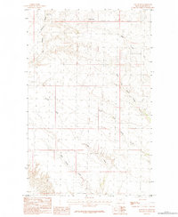
 1984 Down Reservoir NE1984 Print · USGSNorthern Montana's high plains are captured in the mid-eighties as they straddle the Blaine Co and Phillips Co line. Researchers can trace the seasonal watercourses of Little Jewel Coulee and Black Coulee across this rural landscape.
 - 1984 Map of Turner NW
 1984 Turner NW1984 Print · USGSThe northern edge of Blaine County meets the international border during the mid-1980s. Researchers can trace the winding path of Woody Island Coulee across the Canada United States line and follow the drainage of Buckley Creek.
 - 1984 Map of Big John Butte
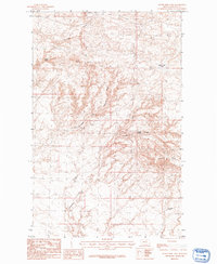
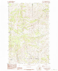 1984 Big John Butte1984 Print · USGSNorth-central Montana territory at the edge of the Bear Paw Mountains is captured here in the mid-1980s. Researchers can trace the borders of the Rocky Boy Indian Reservation and locate landmarks like Big John Butte and Moses Mtn.
 - 1984 Map of Hogeland
 1984 Hogeland1984 Print · USGSBlaine County plains come into focus in the late seventies, showing the rural layout of the Big Flat region near the Canadian border. Genealogists and researchers can trace the local road network surrounding the settlement of Hogeland and the course of Murphy Coulee.
 - 1984 Map of Havre
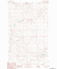
 1984 Havre1984 Print · USGSThe Milk River valley and the northern high plains come into focus in the mid-1980s, detailing a landscape defined by rail, ranching, and water management. Trace the path of the Burlington Northern through Havre and Chinook, or locate sites like the Havre Air Force Station and Hilldale Colony.
 - 1984 Map of Aubrey Dam
 1984 Aubrey Dam1984 Print · USGSThe Montana-Saskatchewan borderlands come into focus during the mid-1980s, showing the intersection of international boundaries and prairie geography. Map collectors and historians can trace the course of Woody Island Coulee and locate the remote Aubrey Dam.
 - 1984 Map of Down Reservoir SW
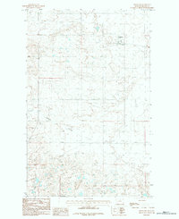
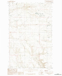 1984 Down Reservoir SW1984 Print · USGSNorthern Montana prairie life is documented in this mid-eighties survey of Blaine County. Researchers can trace the winding paths of Milk Creek, Black Creek, and Dodson Creek across the open plains.
 - 1984 Map of East Butte
 1984 East Butte1984 Print · USGSNorthern Montana's high plains are revealed in the early 1980s, centered on the prominent rise of East Butte. Researchers can trace the drainages of Wayne Creek and Forgey Creek, and locate the historic Box Spring.
 - 1984 Map of Silver Bow Spring
 1984 Silver Bow Spring1984 Print · USGSBlaine County's high plains are mapped here during the early eighties, revealing a landscape shaped by vital water sources. Researchers can trace the drainage of Woody Island Coulee and locate named landmarks like Silver Bow Spring and Middle Butte.
 - 1984 Map of Shambo SE
 1984 Shambo SE1984 Print · USGSThe borderlands of Hill Co and Blaine Co are captured here in the mid-1980s. Local researchers can trace the drainages of Little Boxelder Creek and Clear Creek, and locate the distinct terrain of Sawmill Coulee.
 - 1984 Map of Irvins Coulee
 1984 Irvins Coulee1984 Print · USGSBlaine County sits along the international border in the mid-1980s, where the high plains meet the Canadian line. Genealogists and historians can trace the rugged drainage of East Fork Battle Creek and the heights of Cherry Ridge.
 - 1984 Map of Richmond Reservoir NE
 1984 Richmond Reservoir NE1984 Print · USGSThe international border between Montana and Saskatchewan comes into focus in this mid-eighties survey of northern Blaine County. Researchers can trace the rugged drainage of Battle Creek and its tributary East Fork Battle Creek along the borderlands.
Showing maps 1-25 of 58
Top cities of Blaine County
Frequently asked questions
- What are the different types of historical maps available for Blaine County?
- What is the oldest map of Blaine County?
- Where can I purchase historical maps of Blaine County for my home or office?
- Where can I download high-res historical maps of Blaine County?
- Are there historical topographic maps available for Blaine County?
- Is there historical aerial imagery available for Blaine County?
- Where are historical maps of Blaine County sourced from?