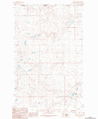
1984 Map of Aubrey Dam
USGS Topo · Published 1984About this map
Woody Island Coulee cuts through the northern plains of Blaine Co, Montana, in this mid-1980s topographic survey. The landscape is defined by the international border between Canada and the United States, where the southern edge of Saskatchewan meets the Big Sky State. This specific region focuses on the drainage and water management of the high prairie, centered on the Aubrey Dam reservoir. The map reveals the intricate natural contours of the coulee systems that snake across the border, illustrating how the physical geography ignores political boundaries. It serves as a precise record of the remote borderlands before further modern development, highlighting the essential infrastructure of Aubrey Dam in an otherwise sparsely populated ranching or conservation environment.
Find a feature on this map
5 named features on this map. Tap any name to fly to it.
Don’t see what you’re looking for? This feature index may not catch every label — zoom into the map to look around manually.
Map Details
Editions of this 1984 Aubrey Dam Map
This is the sole edition of this map. No revisions or reprints were ever made.
Other maps of this area

1913 · Cherry Ridge
USGS Topo · 1:125,000

1953 · Havre
USGS Topo · 1:250,000

1957 · Havre
USGS Topo · 1:250,000

1958 · Havre
USGS Topo · 1:250,000
1984 · Silver Bow Lake
USGS Topo · 1:24,000
1984 · Hogeland
USGS Topo · 1:24,000
1984 · Silver Bow Spring
USGS Topo · 1:24,000
1984 · Irvins Coulee
USGS Topo · 1:24,000
1984 · Hogeland NW
USGS Topo · 1:24,000
2011 · Hogeland NW
USGS Topo · 1:24,000