Old Maps of Agency District, Montana for Genealogy
Trace your family roots with 116 historic maps of Agency District. These high-res maps reveal old neighborhoods, homesites, landmarks, and streets — helping you uncover where your ancestors lived and how the area evolved over time.
- Explore historic neighborhoods: Identify where your relatives may have lived in the 1800s or 1900s.
- Compare maps over time: Trace the changes in streets, buildings, and landmarks for multi-generational research.
- Perfect for genealogy & ancestry research: Used by family historians and researchers to map out lineage and migration.
These maps are an incredible resource for exploring your personal connection to Agency District's past.
Agency District, MT maps
(116)- 1903 Map of Wayne Creek, 1958 Print
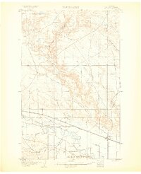
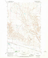
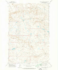
 1903 Wayne Creek1958 Print · USGSBlaine County was an open ranching landscape at the turn of the century, defined by the northern plains and the river valley corridor. Trace the early Great Plains rail economy at Montauk along the Great Northern RR and locate pioneer outposts like Nickols Ranch.
 - 1905 Map of Wayne Creek
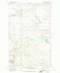
 1905 Wayne Creek1905 Print · USGSEarly ranching and rail expansion characterize this northern Montana landscape in the first decade of the new century. Researchers can trace historic homesteads like Reddenbacks and Nickols Ranch along the route of the Great Northern R R.
 - 1905 Map of Harlem
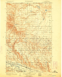
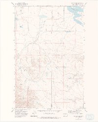
 1905 Harlem1905 Print · USGSThe Milk River valley at the turn of the century shows a landscape transitioning from open range to irrigated agriculture and rail-side settlements. Researchers can locate early outposts like Sorterstorm's Ranch and follow the route of the Great Northern R R past Harlem and Madras.2 unique versions available
 - 1913 Map of Cherry Ridge
 1913 Cherry Ridge1913 Print · USGSNorthern Montana ranching and the Fort Belknap Indian Reservation are captured here during the early twentieth century. Genealogists and historians can locate early homesteads like Arbagasts Ranch and trace the path of the Great Northern railroad.3 unique versions available
 - 1953 Map of Havre, 1967 Print
 1953 Havre1967 Print · USGSNorthern Montana’s Hi-Line comes into focus in the mid-fifties, centered on the Milk River and the critical Great Northern rail link. Genealogists can trace small sidings and settlements like Assinniboine, Laredo, and Box Elder alongside the Fort Belknap Agency.3 unique versions available
 - 1957 Map of Havre
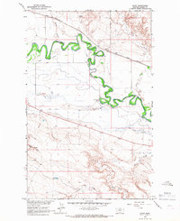
 1957 Havre1957 Print · USGSNorth-central Montana at the mid-century is defined by the vital Great Northern rail corridor and the winding Milk River. Researchers can trace old settlements like Laredo and Savoy, or locate historic sites such as the Hays (old) Sub Agency and the Chinook No 1 mine.
 - 1958 Map of Havre
 1958 Havre1958 Print · USGSUpper Montana in the late fifties was a landscape of remote rail towns and vast high-plain ranges. Genealogists and historians can trace the Great Northern railroad through Havre, Chinook, and the Fort Belknap Indian Reservation.
 - 1964 Map of Threemile Reservoir, 1967 Print
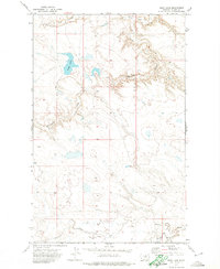
 1964 Threemile Reservoir1967 Print · USGSNorth of the Milk River in the mid-sixties, this area of Blaine County shows the development of the Missouri River Basin. Genealogists and historians can trace the Fort Belknap Indian Reservation boundary and locate the Sacred Heart Ch near Threemile Reservoir.
 - 1964 Map of Coburg, 1967 Print
 1964 Coburg1967 Print · USGSThe rural plains of northern Montana are captured here in the 1960s, centered on the railroad siding of Coburg. Genealogists and historians can trace the Great Northern rail line and locate the Horn Cem near the banks of the Milk River.
 - 1964 Map of Fort Belknap Agency, 1967 Print
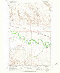
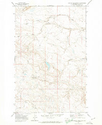
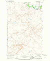 1964 Fort Belknap Agency1967 Print · USGSThe Fort Belknap Indian Reservation in the mid-sixties is centered on the Fort Belknap Agency along the winding Milk River. Researchers can trace the path of the Old Railroad Grade and locate landmarks like Snake Butte and the local Cem.
 - 1964 Map of Big Coulee, 1967 Print
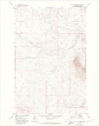
 1964 Big Coulee1967 Print · USGSBlaine County ranchlands and the western edge of the reservation appear in the mid-sixties as part of the Missouri River Basin project. Researchers can trace the Fort Belknap Indian Reservation Boundary and locate local landmarks like Snake Butte and the Snake Butte Sch.
 - 1964 Map of Grable Coulee, 1967 Print
 1964 Grable Coulee1967 Print · USGSBlaine County's river valley and northern prairie are captured in the mid-1960s as irrigation and rail infrastructure shaped the plains. Researchers can trace the path of the Great Northern railroad and locate water sources like Thirtymile Reservoir and Grable Coulee Spring.
 - 1964 Map of Savoy, 1967 Print
 1964 Savoy1967 Print · USGSThe Milk River valley and the Fort Belknap Indian Reservation are shown in the mid-1960s, a period of managed irrigation and rail-side growth. Trace old property lines near Savoy, the Great Northern railroad, and the Fort Belknap Cem.
 - 1964 Map of Weigand Reservoir, 1967 Print
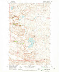
 1964 Weigand Reservoir1967 Print · USGSThe northern Montana prairie comes into focus during the 1960s, showing the intersection of the Fort Belknap Indian Reservation and the county line. Trace the local hydrology through landmarks like Weigand Reservoir, Old Woman Lake, and a rural Mine.
 - 1964 Map of Fort Belknap Siding, 1967 Print
 1964 Fort Belknap Siding1967 Print · USGSBlaine County ranching and rail transport are centered along the Milk River in the mid-1960s. Trace the irrigation network of the Fort Belknap Canal and the operations at Fort Belknap Siding on the Great Northern line.
 - 1964 Map of Harlem, 1967 Print
 1964 Harlem1967 Print · USGSThe northern Milk River valley comes into focus during the mid-sixties, showing the intersection of the Fort Belknap Indian Reservation and the town of Harlem. Researchers can trace the path of the Great Northern railway, find the town Cem, and locate the Rodeo Ground.
 - 1971 Map of Putnam Lake, 1974 Print
 1971 Putnam Lake1974 Print · USGSBlaine County, Montana, at the start of the 1970s shows a landscape shaped by drainage coulees and the Fort Belknap Indian Reservation Boundary. Trace water-focused landmarks like Putnam Lake, Suction Creek, and Haystack Butte.
 - 1971 Map of Fort Belknap Agency SE, 1974 Print
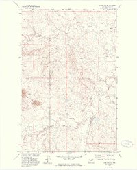
 1971 Fort Belknap Agency SE1974 Print · USGSBlaine County, Montana, was documented in the early seventies during this survey of tribal lands within the Fort Belknap Indian Reservation. Researchers can trace drainage patterns along Peoples Creek and identify landmarks like Snake Butte.
 - 1971 Map of Lodge Pole NW, 1974 Print
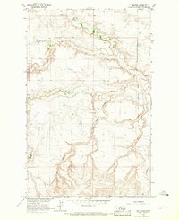
 1971 Lodge Pole NW1974 Print · USGSThe Fort Belknap Indian Reservation in the early seventies reveals a landscape shaped by hydrology and isolated infrastructure. Researchers can trace water resources like Peoples Creek or locate the remote Landing Strip and the high points of the Three Buttes.
 - 1971 Map of Lodge Pole NE, 1974 Print
 1971 Lodge Pole NE1974 Print · USGSThe Fort Belknap Indian Reservation in northern Montana appears here in the early 1970s, showcasing its complex drainage patterns. Genealogists and historians can trace the paths of Peoples Creek, Lodge Pole Creek, and the prominent landmark of Black Butte.
 - 1971 Map of Lake Seventeen NE, 1974 Print
 1971 Lake Seventeen NE1974 Print · USGSThe high plains of Blaine County in the early 1970s reveal a landscape of deep coulees and isolated buttes. Researchers can trace the winding Peoples Creek, locate the prominent Three Buttes, and follow the historic Pack Trail across the eastern ridges.
 - 1971 Map of Bigby Lake, 1974 Print
 1971 Bigby Lake1974 Print · USGSBlaine County ranchlands within the Fort Belknap Indian Reservation are captured here in the early 1970s. Researchers can trace the drainages of Bigby Lake, Fifteenmile Creek, and Peoples Creek across this open prairie.
 - 1971 Map of Newhouse Reservoir, 1974 Print
 1971 Newhouse Reservoir1974 Print · USGSBlaine County was characterized by sparse ranching infrastructure and reservation borderlands during the early 1970s. Researchers can trace land use through features like Newhouse Reservoir, the Barney Olson Road, and the Fort Belknap Indian Reservation Boundary.
 - 1971 Map of Wild Horse Butte, 1974 Print
 1971 Wild Horse Butte1974 Print · USGSBlaine County rangeland within the Fort Belknap Indian Reservation is shown here in the early 1970s. Researchers can trace land use patterns and water sources like Wild Horse Spring, Old Woman Reservoir, and the namesake Wild Horse Butte.
 - 1971 Map of Big Flat West, 1975 Print
 1971 Big Flat West1975 Print · USGSThe high plains of the Fort Belknap Indian Reservation are documented here in the early 1970s, showing the intersection of Blaine and Phillips counties. Researchers can trace the drainage of Big Flat through the network of Weigand Reservoir, Lone Tree Coulee, and Corral Coulee.2 unique versions available
Showing maps 1-25 of 116
Top cities near Agency District
Top neighborhoods of Agency District
Frequently asked questions
- What are the different types of historical maps available for Agency District?
- What is the oldest map of Agency District?
- Where can I purchase historical maps of Agency District for my home or office?
- Where can I download high-res historical maps of Agency District?
- Are there historical topographic maps available for Agency District?
- Is there historical aerial imagery available for Agency District?
- Where are historical maps of Agency District sourced from?