1980s Maps of Broadwater County, Montana
Explore 28 historic maps of Broadwater County from the 1980s. These maps offer a rare glimpse into what life looked like during the 1980s — showing old roads, neighborhoods, homes, and landmarks that have changed or disappeared over time.
Whether you're researching your family's past, planning a metal detecting trip, or studying how Broadwater County's landscape evolved across the 1980s, these high-resolution maps are a powerful tool for exploring the history of this region.
- Focus on a specific era: All maps on this page are from the 1980s, giving you a focused view of this time period.
- See what’s changed: Compare century-old streets, trails, and buildings to today's modern landscape using overlays and satellite layers.
- Research with precision: Use these maps for genealogy, historical research, land use analysis, or educational projects.
- View, download, or print: Maps are fully viewable online in high resolution, and can be downloaded or printed for your own records.
Start exploring Broadwater County's history through authentic maps from the 1980s. This is your window into the past.
Broadwater County, MT maps
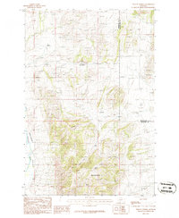
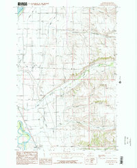
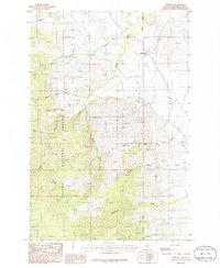
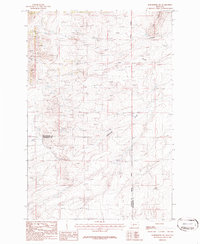
(28)- 1985 Map of Louisville
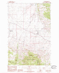 1985 Louisville1985 Print · USGSCentral Montana in the mid-1980s reveals a landscape shaped by national forest boundaries and utility corridors. Genealogists and local historians can trace the small settlements of Louisville and Clasoil or locate mineral Prospects near Mitchell Gulch.
 - 1985 Map of Crow Creek Falls, 1986 Print
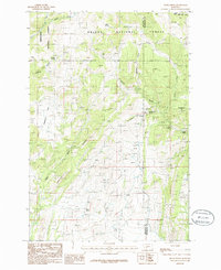
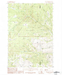 1985 Crow Creek Falls1986 Print · USGSHigh in the Elkhorn Mountains during the mid-1980s, this area reveals a landscape shaped by mining and timber. Trace the paths of the Tizer Trail past numerous prospects and name family landmarks like Manley Park and Bonanza Ridge.
 - 1985 Map of Casey Peak, 1986 Print
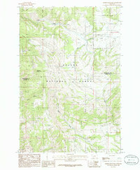
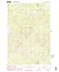 1985 Casey Peak1986 Print · USGSThe Elkhorn Mountains and Helena National Forest define this mid-1980s landscape of high peaks and secluded mountain parks. Researchers can trace historic trails to landmarks like Casey Peak, Airplane Park, and old mining Shaft sites.2 unique versions available
 - 1986 Map of Deer Park
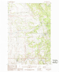 1986 Deer Park1986 Print · USGSBroadwater and Gallatin counties are captured in the mid-1980s, centered on the rugged canyon country of the Helena National Forest. Researchers can trace the Old Railroad Grade as it winds through the canyon past Deer Park and Sixteenmile Creek.
 - 1986 Map of Willow Springs
 1986 Willow Springs1986 Print · USGSThe Boulder River valley and surrounding peaks are captured in the mid-1980s, showcasing a landscape shaped by mineral exploration. Researchers can trace numerous Mine Shafts and Prospects near Willow Springs.
 - 1986 Map of Lombard
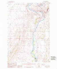 1986 Lombard1986 Print · USGSThe Missouri River corridor in Broadwater County is captured here in the mid-1980s as a vital junction of irrigation and rail history. Trace the Old Railroad Grade past Lombard or locate rural landmarks like Cramp Spring and Sixteenmile Creek.
 - 1986 Map of Parker
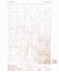
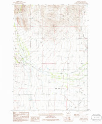 1986 Parker1986 Print · USGSBroadwater County's ranching and mining landscape is captured here in the mid-1980s. Genealogists and local historians can trace the settlement at Parker, find the local Cem, and follow the path of Crow Creek toward the Missouri River.2 unique versions available
 - 1986 Map of Gurnett Creek East
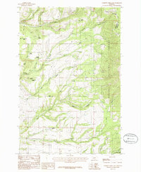 1986 Gurnett Creek East1986 Print · USGSThe Big Belt Mountains of Broadwater and Meagher counties are mapped in the mid-1980s as a landscape of timber and ranching. Trace family-named landmarks and water sources like Hooligans Hill, Hard Cash Spring, and Duck Creek Pass.
 - 1986 Map of Holker
 1986 Holker1986 Print · USGSBroadwater County during the 1980s reveals a Missouri River landscape dominated by irrigation projects and rural aviation. Researchers can locate the small community of Holker, a riverside Cem, and the historic Broadwater Canal.2 unique versions available
 - 1986 Map of Plunket Lake
 1986 Plunket Lake1986 Print · USGSBroadwater County in the mid-1980s reveals a working landscape of high-plains agriculture and mineral exploration. Genealogists and historians can trace the irrigation network of the Toston Canal or locate rural landmarks like Mammoth Springs and the Landing Strip.
 - 1986 Map of Townsend
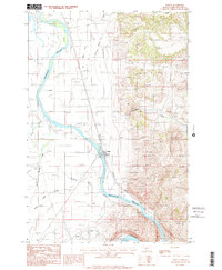
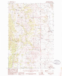
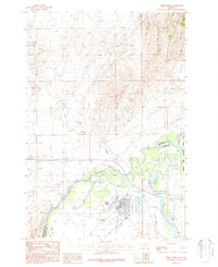
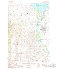 1986 Townsend1986 Print · USGSTownsend and the surrounding Broadwater County territory are shown here in the mid-1980s during a period of established river management. Genealogists and local historians can trace the Townsend townsite, the Cem, and rural landmarks like the Bedford settlement and Deep Creek.
 - 1986 Map of Devils Fence
 1986 Devils Fence1986 Print · USGSIn the mid-1980s, the high country of Jefferson and Broadwater counties supported both forestry and mineral exploration. Researchers can trace the era's mining activity through Mine Shaft sites and Prospects near landmarks like Devils Fence and Frenchman Hill.
 - 1986 Map of Winston
 1986 Winston1986 Print · USGSWinston and the foothills of the Elkhorn Mountains are captured here in the mid-eighties as a landscape of rail transit and mountain ranching. Researchers can trace historic access routes like the Pack Trail and locate old industrial sites including a Mine Shaft and the Burlington Northern line.
 - 1986 Map of Townsend NE
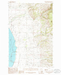
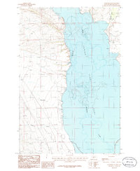 1986 Townsend NE1986 Print · USGSThe Missouri River valley in Broadwater County transitioned into a major reservoir landscape by the mid-eighties. Researchers can trace the submerged river channel beneath Canyon Ferry Lake and locate early landmarks like Antelope Springs and the Cem near the western hills.
 - 1986 Map of Toston
 1986 Toston1986 Print · USGSToston sits along the Missouri River in the mid-1980s, revealing a landscape transformed by intensive irrigation. Researchers can trace the path of the Broadwater Missouri Canal and Big Springs Canal alongside local landmarks like the Cem and Landing Strip.2 unique versions available
 - 1986 Map of Giant Hill
 1986 Giant Hill1986 Print · USGSBroadwater County in the 1980s was a rugged territory of active prospects and deep-rooted mining heritage. Searchers can locate family-named landmarks like Mc Mullan and trace old industrial sites from Hassel to the high Giant Hill Prospects.
 - 1986 Map of Roy Gulch
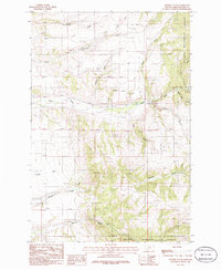
 1986 Roy Gulch1986 Print · USGSThe Horseshoe Hills in the mid-1980s reveal a landscape shaped by drainage and elevation along the Gallatin and Broadwater county lines. Genealogists and historians can trace water rights and old boundaries through named springs like Townsend Spring and gulches such as Home Gulch and Garden Gulch.
 - 1986 Map of Sixmile Mountain
 1986 Sixmile Mountain1986 Print · USGSBroadwater and Gallatin counties are captured here in the mid-1980s, showcasing the high-country landscape of the Helena National Forest. Researchers can trace the drainages of Sawmill Gulch and Haw Gulch or locate specific mining Prospects near the slopes of Sixmile Mountain.
 - 1986 Map of Gurnett Creek West
 1986 Gurnett Creek West1986 Print · USGSBroadwater County during the mid-1980s shows a landscape shaped by the Missouri River and its upland tributaries. Researchers can trace the path of the Broadwater Canal, find remote Prospects, and locate landmarks like Black Butte.
 - 1986 Map of Radersburg
 1986 Radersburg1986 Print · USGSRadersburg and the surrounding Broadwater County foothills are captured here in the mid-1980s during a period of active mineral extraction. Researchers can trace historic mining operations via several Mine Shafts and explore the rugged drainage paths of Keating Gulch and Uncle Johnnys Gulch.
 - 1986 Map of Lippert Gulch
 1986 Lippert Gulch1986 Print · USGSBroadwater County during the mid-1980s reveals a landscape of high forest ridges and valley ranching near the Big Belt Mountains. Researchers can trace irrigation history through the Flume and Siphon near Deep Creek or locate the settlement of Boone.
 - 1986 Map of Radersburg SW
 1986 Radersburg SW1986 Print · USGSMining prospects and mountain terrain define this corner of Broadwater and Jefferson counties in the mid-1980s. Researchers can trace historical mineral exploration through numerous Prospects and Mine Shafts near Lone Mountain.
 - 1986 Map of Francis
 1986 Francis1986 Print · USGSThe mountains of Meagher, Broadwater, and Gallatin counties are shown here in the mid-eighties as a hub of early rail engineering. You can trace the Old Railroad Grade past Francis and follow the steep drainages of Sixteenmile Creek and Paddox Run.
 - 1987 Map of Three Forks
 1987 Three Forks1987 Print · USGSThe confluence of the Jefferson, Madison, and Missouri Rivers dominates this 1980s Montana landscape near the Gallatin and Broadwater county line. Researchers can trace the town's industrial footprint through the Grain Elevator, Old RR Grade, and various Mine Shafts in the northern hills.
 - 1987 Map of Milligan Canyon
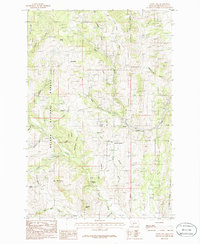
 1987 Milligan Canyon1987 Print · USGSJefferson and Broadwater Counties appear here in the 1980s as a landscape of remote ranching and essential water sources. Researchers can trace family-named landmarks like Silver Sage Ranch and the small settlement of Milligan near the canyon floor.
Showing maps 1-25 of 28
Top cities of Broadwater County
Frequently asked questions
- What are the different types of historical maps available for Broadwater County?
- What is the oldest map of Broadwater County?
- Where can I purchase historical maps of Broadwater County for my home or office?
- Where can I download high-res historical maps of Broadwater County?
- Are there historical topographic maps available for Broadwater County?
- Is there historical aerial imagery available for Broadwater County?
- Where are historical maps of Broadwater County sourced from?