Old Maps of Broadwater County, Montana for Academic Research
Study the evolution of Broadwater County with 304 high-resolution historic maps. Whether you're teaching, researching, or modeling changes in land use, these maps provide essential visual documentation of urban, environmental, and geographic change.
- Analyze long-term change: Track patterns in development, transportation, and natural features.
- Ideal for environmental or urban studies: Support academic projects with primary historical map data.
- Use in the classroom or lab: Educators and researchers rely on these maps to bring historical context to life.
These maps are a powerful tool for teaching, research, and visualizing how Broadwater County has changed over the decades.
Broadwater County, MT maps
(304)- 1886 Map of Fort Logan
 1886 Fort Logan1886 Print · USGSCentral Montana in the mid-1880s was a landscape of military outposts and early mining camps. Researchers can trace the frontier development of Radersburg and Crow Creek City or locate the historic military presence at Ft Logan.5 unique versions available
 - 1888 Map of Three Forks
 1888 Three Forks1888 Print · USGSSouthwestern Montana was a land of mining camps and river junctions in the late nineteenth century, as the railroad began to connect established valleys. Genealogists can trace family roots through pioneer settlements like Virginia City, Salesville, and Spring Hill, or locate early crossings at Barton's Bridge.
 - 1894 Map of Three Forks
 1894 Three Forks1894 Print · USGSSouthwestern Montana thrives along the river forks and rail lines during the mid-1880s. Genealogists and historians can trace early town sites like Pony, Logan, and Salesville while locating river crossings such as Fly's Bridge and Shedds Bridge.
 - 1895 Map of Three Forks
 1895 Three Forks1895 Print · USGSSouthern Montana was a landscape of emerging rail towns and gold-country gulches during the mid-1890s. Genealogists and historians can trace the early footprints of Bozeman, locate Guns Ranch, and follow the Northern Pacific Railroad through Three Forks.5 unique versions available
 - 1947 Map of Bozeman, 1948 Print
 1947 Bozeman1948 Print · USGSBozeman and the surrounding mountain ranges are captured here just after the war, showing the vital rail and river networks of southwestern Montana. Genealogists and historians can trace routes to early settlements like Virginia City, Gallatin Gateway, and the mountain community of Jardine.
 - 1948 Map of Bozeman, 1951 Print
 1948 Bozeman1951 Print · USGSSouthern Montana in the late 1940s is shown as a high-country crossroads of rail lines and river headwaters. Genealogists and historians can trace old town sites like Virginia City and McLeod alongside the Northern Pacific and Milwaukee Road railroads.
 - 1948 Map of White Sulphur Springs, 1951 Print
 1948 White Sulphur Springs1951 Print · USGSMontana's capital and the high country of the Big Belt Mountains come alive in this mid-century survey. Trace the early hydroelectric developments at Canyon Ferry Dam or follow the historic rail lines through Ringling and Townsend.
 - 1949 Map of Radersburg, 1953 Print
 1949 Radersburg1953 Print · USGSRadersburg and the surrounding mountain gulches are captured here in the late 1940s during a period of transition for Montana's mining and ranching communities. Researchers can trace deep-rooted mining claims like the Black Friday Mines or locate rural landmarks such as the Crow Creek School and Riverside Ranch.5 unique versions available
 - 1949 Map of Manhattan, 1953 Print
 1949 Manhattan1953 Print · USGSThe Gallatin Valley in the late 1940s was a hub of irrigation and rail transport at the headwaters of the Missouri. Genealogists can locate family holdings like the Sinnema Ranch and rural landmarks such as the Heeb School and Church Hill Church.4 unique versions available
 - 1949 Map of Maudlow, 1954 Print
 1949 Maudlow1954 Print · USGSGallatin County ranching and railroad life are preserved here in the late 1940s as the high peaks meet the rail lines. Genealogists and historians can trace family landmarks like the Morgan Cemetery, Francis School, and the remote settlement of Maudlow.4 unique versions available
 - 1949 Map of Toston, 1970 Print
 1949 Toston1970 Print · USGSMid-century Broadwater County is centered here on the Missouri River and its critical rail junctions. Researchers can trace the industrial footprint of the Milwaukee Road, locate the Crane School, or find the abandoned Coke Oven at Lombard.
 - 1950 Map of Devils Fence
 1950 Devils Fence1950 Print · USGSJefferson County ranchlands and mining districts are meticulously detailed in this mid-century survey of the Boulder Valley region. Researchers can locate remote family landmarks such as the Quaintance Ranch, Boulder Valley Church, and the active Ida Mine.5 unique versions available
 - 1950 Map of Canyon Ferry, 1952 Print
 1950 Canyon Ferry1952 Print · USGSBroadwater and Lewis and Clark counties are captured here in the mid-century as the Missouri River valley underwent massive change. Genealogists and historians can trace the transition from old settlements like York and Placer to the rising waters of Canyon Ferry Lake.3 unique versions available
 - 1950 Map of Townsend, 1953 Print
 1950 Townsend1953 Print · USGSBroadwater County is documented here in the mid-twentieth century just before the valley floor was reshaped by the Canyon Ferry Reservoir project. Trace family roots and local history through the Centerville Cemetery, the Whitehead Ranch, and mining sites like the East Pacific Mine.3 unique versions available
 - 1950 Map of Three Forks, 1953 Print
 1950 Three Forks1953 Print · USGSThree Forks and the surrounding Gallatin Valley are captured here just after the war, showing the historic meeting of the rivers that form the Missouri. Genealogists and historians can trace the foundations of this ranching community through the Jefferson Sch, Fairview Cem, and the Climbing Arrow Ranch.4 unique versions available
 - 1950 Map of Duck Creek Pass, 1953 Print
 1950 Duck Creek Pass1953 Print · USGSBroadwater County ranching and mining sites appear in detail during the early postwar era as the landscape shifted. Genealogists can locate family holdings like Merritt Ranch, several Gold Mines, and the Holy Cross Cem near the Missouri River.4 unique versions available
 - 1950 Map of East Helena, 1954 Print
 1950 East Helena1954 Print · USGSThe Missouri River valley near East Helena comes to life in the early fifties as a hub of rail transport and industrial mining. Genealogists and local historians can locate rural landmarks like Harmony School, St Anns Cem, and the Economy Mine.4 unique versions available
 - 1950 Map of Clancy, 1954 Print
 1950 Clancy1954 Print · USGSIn the mid-century Montana mountains, the mining district around Clancy and Elkhorn remains a network of high-altitude claims and forest outposts. Genealogists and historians can trace old operations like the Golden Age Mine and Elkhorn Skyline Mine or locate the Clancy Post Office.5 unique versions available
 - 1955 Map of Bozeman
 1955 Bozeman1955 Print · USGSBozeman and the upper Missouri River headwaters are captured here during the mid-fifties, showing the vital rail and river networks of southwestern Montana. Local historians can trace the routes of the Northern Pacific railroad through Livingston and locate smaller settlements like Trident, Anceney, and Jardine.
 - 1958 Map of Bozeman, 1968 Print
 1958 Bozeman1968 Print · USGSThe Gallatin and Madison River valleys are captured here in the late fifties, showing the region's transition into a modern mountain hub. Genealogists and historians can trace the paths of the Northern Pacific RR, locate the Anceney School, and see the early layout of Bozeman.3 unique versions available
 - 1958 Map of White Sulphur Springs, 1968 Print
 1958 White Sulphur Springs1968 Print · USGSCentral Montana in the late fifties was a landscape of high-country mining and newly formed reservoirs. You can trace the rail-and-river economy of the era through sites like Canyon Ferry Lake, the East Pacific Mine, and the historic Fort Logan.3 unique versions available
 - 1960 Map of Willow Creek, 1962 Print
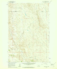 1960 Willow Creek1962 Print · USGSThe rural borderlands between Rosebud and Treasure counties appear in the early sixties as a landscape defined by seasonal waters and range roads. Genealogists and local historians can trace the paths of Willow Creek, Muggins Creek, and the curiously named Bone Coulee.
 - 1961 Map of White Sulphur Springs
 1961 White Sulphur Springs1961 Print · USGSThe Missouri River valley and central Montana highlands are captured here during a period of significant hydroelectric and rail expansion. Genealogists and rail historians can trace the paths of the Northern Pacific and Chicago Milwaukee St Paul and Pacific through settlements like White Sulphur Springs and Townsend.
 - 1962 Map of Snedaker Basin, 1964 Print
 1962 Snedaker Basin1964 Print · USGSThe high Big Belt Mountains at the start of the sixties are detailed here, showing a landscape of remote basins and ranch outposts. Researchers can trace historic access routes like the Pack Trail and locate family-named landmarks such as Sunshine Ranch and Jim Ball Basin.2 unique versions available
 - 1965 Map of White Sulphur Springs
 1965 White Sulphur Springs1965 Print · USGSCentral Montana in the late 1950s and early 60s reveals a rugged mountain landscape shaped by the Missouri River and the emergence of the Canyon Ferry Reservoir. Genealogists and local historians can trace legacy ranching sites, the Northern Pacific rail line, and remote schoolhouses like Cottonwood School and Spokane Creek School.
Showing maps 1-25 of 304
Top cities of Broadwater County
Frequently asked questions
- What are the different types of historical maps available for Broadwater County?
- What is the oldest map of Broadwater County?
- Where can I purchase historical maps of Broadwater County for my home or office?
- Where can I download high-res historical maps of Broadwater County?
- Are there historical topographic maps available for Broadwater County?
- Is there historical aerial imagery available for Broadwater County?
- Where are historical maps of Broadwater County sourced from?