1900s (20th Century) Maps of Fergus County, Montana
Explore 139 historic maps of Fergus County from the 1900s (20th Century). These maps offer a rare glimpse into what life looked like during the 1900s — showing old roads, neighborhoods, homes, and landmarks that have changed or disappeared over time.
Whether you're researching your family's past, planning a metal detecting trip, or studying how Fergus County's landscape evolved across the 1900s, these high-resolution maps are a powerful tool for exploring the history of this region.
- Focus on a specific era: All maps on this page are from the 1900s, giving you a focused view of this time period.
- See what’s changed: Compare century-old streets, trails, and buildings to today's modern landscape using overlays and satellite layers.
- Research with precision: Use these maps for genealogy, historical research, land use analysis, or educational projects.
- View, download, or print: Maps are fully viewable online in high resolution, and can be downloaded or printed for your own records.
Start exploring Fergus County's history through authentic maps from the 1900s. This is your window into the past.
Fergus County, MT maps
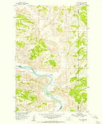
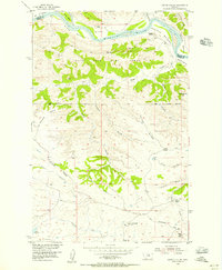
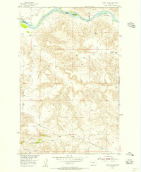
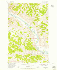
(139)- 1941 Map of Lewistown, 1959 Print
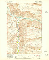
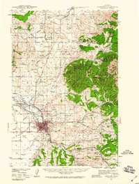 1941 Lewistown1959 Print · USGSFergus County's mining and ranching heart comes into focus during the early 1940s as the Judith Mountains overlook a bustling rail-fed valley. Trace the legacy of local industry through the Divide Coal Mine, the Heath Post Office, and the early footprint of the Lewistown Airport.3 unique versions available
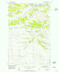
 - 1941 Map of Judith Peak, 1959 Print
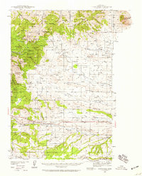 1941 Judith Peak1959 Print · USGSFergus County's high-altitude mining districts and military ruins are frozen in time just before the war. Trace the remnants of a gold boom at Maiden and Giltedge, or locate the Ruins of Fort Maginnis and several rural schoolhouses like Skaggs Sch.3 unique versions available
 - 1943 Map of Landusky
 1943 Landusky1943 Print · USGSPhillips County during the early 1940s is shown here as a landscape of isolated mountain settlements and the wild Missouri Breaks. Researchers can trace the layout of Landusky, the mountain peaks of the Jefferson National Forest, and river landmarks such as Cow Island.
 - 1944 Map of Lewistown
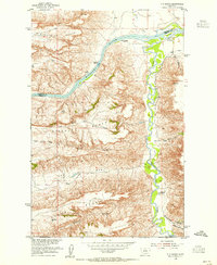
 1944 Lewistown1944 Print · USGSFergus County at the height of the mid-century mining and rail era reveals a landscape shaped by resource extraction and high-plains settlement. Researchers can trace the legacy of local industry through the Divide Coal Mine, the Oil Refinery, and the State Fish Hatchery.2 unique versions available
 - 1944 Map of Judith Peak
 1944 Judith Peak1944 Print · USGSThe Judith Mountains mining districts are shown in high detail during the early 1940s, from high peaks to the prairie rail lines. Genealogists and historians can locate the Ruins of Fort Maginnis, the Fort Maginnis Cem, and numerous mines like the Old Glory Mine.2 unique versions available
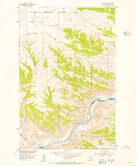
 - 1953 Map of Starve Out Flat, 1955 Print
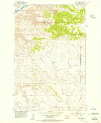
 1953 Starve Out Flat1955 Print · USGSChouteau and Fergus Counties were still defined by remote ranching and river breaks in the early fifties. Local historians can trace early water sources like the Artesian Well and Cow Camp Spring near the dramatic landforms of The Big Sag.2 unique versions available
 - 1954 Map of Great Falls
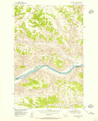
 1954 Great Falls1954 Print · USGSThe Missouri River valley in the mid-1950s is shown at a time of significant industrial and military growth. Genealogists and historians can locate early schools and rail stops like Tiger Butte Community Center, Fort Benton, and the Anaconda Wire Plant.4 unique versions available
 - 1954 Map of P N Ranch, 1955 Print
 1954 P N Ranch1955 Print · USGSThe confluence of the Missouri and Judith Rivers is captured here in the mid-1950s, showing a landscape defined by ranching and frontier heritage. Historians can trace the Wagon Wheel Trail, locate Old Fort Clagget (Site), and find the Grave (Historical) on Claggett Hill.2 unique versions available
 - 1954 Map of Taffy Ridge, 1956 Print
 1954 Taffy Ridge1956 Print · USGSThe Missouri River breaks through the Fergus County high plains in the mid-1950s, revealing a landscape of high ridges and deep coulees. Researchers can trace the cattle country terrain from Whiskey Ridge down to the Missouri River at Dauphin Rapids.2 unique versions available
 - 1954 Map of Bird Rapids, 1956 Print
 1954 Bird Rapids1956 Print · USGSThe Missouri River breaks are captured here in the mid-1950s, showing the wild river channel before modern alterations. Researchers can trace the exact locations of Castle Bluffs Rapids, Bird Rapids, and early landmarks like Black Butte.
 - 1954 Map of Cow Island, 1956 Print
 1954 Cow Island1956 Print · USGSThe Missouri River breaks of Montana are captured here during the mid-fifties, showing the isolated river valley at the borders of Blaine, Fergus, and Phillips counties. Researchers can locate the Kip Homestead, trace the path of the Jeep Trail, and see the prominent Cow Island in the river's bend.3 unique versions available
 - 1954 Map of Hessler Ridge, 1956 Print
 1954 Hessler Ridge1956 Print · USGSThe Missouri River corridor of north-central Montana was undergoing focused basin development in the mid-fifties. Researchers can trace the varied terrain of the Fort Peck Game Range and early-named landmarks like King Island, Hessler Ridge, and Gardipee Bottoms.3 unique versions available
 - 1954 Map of Leroy, 1956 Print
 1954 Leroy1956 Print · USGSBlaine County ranching country and the Missouri River breaks are captured here in the mid-fifties. Researchers can locate the Lone Tree Bench Sch, the small settlement of Leroy, and river features like Lone Pine Rapids.2 unique versions available
 - 1954 Map of Baker Monument, 1956 Print
 1954 Baker Monument1956 Print · USGSThe Missouri River breaks of central Montana are captured here during the 1950s era of river basin development. Researchers can trace historic river crossings and infrastructure like the Ferry, the Heller Sch, and early Powerplant (Ruins).2 unique versions available
 - 1954 Map of Carter Coulee, 1956 Print
 1954 Carter Coulee1956 Print · USGSThe Missouri River breaks and the high plains of central Montana are captured here during the mid-fifties ranching era. Genealogists and historians can trace the foundations of local settlement through the Little Crooked Creek School, the Mathison Ranch, and the winding path of an Old Trail.2 unique versions available
 - 1954 Map of Sturgeon Island, 1956 Print
 1954 Sturgeon Island1956 Print · USGSThe Missouri River breaks through the northern plains in the mid-1950s, marking the border of Blaine and Fergus Counties. Researchers can trace the river's path past Sturgeon Island and locate isolated landmarks like Gist Ranch and Ervin Ridge.2 unique versions available
 - 1954 Map of Bell Ridge West, 1956 Print
 1954 Bell Ridge West1956 Print · USGSCentral Montana ranching lands along the Missouri River are captured here in the mid-fifties. Researchers can trace riverside land use through Kendall Bottoms and Gardipee Bottoms or locate the Kendall Cow Camp within the Fort Peck Game Range.3 unique versions available
 - 1954 Map of Gallatin Rapids, 1956 Print
 1954 Gallatin Rapids1956 Print · USGSThe Missouri River breaks into the Gallatin Rapids and Dauphin Rapids along the Blaine and Fergus county line during the mid-fifties. Researchers can locate early petroleum exploration sites like the Oil Well (Alex) and trace the high country of Whiskey Ridge.2 unique versions available
 - 1954 Map of Council Island, 1956 Print
 1954 Council Island1956 Print · USGSThe Missouri River breaks through the central Montana breaks during the mid-fifties, serving as a boundary for three counties. Local historians can trace early crossing points at Lohse PN Ferry and explore the remote path of Seventy-nine Road.2 unique versions available
 - 1954 Map of Grand Island, 1956 Print
 1954 Grand Island1956 Print · USGSThe Missouri River breaks of Central Montana are captured here during the mid-fifties, showing the intersection of Fergus and Phillips Counties. Researchers can trace the wild river corridor through Grand Island and Kendall Bottoms, or locate isolated landmarks like the Landing Strip and VABM Crystal 3097.3 unique versions available
 - 1954 Map of Roundup, 1966 Print
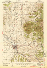
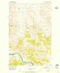
 1954 Roundup1966 Print · USGSCentral Montana in the mid-1960s showcases a landscape of high-plains agriculture and vital rail connections. Researchers can trace historic routes through Harlowton and Roundup while locating landmarks like Judith Cemetery and Deadmans Basin Reservoir.2 unique versions available
 - 1954 Map of Lewistown, 1967 Print
 1954 Lewistown1967 Print · USGSCentral Montana at the height of the mid-century rail era reveals a landscape shaped by the Judith River and high mountain ranges. Trace the old lines of the Great Northern through Lewistown and Denton, or locate sites like Giltedge and Landusky.3 unique versions available
 - 1957 Map of Great Falls
 1957 Great Falls1957 Print · USGSMontana's central plains and mountain foothills are captured here in the mid-fifties, showing the hub of Great Falls and the surrounding grain-shipping towns. Genealogists can trace family roots through the rail sidings of the Great Northern and small rural communities like Sand Coulee or Fort Benton.
 - 1958 Map of Roundup
 1958 Roundup1958 Print · USGSCentral Montana ranching and rail infrastructure are captured here in the late fifties as the Musselshell River valley thrived. Researchers can trace the Great Northern line through Harlowton or locate the Judith Cemetery and Gage Community.2 unique versions available
 - 1959 Map of Lewistown
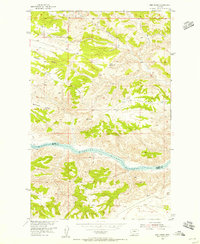
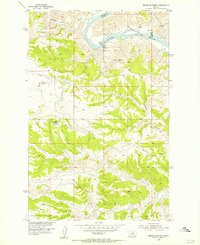
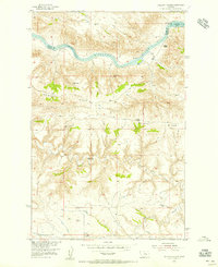
 1959 Lewistown1959 Print · USGSCentral Montana in the mid-1950s shows a landscape defined by the winding Missouri River and the rise of the South Moccasin Mtns. Researchers can trace the rail lines of the Great Northern through towns like Winifred and locate the Cat Creek Oil Field.3 unique versions available
Showing maps 1-25 of 139
Top cities of Fergus County
- Lewistown historical maps
- Denton historical maps
- Moore historical maps
- Winifred historical maps
- Grass Range historical maps
Frequently asked questions
- What are the different types of historical maps available for Fergus County?
- What is the oldest map of Fergus County?
- Where can I purchase historical maps of Fergus County for my home or office?
- Where can I download high-res historical maps of Fergus County?
- Are there historical topographic maps available for Fergus County?
- Is there historical aerial imagery available for Fergus County?
- Where are historical maps of Fergus County sourced from?