1980s Maps of Fergus County, Montana
Explore 60 historic maps of Fergus County from the 1980s. These maps offer a rare glimpse into what life looked like during the 1980s — showing old roads, neighborhoods, homes, and landmarks that have changed or disappeared over time.
Whether you're researching your family's past, planning a metal detecting trip, or studying how Fergus County's landscape evolved across the 1980s, these high-resolution maps are a powerful tool for exploring the history of this region.
- Focus on a specific era: All maps on this page are from the 1980s, giving you a focused view of this time period.
- See what’s changed: Compare century-old streets, trails, and buildings to today's modern landscape using overlays and satellite layers.
- Research with precision: Use these maps for genealogy, historical research, land use analysis, or educational projects.
- View, download, or print: Maps are fully viewable online in high resolution, and can be downloaded or printed for your own records.
Start exploring Fergus County's history through authentic maps from the 1980s. This is your window into the past.
Fergus County, MT maps
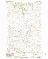
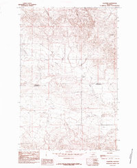
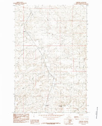
(60)- 1984 Map of Belt
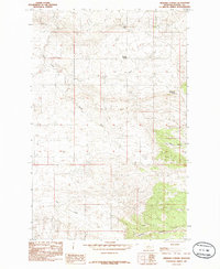
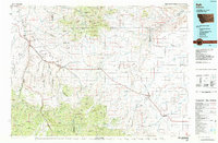 1984 Belt1984 Print · USGSCentral Montana's high peaks and ranching benches are captured here in the early 1980s, documenting the region's mining and rail heritage. Genealogists and historians can locate remote mining outposts like Hughesville and Barker, or trace the Burlington Northern Railroad through Belt and Stanford.
 - 1984 Map of Zortman
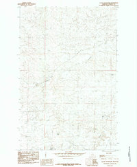
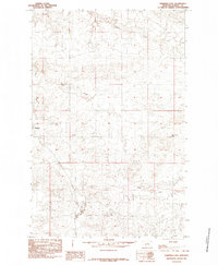
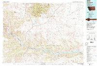 1984 Zortman1984 Print · USGSCentral Montana in the mid-eighties shows a vast landscape of tribal lands and protected wilderness along the Missouri River breaks. Genealogists and historians can trace the remote settlements of Zortman and Landusky or locate landmarks like Mission Peak and D V Junction.
 - 1985 Map of The Horse Ranch
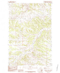
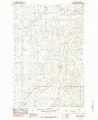
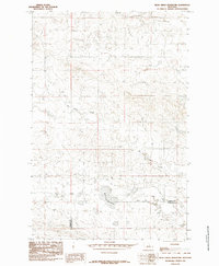
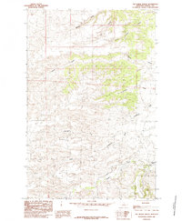 1985 The Horse Ranch1985 Print · USGSFergus County ranchlands are documented here in the mid-1980s, showcasing a landscape defined by seasonal water and isolated homesteads. Researchers can trace the rugged drainage systems of Cottonwood Creek and find local landmarks like The Horse Ranch or Deadman Coulee.
 - 1985 Map of Brown Spring
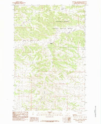
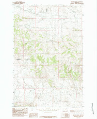 1985 Brown Spring1985 Print · USGSThe Petroleum County rangeland comes alive in the mid-1980s, showcasing the intricate system of coulees and high plains terrain. Trace the drainage of Blood Creek or locate landmarks like Dog Butte and Dunn Ridge in this detailed survey.
 - 1985 Map of Griffee Coulee
 1985 Griffee Coulee1985 Print · USGSFergus County's open rangeland and river drainage are detailed here in the mid-1980s. Researchers can trace the winding Sacagawea River and identify named topographic features like Griffee Ridge and Dexter Coulee.
 - 1985 Map of Hilger NW
 1985 Hilger NW1985 Print · USGSFergus County's high-plains landscape is captured here in the mid-eighties, showing a sparsely settled region defined by its vital water sources and branching coulees. Researchers can trace the rugged drainages of Salt Creek and Box Elder Creek or locate the isolated Little Cottonwood Spring.
 - 1985 Map of Dovetail Butte
 1985 Dovetail Butte1985 Print · USGSPetroleum County and Fergus County are shown in the mid-1980s, revealing a landscape of high plains and deep coulees. Researchers can trace the winding Sacagawea River and find family-named landmarks like Dovetail Butte and Chimney Crossing.
 - 1985 Map of Bear Creek Reservoir SE
 1985 Bear Creek Reservoir SE1985 Print · USGSThe high plains of central Montana are captured in the mid-1980s, detailing the county line between Fergus Co and Petroleum Co. Researchers can trace the winding paths of Blood Creek, Sage Creek, and Box Elder Creek through this sparsely settled ranching country.
 - 1985 Map of Thompson Coulee
 1985 Thompson Coulee1985 Print · USGSThe Fergus County breaks come into focus in the mid-1980s, showcasing a landscape of high ridges and winding coulees. Trace the drainage of Armells Creek and explore the rugged heights of Knox Ridge and Snell Ridge.
 - 1985 Map of Fergus
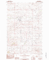
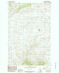 1985 Fergus1985 Print · USGSCentral Montana ranching country comes into focus in the mid-1980s as the plains rise toward the foothills. Trace the path of the Old RR Grade and find remote landmarks like Cone Butte and the small settlement of Fergus.
 - 1985 Map of Woodhawk Hill
 1985 Woodhawk Hill1985 Print · USGSFergus County ranching country is captured here in the mid-1980s, revealing a landscape shaped by deep coulees and high plains buttes. Researchers can trace the rugged drainages of Woodhawk Creek and Lambing Camp Creek around the prominent Woodhawk Hill.
 - 1985 Map of Kendall
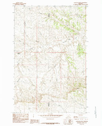
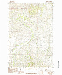
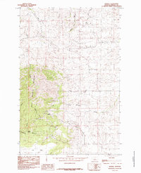 1985 Kendall1985 Print · USGSThe North Moccasin Mountains dominate the landscape of central Montana in the mid-1980s. Local researchers can trace the foothill geography around Kendall or follow the paths of Box Elder Creek, Mason Canyon, and The Park.
 - 1985 Map of Valentine
 1985 Valentine1985 Print · USGSThe high plains of central Montana are captured in the mid-1980s, documenting the remote settlement of Valentine and the surrounding ranchlands. Researchers can trace the winding paths of Blood Creek and Sage Creek or locate the site of Valentine Springs.
 - 1985 Map of Sloan Reservoir
 1985 Sloan Reservoir1985 Print · USGSFergus County ranchlands and water catchments are documented in this mid-eighties survey of the Montana high plains. Researchers can trace local land use through features like Sloan Reservoir, Sacagawea River, and the family-named Kosier Reservoir.
 - 1985 Map of Hilger
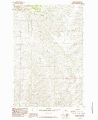
 1985 Hilger1985 Print · USGSCentral Montana ranching country is captured here in the mid-1980s, centered on the community of Hilger. Local historians can trace the watercourses and crossroads that defined this area, including Roy Junction, Moulton, and the winding path of Dog Creek.
 - 1985 Map of Mitchell Crossing
 1985 Mitchell Crossing1985 Print · USGSCentral Montana's high plains and Missouri River breaks are captured in the mid-1980s, showcasing a landscape of deep coulees and isolated ridges. Trace the winding course of Armells Creek past the Mitchell Crossing settlement and into the Charles M Russell National Wildlife Refuge.
 - 1985 Map of Christina
 1985 Christina1985 Print · USGSCentral Montana ranching country in the mid-1980s is defined here by its rail-linked settlements and high prairie peaks. Trace the old Milwaukee Road line through Suffolk or locate family landmarks near Christina and Sheepherder Peak.
 - 1985 Map of Roy
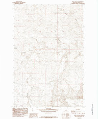
 1985 Roy1985 Print · USGSThe ranching community of Roy is shown during the mid-1980s, revealing the town's structure and the surrounding Fergus County drainage basins. Researchers can trace the path of the Old RR Grade or locate landmarks like the Athletic Field and Butte.
 - 1985 Map of Kachia Reservoir
 1985 Kachia Reservoir1985 Print · USGSFergus County, Montana, is documented here in the mid-eighties just as modern topographic standards were being applied to this cattle-country landscape. Researchers can trace the drainage patterns of the Sacagawea River and locate vital water sources like Kachia Reservoir and Harr Reservoir.
 - 1985 Map of Pipes Coulee
 1985 Pipes Coulee1985 Print · USGSFergus County in the mid-1980s is shown here as a landscape of deep drainage and river crossings. Genealogists and historians can trace the paths of the Sacagawea River and Pipes Coulee or find historical landmarks like Cottonwood Crossing.
 - 1985 Map of Armells
 1985 Armells1985 Print · USGSFergus County ranching country is captured here in the mid-1980s, centered on the drainage of Armells Creek. Genealogists and historians can trace the path of the Old RR Grade or locate the small settlement of Armells near the confluence of the East Fork Armells Creek.
 - 1985 Map of Roy NW
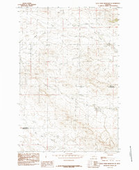
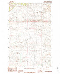
 1985 Roy NW1985 Print · USGSFergus County's high plains and river breaks are captured in the mid-1980s as they appeared during a period of late-century topographic mapping. Researchers can trace the path of the Sacagawea River and identify landmarks like Snell Ridge and Dry Armells Creek.
 - 1985 Map of Gerhard Corner
 1985 Gerhard Corner1985 Print · USGSFergus County's high plains and coulees are captured here in the mid-eighties, showing a landscape defined by ranching and vital water sources. Researchers can trace the rugged topography around Gerhard Corner, locating landmarks like Bald Butte and Sourdough Spring.
 - 1985 Map of Winifred East
 1985 Winifred East1985 Print · USGSFergus County ranching country is captured here during the mid-eighties, showing the high plains landscape around the town of Winifred. Genealogists and local historians can trace the drainages of Rose Creek and Dog Creek or locate the landmark of Bloomfield Butte.
 - 1985 Map of Bear Creek Reservoir
 1985 Bear Creek Reservoir1985 Print · USGSThe Fergus and Petroleum county line runs through this Montana rangeland in the mid-1980s. Researchers can trace the drainage of Box Elder Creek and Antelope Creek or locate the namesake Bear Creek Reservoir and its feeding Bear Creek.
Showing maps 1-25 of 60
Top cities of Fergus County
- Lewistown historical maps
- Denton historical maps
- Moore historical maps
- Winifred historical maps
- Grass Range historical maps
Frequently asked questions
- What are the different types of historical maps available for Fergus County?
- What is the oldest map of Fergus County?
- Where can I purchase historical maps of Fergus County for my home or office?
- Where can I download high-res historical maps of Fergus County?
- Are there historical topographic maps available for Fergus County?
- Is there historical aerial imagery available for Fergus County?
- Where are historical maps of Fergus County sourced from?