1990s Maps of Fergus County, Montana
Explore 13 historic maps of Fergus County from the 1990s. These maps offer a rare glimpse into what life looked like during the 1990s — showing old roads, neighborhoods, homes, and landmarks that have changed or disappeared over time.
Whether you're researching your family's past, planning a metal detecting trip, or studying how Fergus County's landscape evolved across the 1990s, these high-resolution maps are a powerful tool for exploring the history of this region.
- Focus on a specific era: All maps on this page are from the 1990s, giving you a focused view of this time period.
- See what’s changed: Compare century-old streets, trails, and buildings to today's modern landscape using overlays and satellite layers.
- Research with precision: Use these maps for genealogy, historical research, land use analysis, or educational projects.
- View, download, or print: Maps are fully viewable online in high resolution, and can be downloaded or printed for your own records.
Start exploring Fergus County's history through authentic maps from the 1990s. This is your window into the past.
Fergus County, MT maps
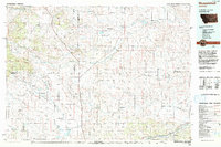
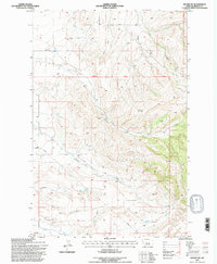
(13)- 1993 Map of Big Snowy Mountains
 1993 Big Snowy Mountains1993 Print · USGSCentral Montana ranching and mountain landscapes come into focus in the early 1990s as small settlements like Judith Gap and Straw dot the plains. Genealogists and historians can trace the Burlington Northern rail line and identify remote sites like Living Springs or the Elephant Rocks.
 - 1993 Map of Musselshell
 1993 Musselshell1993 Print · USGSCentral Montana's high plains and river valleys are shown in the early nineties, centered on the ranching and resource hubs of Winnett and Musselshell. Researchers can trace the Musselshell Ditch, locate the Melstone Oil Field, and explore the diverse wetlands of Lake Mason.
 - 1995 Map of Half Moon Canyon, 1997 Print
 1995 Half Moon Canyon1997 Print · USGSCentral Montana's high country is captured here during the 1990s, showing the complex ridges of the Big Snowy Mountains. Researchers can trace the winding Red Hill Road and locate remote landmarks like Half Moon Pass and Greathouse Peak.
 - 1995 Map of Judith Gap, 1997 Print
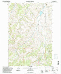
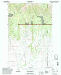
 1995 Judith Gap1997 Print · USGSThe mountain pass at Judith Gap remained a vital corridor for Montana ranching and transport in the mid-nineties. Researchers can trace the legacy of the high plains through the Old Railroad Grade, the local Cem, and natural landmarks like Oka Butte.
 - 1995 Map of Crystal Lake, 1997 Print
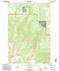
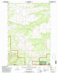
 1995 Crystal Lake1997 Print · USGSThe Big Snowy Mountains in the mid-1990s offer a detailed view of high-altitude forest management and rugged Montana geography. Researchers can locate specific recreation landmarks like Crystal Lake, the Ice Cave, and the Crystal Lake Guard Station.
 - 1995 Map of Alaska Bench, 1997 Print
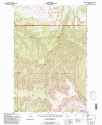
 1995 Alaska Bench1997 Print · USGSThe Little Snowy Mountains and Lewis and Clark National Forest dominate this Montana landscape in the mid-nineties. Trace the high terrain of Alaska Bench and remote water sources like McCartney Springs and the Flatwillow Creek forks.
 - 1995 Map of Heath, 1997 Print
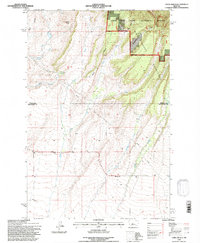
 1995 Heath1997 Print · USGSFergus County's rural heartland is documented here in the mid-nineties, showing the community of Heath and the drainage networks of the Big Snowy foothills. Genealogists and historians can trace the Old Railroad Bed, Mountain View School, and the local Community Hall.
 - 1995 Map of Jump Off Peak, 1997 Print
 1995 Jump Off Peak1997 Print · USGSThe high Big Snowy Mountains in the mid-1990s reveal a landscape of sharp ridges and deep canyons along the Fergus and Golden Valley county line. Trace the remote drainage systems of Big Rock Creek and Blake Creek or locate landmarks like Jump Off Peak and Lime Cave Peak.
 - 1995 Map of Castle Butte, 1997 Print
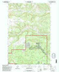
 1995 Castle Butte1997 Print · USGSThe Fergus County high country in the mid-1990s reveals a landscape of ranching, recreation, and rural education. Genealogists and local historians can locate the Cottonwood School, the Castle Hill Ski Area, and the grounds of Camp Lewtana.
 - 1995 Map of Moore SW, 1997 Print
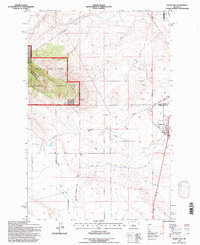
 1995 Moore SW1997 Print · USGSFergus County in the mid-1990s was a landscape defined by ranching terrain and the early digital infrastructure of an Electronic Site. Researchers can trace the layout of the Garneill settlement and locate rural landmarks like Buffalo Creek and several Gravel Pits.
 - 1995 Map of Snow Saucer Coulee, 1997 Print
 1995 Snow Saucer Coulee1997 Print · USGSThe northern Snowy Mountains meet the Montana plains in the mid-nineties, revealing a landscape of timbered ridges and deep coulees. Trace the headwaters of Careless Creek and West Fork Big Snowy Creek near Windy Point.
 - 1995 Map of Yaple Bench, 1997 Print
 1995 Yaple Bench1997 Print · USGSCentral Montana ranchlands and the fringe of the Little Snowies are captured here in the mid-1990s. Researchers can trace land use across Yaple Bench and identify remote sites like the Radio Facility and Castle Rocks.
 - 1995 Map of South Bench, 1997 Print
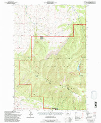
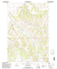
 1995 South Bench1997 Print · USGSCentral Montana’s high-country drainages are captured here in the mid-1990s as the wilderness landscape transitions into ranching benches. Trace the intricate headwaters of the Little Snowy Mountains and the winding course of Willow Creek.
End of results
Showing maps 1-13 of 13
Top cities of Fergus County
- Lewistown historical maps
- Denton historical maps
- Moore historical maps
- Winifred historical maps
- Grass Range historical maps
Frequently asked questions
- What are the different types of historical maps available for Fergus County?
- What is the oldest map of Fergus County?
- Where can I purchase historical maps of Fergus County for my home or office?
- Where can I download high-res historical maps of Fergus County?
- Are there historical topographic maps available for Fergus County?
- Is there historical aerial imagery available for Fergus County?
- Where are historical maps of Fergus County sourced from?