1960s Maps of Lake County, Montana
Explore 55 historic maps of Lake County from the 1960s. These maps offer a rare glimpse into what life looked like during the 1960s — showing old roads, neighborhoods, homes, and landmarks that have changed or disappeared over time.
Whether you're researching your family's past, planning a metal detecting trip, or studying how Lake County's landscape evolved across the 1960s, these high-resolution maps are a powerful tool for exploring the history of this region.
- Focus on a specific era: All maps on this page are from the 1960s, giving you a focused view of this time period.
- See what’s changed: Compare century-old streets, trails, and buildings to today's modern landscape using overlays and satellite layers.
- Research with precision: Use these maps for genealogy, historical research, land use analysis, or educational projects.
- View, download, or print: Maps are fully viewable online in high resolution, and can be downloaded or printed for your own records.
Start exploring Lake County's history through authentic maps from the 1960s. This is your window into the past.
Lake County, MT maps
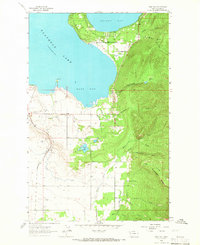
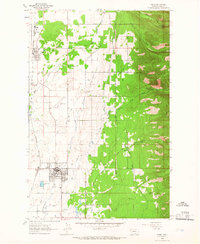
(55)- 1960 Map of Kalispell
 1960 Kalispell1960 Print · USGSNorthwest Montana in the late fifties is defined by the mountain corridors of the Great Northern Railway and the vast reaches of Glacier National Park. Researchers can trace the legacy of timber and mining towns like Libby, Rexford, and Whitefish, or locate landmarks such as the Snowshoe Mine.
 - 1960 Map of Wallace
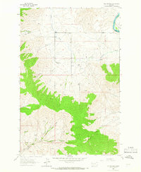
 1960 Wallace1960 Print · USGSNorthwestern Montana and the Idaho panhandle are captured in the late fifties, showing the vast Flathead Indian Reservation and the mining districts of the Bitterroot Range. Researchers can trace the rail lines of the Northern Pacific or locate early sites like the Morning Mine and the National Bison Range.
 - 1960 Map of Cut Bank, 1968 Print
 1960 Cut Bank1968 Print · USGSThe high peaks of the Rockies meet the eastern plains in the 1960s, showing the intersection of federal lands and the Blackfeet Indian Reservation. Trace the path of the Great Northern railway and find local landmarks like the Blackfoot Boarding School and Family Mission Cem.3 unique versions available
 - 1961 Map of Kalispell
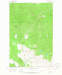
 1961 Kalispell1961 Print · USGSNorthwestern Montana at the start of the 1960s shows a landscape of timber-driven rail towns and the sprawling wild lands of Glacier National Park. Genealogists and historians can trace the route of the Great Northern through mountain passes or locate old settlements like Fortine, Trego, and Warland.
 - 1962 Map of Choteau
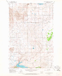
 1962 Choteau1962 Print · USGSThe Rocky Mountain Front meets the western plains in the early 1960s, showing a landscape defined by the Continental Divide. Genealogists and researchers can trace the tracks of the Great Northern and find settlements like Choteau, Augusta, and Bynum.
 - 1962 Map of Bigfork, 1964 Print
 1962 Bigfork1964 Print · USGSThe Flathead Valley and the shores of Bigfork are captured here during the early sixties, showing a landscape of timber management and lakeside settlement. Researchers can locate the Big Fork Dam, the McCaffery Lookout Tower, and local landmarks like Little Brown Ch and Bethany Ch.3 unique versions available
 - 1963 Map of Cut Bank
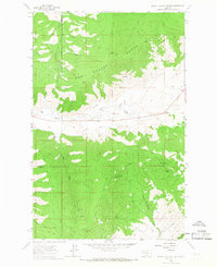
 1963 Cut Bank1963 Print · USGSNorthern Montana’s mountain passes and high plains are captured here in the early 1960s. Genealogists and historians can trace the Great Northern rail stops from Browning to Ethridge or locate the remote outposts at Polebridge and Babb.
 - 1964 Map of Bull Island
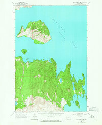
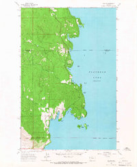
 1964 Bull Island1964 Print · USGSFlathead Lake and its eastern shoreline appear here in the mid-1960s, showing the early recreational and tribal land patterns. Trace the unique geography of Finley Point, the islands at The Narrows, and the inlets of Yellow Bay and Blue Bay.4 unique versions available
 - 1964 Map of Cut Bank
 1964 Cut Bank1964 Print · USGSGlacier National Park and the Blackfeet Indian Reservation meet in the early sixties at the triple divide of North America. Researchers can trace the Great Northern Railway through mountain passes and locate local landmarks like the Blackfoot Boarding School and Apgar Village.
 - 1964 Map of Buffalo Bridge
 1964 Buffalo Bridge1964 Print · USGSThe Flathead River valley comes into focus in the mid-sixties, showing the intersection of reservation life and rural development. Trace local community roots at Valley View Sch or follow the water from Loon Lake to the Pablo Canal.2 unique versions available
 - 1964 Map of Wild Horse Island, 1966 Print
 1964 Wild Horse Island1966 Print · USGSFlathead Lake in the mid-1960s reveals a quiet shoreline of isolated camps and rugged island interiors. Trace local landmarks like Lindisfarne (Camp Marshall) and geographical features from White Swan Bay to Wymore Lake.
 - 1964 Map of East Bay, 1966 Print
 1964 East Bay1966 Print · USGSThe southern shores of Flathead Lake come into focus in the mid-1960s, showing a landscape defined by the water and the rising Mission Mountains. Researchers can trace the path of the Northern Pacific railroad or locate features like Finley Point and the Pablo Feeder Canal.2 unique versions available
 - 1964 Map of Irvine Lookout Tower, 1966 Print
 1964 Irvine Lookout Tower1966 Print · USGSThe Hog Heaven Range and the Flathead Indian Reservation are captured here in the mid-1960s. Researchers can locate remote outposts like Hog Heaven Lookout Tower and ranching landmarks such as Pablo Ranch and Bower Ranch.
 - 1964 Map of Dixon, 1966 Print
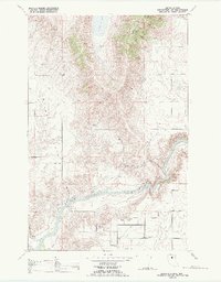
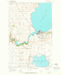
 1964 Dixon1966 Print · USGSThe Flathead and Jocko rivers meet in this 1960s survey of the Sanders and Lake County line. Researchers can trace the mid-century rail-and-water economy through features like the Northern Pacific railroad, Dixon Indian Chapel, and the National Bison Range.
 - 1964 Map of Lake Mary Ronan, 1966 Print
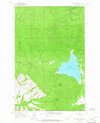 1964 Lake Mary Ronan1966 Print · USGSIn the mid-1960s, the shores of Lake Mary Ronan were surrounded by the timbered slopes of the Flathead National Forest. You can trace old access routes through the Hog Heaven Range and find remote landmarks like Rock Spring and Big Meadows.
 - 1964 Map of Fort Connah, 1966 Print
 1964 Fort Connah1966 Print · USGSThe Flathead Indian Reservation in the mid-1960s shows a sophisticated irrigation network supporting valley life. Researchers can locate the Fort Connah (Site) and trace water flow through the Kicking Horse Reservoir and Mission Canal.
 - 1964 Map of Melton Ranch, 1966 Print
 1964 Melton Ranch1966 Print · USGSSanders County ranching country comes to life in the 1960s as a network of family homesteads and valley streams. Genealogists and researchers can trace the locations of Melton Ranch, Jennings Ranch, and the winding path of the Little Bitterroot River.2 unique versions available
 - 1964 Map of Rollins, 1966 Print
 1964 Rollins1966 Print · USGSThe western banks of Flathead Lake come alive in this mid-sixties survey of the Rollins area. Genealogists and historians can trace the shoreline through West Shore State Park down to the Flathead Indian Reservation Boundary and the community of Rollins.
 - 1964 Map of Elmo, 1966 Print
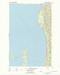
 1964 Elmo1966 Print · USGSThe western shore of Flathead Lake appears in the mid-sixties, showcasing the lakefront communities and steep mountain topography of the region. Researchers can trace the layout of Elmo and Dayton, or locate the Indian Cem and Cromwell Island.2 unique versions available
 - 1964 Map of Polson, 1966 Print
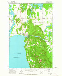
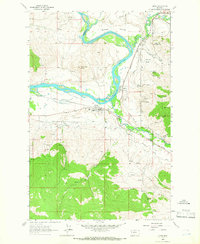
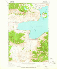
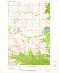
 1964 Polson1966 Print · USGSPolson and the southern reaches of Flathead Lake are captured in the mid-1960s, showing the town's growth as a rail and water hub. Genealogists and researchers can trace the Northern Pacific line, Kerr Dam, and family sites near Polson Cem or the Valley View Hills.
 - 1964 Map of Ronan, 1966 Print
 1964 Ronan1966 Print · USGSIn the mid-sixties, the Mission Valley was a network of rail-side towns and mountain canyons. Researchers can trace the legacy of Lake County through the Ronan Cemetery, the Northern Pacific line, and the North Crow Community House.2 unique versions available
 - 1964 Map of Proctor, 1966 Print
 1964 Proctor1966 Print · USGSThe small mountain community of Proctor is seen here in the 1960s, situated where the national forest meets the reservation boundary. Local researchers can locate family-named landmarks like Bickford Spring, the Community Ch, and the remote Grants Meadow.2 unique versions available
 - 1964 Map of Lower Crow Reservoir, 1966 Print
 1964 Lower Crow Reservoir1966 Print · USGSLake County during the mid-sixties reveals an intricate irrigation landscape shaped by the Pablo Canal and the waters of the Lower Crow Reservoir. Researchers can trace the Northern Pacific tracks or locate family landmarks like Round Butte and the Sloan Buttes.
 - 1964 Map of Saint Ignatius, 1966 Print
 1964 Saint Ignatius1966 Print · USGSSaint Ignatius and the Mission Valley foothills come into focus in the mid-1960s, showing a landscape shaped by irrigation and community institutions. Researchers can locate St Joseph Sch, the Mission Hospital, and family sites near Pleasant View Cem.3 unique versions available
 - 1964 Map of Woods Bay, 1966 Print
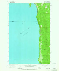 1964 Woods Bay1966 Print · USGSThe eastern shore of Flathead Lake appears in the mid-1960s as a developing corridor of forest recreation and small settlements. Researchers can trace the tribal lands at the Flathead Indian Reservation Boundary or locate family sites near Woods Bay and the Yellow Bay Campground.
Showing maps 1-25 of 55
Top cities of Lake County
Frequently asked questions
- What are the different types of historical maps available for Lake County?
- What is the oldest map of Lake County?
- Where can I purchase historical maps of Lake County for my home or office?
- Where can I download high-res historical maps of Lake County?
- Are there historical topographic maps available for Lake County?
- Is there historical aerial imagery available for Lake County?
- Where are historical maps of Lake County sourced from?