Old Maps of Polson, Montana for Metal Detecting
Plan your next treasure hunt with 17 historic maps of Polson. Find old homesites, ghost towns, trails, and gathering spots that may be lost to time — perfect for identifying promising metal detecting locations.
- Locate forgotten sites: Uncover places like long-lost settlements, abandoned rail lines, or gathering spots.
- Plan better hunts: Use map overlays combined with LiDAR or satellite views to narrow in on historically rich areas.
- Made for detectorists: Thousands of hobbyists use these maps to discover relics, coins, and hidden history.
Use these historic maps to boost your research and find new opportunities beneath the surface of Polson.
Polson, MT maps
(17)- 1920 Map of Flathead Lake
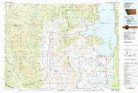
 1920 Flathead Lake1920 Print · USGSWestern Montana at the dawn of the twenties reveals a landscape being transformed by irrigation and rail. Genealogists can trace family roots in early settlements like Polson, Ronan, and Dayton, or locate landmarks such as Wild Horse I. and the Pablo Reservoir.
 - 1956 Map of Wallace, 1966 Print
 1956 Wallace1966 Print · USGSWestern Montana and the Idaho panhandle meet in this mid-century survey of the Bitterroot and Cabinet Mountains. Genealogists and historians can trace the rail-and-river economy through the Northern Pacific line and settlements like Thompson Falls or St. Ignatius.3 unique versions available
 - 1960 Map of Wallace
 1960 Wallace1960 Print · USGSNorthwestern Montana and the Idaho panhandle are captured in the late fifties, showing the vast Flathead Indian Reservation and the mining districts of the Bitterroot Range. Researchers can trace the rail lines of the Northern Pacific or locate early sites like the Morning Mine and the National Bison Range.
 - 1964 Map of East Bay, 1966 Print
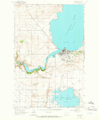
 1964 East Bay1966 Print · USGSThe southern shores of Flathead Lake come into focus in the mid-1960s, showing a landscape defined by the water and the rising Mission Mountains. Researchers can trace the path of the Northern Pacific railroad or locate features like Finley Point and the Pablo Feeder Canal.2 unique versions available
 - 1964 Map of Polson, 1966 Print
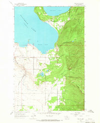
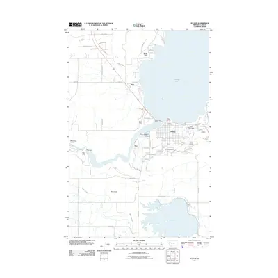
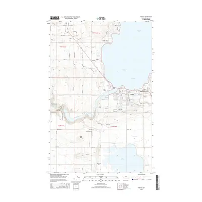
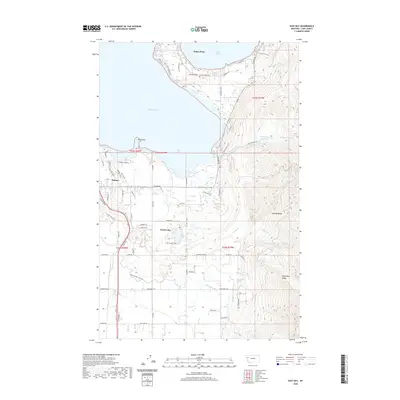
 1964 Polson1966 Print · USGSPolson and the southern reaches of Flathead Lake are captured in the mid-1960s, showing the town's growth as a rail and water hub. Genealogists and researchers can trace the Northern Pacific line, Kerr Dam, and family sites near Polson Cem or the Valley View Hills.
 - 1980 Map of Polson, 1982 Print
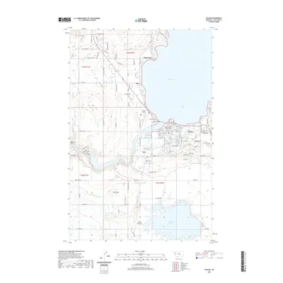
 1980 Polson1982 Print · USGSThe Flathead Indian Reservation and its surrounding timberlands are captured here in the early eighties. Genealogists and historians can trace the development of Polson, locate remote sites like the Flathead Mine, and follow the Burlington Northern rail line through Pablo and Ronan.
 - 1988 Map of East Bay
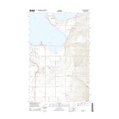
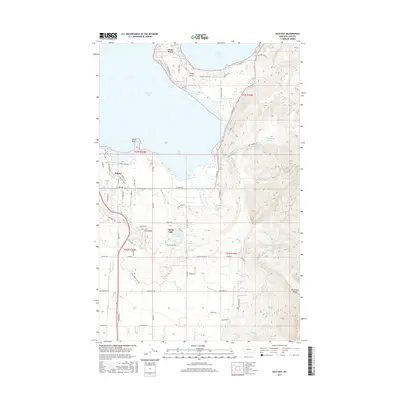
 1988 East Bay1988 Print · USGSThe southeastern shore of Flathead Lake in the late 1980s reveals a unique intersection of tribal wilderness and local industry. Trace the irrigation network of the Pablo Feeder Canal or locate local landmarks like the Drive-in Theater and Minesinger Ridge.
 - 2011 Map of East Bay, 2011 Print
 2011 East Bay2011 Print · USGSCovers Polson, including Finley Point, Turtle Lake, and other nearby areas
 - 2011 Map of Polson, 2011 Print
 2011 Polson2011 Print · USGSCovers Polson, including Rocky Point, Belle-Vue Court, and other nearby areas
 - 2014 Map of Polson, 2014 Print
 2014 Polson2014 Print · USGSCovers Polson, including Rocky Point, Belle-Vue Court, and other nearby areas
 - 2014 Map of East Bay, 2014 Print
 2014 East Bay2014 Print · USGSCovers Polson, including Finley Point, Turtle Lake, and other nearby areas
 - 2017 Map of East Bay, 2017 Print
 2017 East Bay2017 Print · USGSCovers Polson, including Finley Point, Turtle Lake, and other nearby areas
 - 2017 Map of Polson, 2017 Print
 2017 Polson2017 Print · USGSCovers Polson, including Rocky Point, Belle-Vue Court, and other nearby areas
 - 2020 Map of East Bay, 2020 Print
 2020 East Bay2020 Print · USGSCovers Polson, including Finley Point, Turtle Lake, and other nearby areas
 - 2020 Map of Polson, 2020 Print
 2020 Polson2020 Print · USGSCovers Polson, including Rocky Point, Belle-Vue Court, and other nearby areas
 - 2024 Map of East Bay, 2024 Print
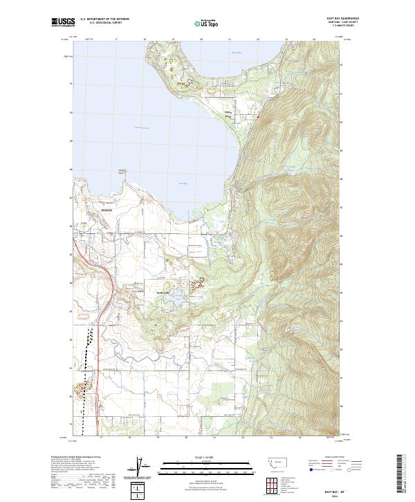 2024 East Bay2024 Print · USGSThe southern shores of Flathead Lake and the Mission Range come into focus in this recent Lake County study. Researchers can trace the water systems of the Pablo Feeder Canal and Hellroaring Reservoir, alongside settlements at Polson and Finley Point.
 - 2024 Map of Polson, 2024 Print
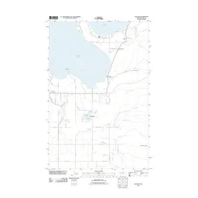
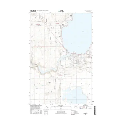
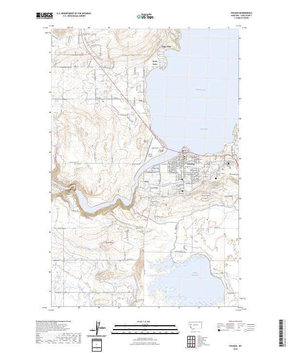 2024 Polson2024 Print · USGSThe southern tip of Flathead Lake and the town of Polson are captured here in the early 2020s. Researchers can trace local lineage at Lakeview Cem or map the complex irrigation network of the Polson B Canal and Pablo Reservoir.
End of results
Showing maps 1-17 of 17
Top cities near Polson
Top neighborhoods of Polson
Frequently asked questions
- What are the different types of historical maps available for Polson?
- What is the oldest map of Polson?
- Where can I purchase historical maps of Polson for my home or office?
- Where can I download high-res historical maps of Polson?
- Are there historical topographic maps available for Polson?
- Is there historical aerial imagery available for Polson?
- Where are historical maps of Polson sourced from?