1960s Maps of Liberty County, Montana
Explore 20 historic maps of Liberty County from the 1960s. These maps offer a rare glimpse into what life looked like during the 1960s — showing old roads, neighborhoods, homes, and landmarks that have changed or disappeared over time.
Whether you're researching your family's past, planning a metal detecting trip, or studying how Liberty County's landscape evolved across the 1960s, these high-resolution maps are a powerful tool for exploring the history of this region.
- Focus on a specific era: All maps on this page are from the 1960s, giving you a focused view of this time period.
- See what’s changed: Compare century-old streets, trails, and buildings to today's modern landscape using overlays and satellite layers.
- Research with precision: Use these maps for genealogy, historical research, land use analysis, or educational projects.
- View, download, or print: Maps are fully viewable online in high resolution, and can be downloaded or printed for your own records.
Start exploring Liberty County's history through authentic maps from the 1960s. This is your window into the past.
Liberty County, MT maps
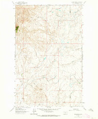
(20)- 1962 Map of Tiber, 1964 Print
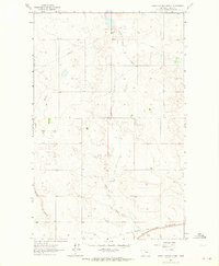
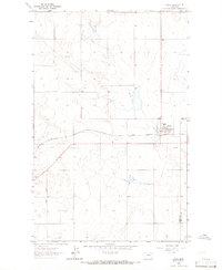
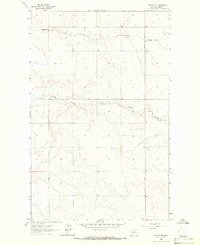
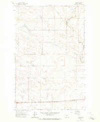 1962 Tiber1964 Print · USGSThe Montana prairie south of the Sweet Grass Hills comes into focus in the early sixties, centered on the Great Northern railway. Researchers can locate the Tiber station and trace the path of Whitlash Road as it winds near Horse Creek.
 - 1962 Map of Bingham Lake, 1964 Print
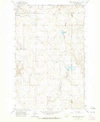
 1962 Bingham Lake1964 Print · USGSLiberty County ranchlands and the international border appear in the early 1960s, showing a landscape defined by high buttes and oil fields. Genealogists and historians can trace family sites like the Old Laird Ranch, Dafoe Ranch, and the remote settlement at Bears Den.2 unique versions available
 - 1962 Map of Lakey Ranch, 1964 Print
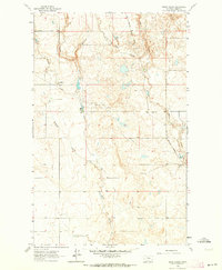
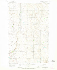
 1962 Lakey Ranch1964 Print · USGSLiberty County ranching culture is documented here during the early sixties, showing a landscape of family-run operations and prairie tracks. Genealogists can locate specific homesteads such as Lakey Ranch, Thieltge Ranch, and Reiland Ranch along the route of Whitlash Road.
 - 1962 Map of Whitlash, 1964 Print
 1962 Whitlash1964 Print · USGSThe Montana-Alberta border country comes into focus in the early 1960s, showing a high-plains landscape defined by ranching and petroleum. Genealogists and historians can locate the Whitlash Cem, the North Sch, and family sites like Demarest Ranch.2 unique versions available
 - 1962 Map of North Lothair School, 1964 Print
 1962 North Lothair School1964 Print · USGSLiberty County ranching and energy production are in focus in the early 1960s, showing a landscape defined by prairie ravines and infrastructure. Trace the Great Northern tracks and search for local landmarks like the North Lothair Sch and the Utopia Gas and Oil Field.2 unique versions available
 - 1962 Map of Berkholder Reservoir, 1964 Print
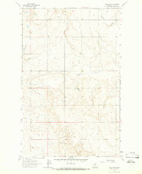
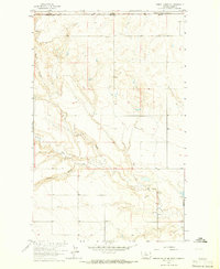
 1962 Berkholder Reservoir1964 Print · USGSToole and Liberty Counties are documented in the early sixties as a network of coulees and remote ranchlands. Researchers can trace rural landmarks and family-named routes like Grandview Cem, Price, and Cavitt Road.
 - 1962 Map of Blair Ranch, 1964 Print
 1962 Blair Ranch1964 Print · USGSLiberty County ranching and energy production are mapped here in the early sixties as the oil industry expanded across the northern plains. Researchers can locate the Blair Ranch, trace the historic Old Whitlash Freight Road, and find the Eagle Creek Sch.
 - 1962 Map of Hawley Hill, 1964 Print
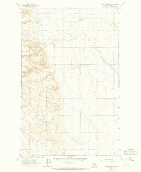
 1962 Hawley Hill1964 Print · USGSThe Montana-Alberta border comes alive in the early 1960s, showing a high-plains landscape defined by petroleum extraction and family ranching. Researchers can trace the holdings of the Bingham Ranch and Dolezal Ranch or locate the rural Bear Gulch Sch.
 - 1962 Map of Haystack Butte, 1964 Print
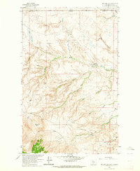
 1962 Haystack Butte1964 Print · USGSLiberty County ranching and mining history come alive in the early sixties, showing a landscape defined by prominent peaks and family homesteads. Genealogists can locate family-named landmarks like Hofer Ranch and Forseth Ranch, or trace old routes like the Old Whitlash Freight Road.
 - 1962 Map of Mc Carters Lake SE, 1964 Print
 1962 Mc Carters Lake SE1964 Print · USGSThe Montana high plains near the Liberty County line appear as a working landscape of ranching and early energy infrastructure in the early sixties. Researchers can trace rural landmarks like the Greenhill Sch, Cavitt Road, and the Childress Reservoir.
 - 1962 Map of Mount Lebanon, 1964 Print
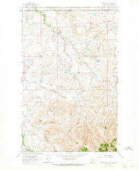
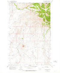
 1962 Mount Lebanon1964 Print · USGSLiberty County ranching and energy production are captured here in the early 1960s, showing the high plains of northern Montana. Researchers can locate family landmarks like Roke Ranch or trace natural features including Devils Chimney and the Bears Den Oil and Gas Field.
 - 1962 Map of Grassy Butte, 1964 Print
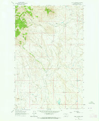
 1962 Grassy Butte1964 Print · USGSToole County ranching and early energy development are captured here in the early sixties. Genealogists and historians can trace family landholdings like the Hartsook Ranch and notable landmarks such as Gold Butte and Alkali Spring.2 unique versions available
 - 1963 Map of Joplin, 1965 Print
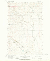
 1963 Joplin1965 Print · USGSLiberty County agricultural life in the early sixties centers on the rail-side grain hub of Joplin. Genealogists and historians can trace the local road network including Bison Road, the Great Northern rail line, and the siding at Buelow.
 - 1963 Map of Bobcat Coulee SE, 1966 Print
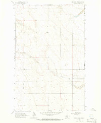 1963 Bobcat Coulee SE1966 Print · USGSNorthern Montana's high plains come into focus in the early sixties, showing the rural landscape along the Liberty and Hill county line. Researchers can locate the Tingdahl School and trace the winding course of Little Sage Creek through this quiet cattle-and-grain country.
 - 1963 Map of Vaver Reservoir, 1966 Print
 1963 Vaver Reservoir1966 Print · USGSLiberty County was entering a period of industrial expansion in the 1960s as petroleum development took hold in the Montana plains. Researchers can trace the early energy footprint through a Gas Field and Gas Wells near Vaver Reservoir.
 - 1963 Map of Chester NW, 1966 Print
 1963 Chester NW1966 Print · USGSNorthern Montana prairie and ranchlands are captured here during the early sixties, as agriculture and local resource extraction shaped the landscape. Researchers can trace rural infrastructure via Whitlash Road and locate the small settlement of Utopia near Adobe Ridge.
 - 1963 Map of Chester NE, 1966 Print
 1963 Chester NE1966 Print · USGSLiberty County's high plains are captured here in the early sixties, showing the rural section-line layout north of Chester. Researchers can trace land divisions along Bison Road and identify seasonal watercourses like Fourmile Coulee and O'Brien Coulee.
 - 1963 Map of Chester, 1966 Print
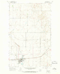 1963 Chester1966 Print · USGSChester sits at a vital railroad junction in northern Montana during the early sixties, anchoring a landscape of agriculture and early energy infrastructure. Genealogists and historians can trace local landmarks like Chester Cemetery, the Great Northern rail line, and Great Northern Reservoir.2 unique versions available
 - 1964 Map of Bobcat Coulee NE, 1965 Print
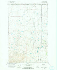
 1964 Bobcat Coulee NE1965 Print · USGSThe northern border of Montana meets Alberta in the mid-1960s, showing a remote prairie landscape defined by deep coulees. Genealogists and historians can trace local landmarks like Immanuel Ch and water sources including Sage Creek and Laird Cr.
 - 1964 Map of Laird School, 1966 Print
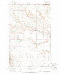 1964 Laird School1966 Print · USGSLiberty County ranching and the Canadian border meet in the mid-1960s along the wind-swept coulees of northern Montana. Genealogists and researchers can trace the locations of the Sage Creek Colony, Laird School, and family operations like Turner Ranch.
End of results
Showing maps 1-20 of 20
Top cities of Liberty County
Frequently asked questions
- What are the different types of historical maps available for Liberty County?
- What is the oldest map of Liberty County?
- Where can I purchase historical maps of Liberty County for my home or office?
- Where can I download high-res historical maps of Liberty County?
- Are there historical topographic maps available for Liberty County?
- Is there historical aerial imagery available for Liberty County?
- Where are historical maps of Liberty County sourced from?