Old Maps of Lincoln County, Montana
Explore 218 old maps of Lincoln County, spanning from 1911 to today. These high-resolution historic maps reveal how streets, neighborhoods, landmarks, and natural features evolved over time — perfect for genealogy, metal detecting, research, and local history exploration.
What you can do with these maps:
- See how Lincoln County changed over time: Compare historical maps to modern-day views to trace roads, homesites, rail lines & more.
- View detailed metadata: Each map includes creators, publishers, year, scale, and archive source.
- Overlay maps with satellite & LiDAR: Visualize the past alongside modern tools to explore terrain & human change.
- Trusted historical sources: Maps sourced from the USGS, Library of Congress, and other archives.
- Access maps your way: View online, download high-res files, or order prints for personal or research use.
Start exploring old maps of Lincoln County to uncover forgotten places, hidden landmarks, and the deep history beneath your feet.
Lincoln County, MT maps
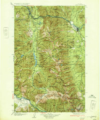
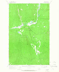
(218)- 1911 Map of Priest Lake, 1954 Print
 1911 Priest Lake1954 Print · USGSCovers Lincoln County, including Sandpoint, Bonners Ferry, and other nearby areas
 - 1913 Map of Priest Lake
 1913 Priest Lake1913 Print · USGSCovers Lincoln County, including Sandpoint, Bonners Ferry, and other nearby areas3 unique versions available
 - 1913 Map of Stryker, 1960 Print
 1913 Stryker1960 Print · USGSCovers Lincoln County, including Trego, Fortine, and other nearby areas
 - 1916 Map of Stryker
 1916 Stryker1916 Print · USGSCovers Lincoln County, including Trego, Fortine, and other nearby areas3 unique versions available
 - 1920 Map of Libby
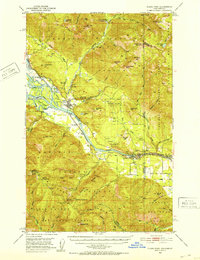
 1920 Libby1920 Print · USGSCovers Lincoln County, including Libby, Troy, and other nearby areas
 - 1920 Map of Jennings
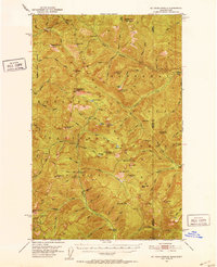
 1920 Jennings1920 Print · USGSCovers Lincoln County, including Happys Inn, Jennings, and other nearby areas
 - 1930 Map of Libby, 1960 Print
 1930 Libby1960 Print · USGSCovers Lincoln County, including Libby, Troy, and other nearby areas
 - 1932 Map of Libby
 1932 Libby1932 Print · USGSCovers Lincoln County, including Libby, Troy, and other nearby areas3 unique versions available
 - 1932 Map of Trout Creek, 1955 Print
 1932 Trout Creek1955 Print · USGSCovers Lincoln County, including Osburn, Trout Creek, and other nearby areas
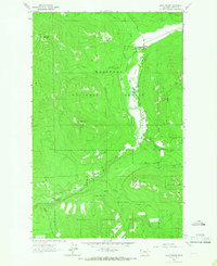
 - 1935 Map of Thompson Lakes
 1935 Thompson Lakes1935 Print · USGSCovers Lincoln County, including Happys Inn, Jennings, and other nearby areas3 unique versions available
 - 1935 Map of Trout Creek, 1949 Print
 1935 Trout Creek1949 Print · USGSCovers Lincoln County, including Osburn, Trout Creek, and other nearby areas
 - 1936 Map of Trout Creek
 1936 Trout Creek1936 Print · USGSCovers Lincoln County, including Osburn, Trout Creek, and other nearby areas2 unique versions available
 - 1937 Map of Thompson Falls
 1937 Thompson Falls1937 Print · USGSCovers Lincoln County, including Thompson Falls, Bend, and other nearby areas2 unique versions available
 - 1942 Map of Thompson Lakes
 1942 Thompson Lakes1942 Print · USGSCovers Lincoln County, including Happys Inn, Jennings, and other nearby areas2 unique versions available
 - 1951 Map of Clark Fork, 1952 Print
 1951 Clark Fork1952 Print · USGSCovers Lincoln County, including Clark Fork, Bonner County, and other nearby areas4 unique versions available
 - 1951 Map of Mt Pend Oreille, 1952 Print
 1951 Mt Pend Oreille1952 Print · USGSCovers Lincoln County, including Bonner County, United States, and other nearby areas4 unique versions available
 - 1956 Map of Wallace, 1966 Print
 1956 Wallace1966 Print · USGSCovers Lincoln County, including Polson, Ronan, and other nearby areas3 unique versions available
 - 1957 Map of Kalispell, 1967 Print
 1957 Kalispell1967 Print · USGSCovers Lincoln County, including Kalispell, Whitefish, and other nearby areas3 unique versions available
 - 1958 Map of Sandpoint, 1966 Print
 1958 Sandpoint1966 Print · USGSCovers Lincoln County, including Sandpoint, Colville, and other nearby areas2 unique versions available
 - 1960 Map of Kalispell
 1960 Kalispell1960 Print · USGSCovers Lincoln County, including Kalispell, Whitefish, and other nearby areas
 - 1960 Map of Wallace
 1960 Wallace1960 Print · USGSCovers Lincoln County, including Polson, Ronan, and other nearby areas
 - 1961 Map of Kalispell
 1961 Kalispell1961 Print · USGSCovers Lincoln County, including Kalispell, Whitefish, and other nearby areas
 - 1963 Map of Sandpoint
 1963 Sandpoint1963 Print · USGSCovers Lincoln County, including Sandpoint, Colville, and other nearby areas
 - 1963 Map of Wolf Prairie, 1965 Print
 1963 Wolf Prairie1965 Print · USGSCovers Lincoln County, including United States, Montana, and other nearby areas2 unique versions available
 - 1963 Map of Yaak, 1966 Print
 1963 Yaak1966 Print · USGSCovers Lincoln County, including Yaak, United States, and other nearby areas
Showing maps 1-25 of 218
Top cities of Lincoln County
- Libby historical maps
- Eureka historical maps
- Troy historical maps
- Trego historical maps
- Fortine historical maps
- Rexford historical maps
See more
Frequently asked questions
- What are the different types of historical maps available for Lincoln County?
- What is the oldest map of Lincoln County?
- Where can I purchase historical maps of Lincoln County for my home or office?
- Where can I download high-res historical maps of Lincoln County?
- Are there historical topographic maps available for Lincoln County?
- Is there historical aerial imagery available for Lincoln County?
- Where are historical maps of Lincoln County sourced from?