1960s Maps of Lincoln County, Montana
Explore 93 historic maps of Lincoln County from the 1960s. These maps offer a rare glimpse into what life looked like during the 1960s — showing old roads, neighborhoods, homes, and landmarks that have changed or disappeared over time.
Whether you're researching your family's past, planning a metal detecting trip, or studying how Lincoln County's landscape evolved across the 1960s, these high-resolution maps are a powerful tool for exploring the history of this region.
- Focus on a specific era: All maps on this page are from the 1960s, giving you a focused view of this time period.
- See what’s changed: Compare century-old streets, trails, and buildings to today's modern landscape using overlays and satellite layers.
- Research with precision: Use these maps for genealogy, historical research, land use analysis, or educational projects.
- View, download, or print: Maps are fully viewable online in high resolution, and can be downloaded or printed for your own records.
Start exploring Lincoln County's history through authentic maps from the 1960s. This is your window into the past.
Lincoln County, MT maps
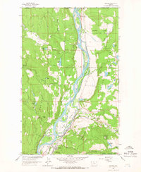
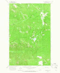
(93)- 1960 Map of Kalispell
 1960 Kalispell1960 Print · USGSNorthwest Montana in the late fifties is defined by the mountain corridors of the Great Northern Railway and the vast reaches of Glacier National Park. Researchers can trace the legacy of timber and mining towns like Libby, Rexford, and Whitefish, or locate landmarks such as the Snowshoe Mine.
 - 1960 Map of Wallace
 1960 Wallace1960 Print · USGSNorthwestern Montana and the Idaho panhandle are captured in the late fifties, showing the vast Flathead Indian Reservation and the mining districts of the Bitterroot Range. Researchers can trace the rail lines of the Northern Pacific or locate early sites like the Morning Mine and the National Bison Range.
 - 1961 Map of Kalispell
 1961 Kalispell1961 Print · USGSNorthwestern Montana at the start of the 1960s shows a landscape of timber-driven rail towns and the sprawling wild lands of Glacier National Park. Genealogists and historians can trace the route of the Great Northern through mountain passes or locate old settlements like Fortine, Trego, and Warland.
 - 1963 Map of Sandpoint
 1963 Sandpoint1963 Print · USGSNorthern Idaho and eastern Washington are shown in the early sixties as a high-country network of timber, mining, and rail. Genealogists and historians can trace the Great Northern line through Metaline Falls, Bonners Ferry, and past the Finch Mine.
 - 1963 Map of Wolf Prairie, 1965 Print
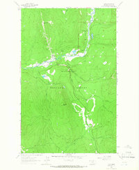
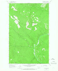
 1963 Wolf Prairie1965 Print · USGSKootenai National Forest in the early sixties is a landscape of mountain peaks and remote ranching outposts. Researchers can trace the legacy of land use through the French 8 Ranch, Fairview Guard Station, and the primitive Pack Trail winding past Sugarloaf Mountain.2 unique versions available
 - 1963 Map of Yaak, 1966 Print
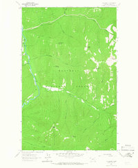
 1963 Yaak1966 Print · USGSThe remote Montana interior comes into focus during the early sixties, centered on the river bend settlement of Yaak. Genealogists and historians can trace the foundations of this mountain community through the Yaak Sch, local Cem, and prospects scattered near Hensley Hill.
 - 1963 Map of Scenery Mountain, 1966 Print
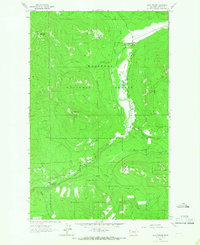
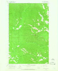
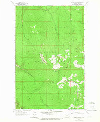
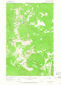
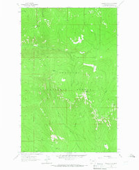
 1963 Scenery Mountain1966 Print · USGSLincoln County in the early 1960s was a landscape of steep timber and high peaks where the Great Northern rail line hugged the river. Trace old wilderness access routes like the Pack Trail or locate remote landmarks like the Lookout Tower and Upper Cedar Lake.2 unique versions available
 - 1963 Map of Spar Lake, 1966 Print
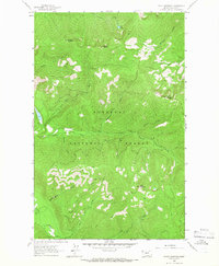
 1963 Spar Lake1966 Print · USGSThe Lincoln County wilderness is captured in the early sixties as a network of forest service trails and remote camps. Researchers can trace the drainages of Spar Lake and locate specific peaks like Stanley Mountain and Lime Butte.2 unique versions available
 - 1963 Map of Rexford, 1966 Print
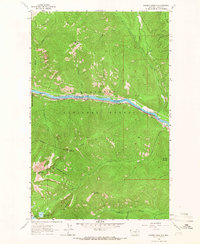
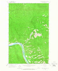
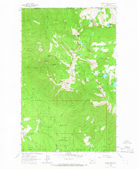
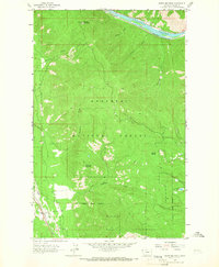
 1963 Rexford1966 Print · USGSThe Kootenai River valley south of the Canadian border is shown here in the early sixties before the completion of the Libby Dam. Genealogists and researchers can trace the original townsite of Rexford and the path of the Great Northern railroad through the Tobacco Plains.3 unique versions available
 - 1963 Map of Turner Mountain, 1966 Print
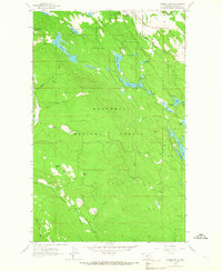
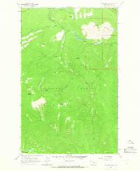 1963 Turner Mountain1966 Print · USGSThe Kootenai National Forest during the early 1960s reveals a wilderness being mapped for both winter recreation and fire management. Trace the early Turner Mountain Ski Area development and pack routes like the Ransome Pack Trail or the Lookout Tower on Quartz Mountain.
 - 1963 Map of Eureka North, 1966 Print
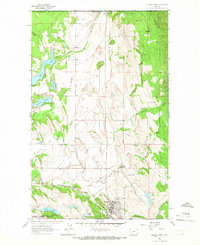 1963 Eureka North1966 Print · USGSThe international border at Roosville and the agricultural reaches of the Tobacco Plains are captured in the early sixties. Researchers can trace the Great Northern rail line, locate the Eureka Cemetery, and find old school sites like Iowa Flats School.3 unique versions available
 - 1963 Map of Sylvanite, 1966 Print
 1963 Sylvanite1966 Print · USGSSylvanite and the Yaak River valley are captured in the early sixties during a period of active timber management and mining. Researchers can locate the Morning Glory Mine, trace old Pack Trails, and identify sites like the Ranger Station and Roderick Mountain lookout.
 - 1963 Map of Vermiculite Mountain, 1966 Print
 1963 Vermiculite Mountain1966 Print · USGSThe Kootenai River valley in the early sixties reveals a landscape of industrial extraction and mountain transit. Local historians can trace the Great Northern rail line past Ripley, or locate the extensive Strip Mine and Tramway on Vermiculite Mountain.3 unique versions available
 - 1963 Map of Mount Baldy, 1966 Print
 1963 Mount Baldy1966 Print · USGSLincoln County in the early sixties is shown as a high-altitude wilderness defined by the Yaak River. Researchers can trace old routes like the Pack Trail to the Lookout Tower on Mount Baldy or locate the Red Top Creek Campground.2 unique versions available
 - 1963 Map of Mount Marston, 1966 Print
 1963 Mount Marston1966 Print · USGSLincoln County, Montana, was a landscape of remote mining claims and high ridges in the early sixties. Researchers can trace the steep access routes of a Pack Trail to the Schwab Mine and Jager Mine or locate landmarks like Mt Marston.2 unique versions available
 - 1963 Map of Robinson Mountain, 1966 Print
 1963 Robinson Mountain1966 Print · USGSNorthwestern Montana's high-country wilderness is documented here during the early sixties, showing the remote reaches of the Kootenai National Forest. Researchers can trace the network of Pack Trails leading to the Robinson Mountain Lookout and numerous high-altitude basins like Gold Lake.2 unique versions available
 - 1963 Map of Mc Guire Mountain, 1966 Print
 1963 Mc Guire Mountain1966 Print · USGSKootenai National Forest in the early sixties is captured here as a landscape of high peaks and forest trails. Researchers can trace historic access routes via Pack Trail and locate named summits like McGuire Mountain and Lydia Mountain.2 unique versions available
 - 1963 Map of Pulpit Mountain, 1966 Print
 1963 Pulpit Mountain1966 Print · USGSNorthwestern Montana’s wilderness is captured here in the early sixties, showing the high ridges and drainage basins of the Kootenai National Forest. Researchers can trace old mountain routes like the PACK TRAIL past Wee Lake or follow the paths of O'Brien Creek and Studebaker Draw.2 unique versions available
 - 1963 Map of Ksanka Peak, 1966 Print
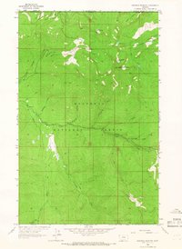
 1963 Ksanka Peak1966 Print · USGSThe international borderlands of northwest Montana are captured here in the early 1960s, showing a high alpine landscape of the Galton Range. Researchers can trace old mountain access routes and mineral prospects like Independence Mine, Twin Peaks Mine, and the Ten Lakes Basin.2 unique versions available
 - 1963 Map of Eureka South, 1966 Print
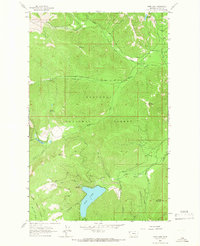
 1963 Eureka South1966 Print · USGSLincoln County’s timber and rail country is captured here in the early sixties as the Great Northern tracks follow the Tobacco River through Eureka. Researchers can trace old forest routes and landmarks like the Black Butte Lookout Tower and Thirsty Lake.3 unique versions available
 - 1963 Map of Davis Mountain, 1966 Print
 1963 Davis Mountain1966 Print · USGSLincoln County high country is documented in the 1960s, showing a landscape defined by forest management and backcountry trails. Researchers can trace the PACK TRAIL network and locate the Davis Mountain Lookout Tower above Swamp Creek.2 unique versions available
 - 1963 Map of Northwest Peak, 1966 Print
 1963 Northwest Peak1966 Print · USGSThe Montana-Canada borderlands are charted in the early 1960s, showing the intersection of two national forests and the high Purcell summits. Researchers can trace remote Pack Trails, mountain Lookouts, and alpine basins like Lake Florence or Hawkins Lakes.2 unique versions available
 - 1963 Map of Pink Mountain, 1966 Print
 1963 Pink Mountain1966 Print · USGSThe high peaks of Lincoln County are captured here in the early 1960s, showing the remote drainages of the Kootenai National Forest. Researchers can trace the old Pack Trail to the Lookout Tower on Big Creek Baldy Mountain and locate the secluded Horse Lakes.
 - 1963 Map of Swede Mountain, 1966 Print
 1963 Swede Mountain1966 Print · USGSLincoln County's mountain and river geography is captured here in the early 1960s as a remote center of timber and rail activity. Researchers can trace the Great Northern rail line through Ripley, locate the summit Lookout Tower, and explore the drainages of McMillan Creek.2 unique versions available
 - 1963 Map of Warland Peak, 1966 Print
 1963 Warland Peak1966 Print · USGSThe Kootenai National Forest of northwestern Montana is shown in the early sixties, centered on the heights of Warland Peak. Hikers and historians can trace the network of Trails and find the mountain-top Lookout Tower near Summit Spring.2 unique versions available
Showing maps 1-25 of 93
Top cities of Lincoln County
- Libby historical maps
- Eureka historical maps
- Troy historical maps
- Trego historical maps
- Fortine historical maps
- Rexford historical maps
See more
Frequently asked questions
- What are the different types of historical maps available for Lincoln County?
- What is the oldest map of Lincoln County?
- Where can I purchase historical maps of Lincoln County for my home or office?
- Where can I download high-res historical maps of Lincoln County?
- Are there historical topographic maps available for Lincoln County?
- Is there historical aerial imagery available for Lincoln County?
- Where are historical maps of Lincoln County sourced from?