1980s Maps of Lincoln County, Montana
Explore 10 historic maps of Lincoln County from the 1980s. These maps offer a rare glimpse into what life looked like during the 1980s — showing old roads, neighborhoods, homes, and landmarks that have changed or disappeared over time.
Whether you're researching your family's past, planning a metal detecting trip, or studying how Lincoln County's landscape evolved across the 1980s, these high-resolution maps are a powerful tool for exploring the history of this region.
- Focus on a specific era: All maps on this page are from the 1980s, giving you a focused view of this time period.
- See what’s changed: Compare century-old streets, trails, and buildings to today's modern landscape using overlays and satellite layers.
- Research with precision: Use these maps for genealogy, historical research, land use analysis, or educational projects.
- View, download, or print: Maps are fully viewable online in high resolution, and can be downloaded or printed for your own records.
Start exploring Lincoln County's history through authentic maps from the 1980s. This is your window into the past.
Lincoln County, MT maps
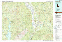
(10)- 1981 Map of Whitefish Range, 1982 Print
 1981 Whitefish Range1982 Print · USGSThe Whitefish Range and Glacier National Park are shown here in the early eighties, documenting a massive wilderness landscape. Researchers can trace remote mountain outposts like Polebridge and rail-town history along the Burlington Northern near Trego and Olney.
 - 1981 Map of Kalispell, 1982 Print
 1981 Kalispell1982 Print · USGSThe Flathead Valley in the early eighties shows a landscape defined by timber, tourism, and transit. Genealogists and historians can trace the growth of Evergreen, Bigfork, and Somers or locate early aviation landmarks like the Glacier Park Intl Airport.
 - 1983 Map of Bonners Ferry
 1983 Bonners Ferry1983 Print · USGSThe Idaho Panhandle and its international border with Canada are shown here in the early 1980s as the timber and mining industries shaped the landscape. Genealogists and researchers can locate northern settlements like Porthill and Naples, alongside family-named peaks and mines such as the American Girl Mine and Parker Mtn.2 unique versions available
 - 1983 Map of Volcour Gulch, 1984 Print
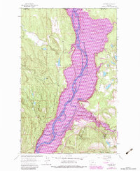
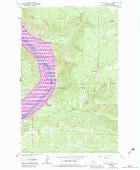 1983 Volcour Gulch1984 Print · USGSThe Kootenai River valley is shown here in the early eighties following the creation of Lake Koocanusa. Researchers can trace the flooded landscape and find the relocated settlement of Warland and high-country landmarks like Ellsworth Mountain and Stenerson Mountain.
 - 1983 Map of Rexford, 1984 Print
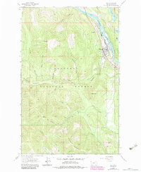
 1983 Rexford1984 Print · USGSThe Montana-Canada borderlands near the Tobacco Plains are captured in the early eighties as the river valley shifted toward recreation and state conservation. Trace the old community around Rexford and find landmarks like the Tooley Lake Sch and Murray Springs State Fish Hatchery.
 - 1983 Map of Troy, 1984 Print
 1983 Troy1984 Print · USGSThe riverside community of Troy and its surrounding mining districts are captured here in the early eighties. Researchers can trace deep-woods mining history at the Big Eight Mine, Liberty Mine, and Crescent Tunnel.
 - 1984 Map of Sandpoint
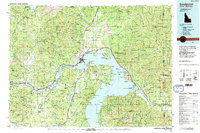 1984 Sandpoint1984 Print · USGSThe Idaho Panhandle in the early 1980s shows a landscape of deep lakes and working forests centered on the rail hub of Sandpoint. Researchers can trace the legacy of regional industry through the Spokane International rail lines and mining sites like the Gold Coin Mine and Sulphide Mine.2 unique versions available
 - 1989 Map of Benning Mountain
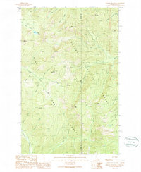 1989 Benning Mountain1989 Print · USGSThe high Cabinet Mountains wilderness along the Idaho-Montana border is documented here in the late eighties. Track the forested divide between Kootenai National Forest and Kaniksu National Forest near Benning Mountain and Moose Lake.
 - 1989 Map of Smith Mountain
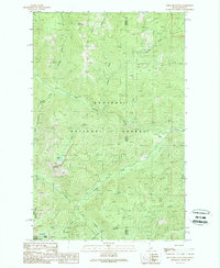 1989 Smith Mountain1989 Print · USGSThe Idaho and Montana borderlands are seen here in the late twentieth century, dominated by the high ridgelines of the Cabinet Mountains. Researchers can trace the drainages of Callahan Creek and find specific landmarks like Smith Lake and Lake Estelle.
 - 1989 Map of Scotchman Peak
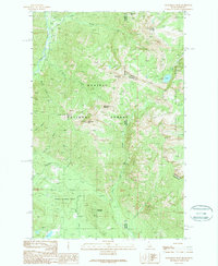 1989 Scotchman Peak1989 Print · USGSThe Idaho-Montana borderlands are mapped here in the late eighties, documenting the wild drainages of the Kaniksu National Forest. Trace backcountry routes to the Open Pit Mine or high summits like Scotchman Peak and Savage Mountain.
End of results
Showing maps 1-10 of 10
Top cities of Lincoln County
- Libby historical maps
- Eureka historical maps
- Troy historical maps
- Trego historical maps
- Fortine historical maps
- Rexford historical maps
See more
Frequently asked questions
- What are the different types of historical maps available for Lincoln County?
- What is the oldest map of Lincoln County?
- Where can I purchase historical maps of Lincoln County for my home or office?
- Where can I download high-res historical maps of Lincoln County?
- Are there historical topographic maps available for Lincoln County?
- Is there historical aerial imagery available for Lincoln County?
- Where are historical maps of Lincoln County sourced from?