Old Maps of McCone County, Montana for Hiking & Exploration
Hike through history with 473 historic maps of McCone County. Explore old trails, ghost towns, and forgotten backroads — perfect for outdoor adventurers and local explorers.
- Rediscover forgotten places: Map out old mining camps, roads, and footpaths that no longer exist on modern maps.
- Layer with modern tools: Combine with LiDAR or satellite views to plan hikes through historical terrain.
- Made for exploration: Popular among hikers, overlanders, and local history lovers.
Use these maps to find adventure and explore the hidden past of McCone County.
McCone County, MT maps
(473)- 1912 Map of Chelsea
 1912 Chelsea1912 Print · USGSNortheastern Montana at the start of the twentieth century shows the intersection of the Fort Peck Indian Reservation and the Great Plains rail economy. Trace early settlements like Chelsea and Nickwall along the Missouri River and the Great Northern tracks.2 unique versions available
 - 1912 Map of Poplar
 1912 Poplar1912 Print · USGSThe High Plains of northeastern Montana are captured here just before the first World War, centered on the confluence of two major waterways. Genealogists and historians can trace early railroad siding stops like Sprole and Arthur along the Great Northern line and through the Fort Peck Indian Reservation.
 - 1914 Map of Nashua, 1965 Print
 1914 Nashua1965 Print · USGSNortheastern Montana ranching and rail life are captured here in the early twentieth century. Researchers can trace rural school locations like Panton School and Galpin School or locate early family holdings such as Nichols Ranch.
 - 1915 Map of Frazer
 1915 Frazer1915 Print · USGSThe Missouri River valley in the years before the Great War shows a burgeoning rail corridor through the Fort Peck Indian Reservation. Trace the early tracks of the Great Northern and find the small stops at Frazer and Kintyre.3 unique versions available
 - 1915 Map of Oswego
 1915 Oswego1915 Print · USGSNortheast Montana at the height of the homesteading era centers on the Oswego rail stop and the wide Missouri River. Genealogists and historians can trace early land patterns across the Fort Peck Indian Reservation and locate landmarks like Three Buttes and the Great Northern rail line.2 unique versions available
 - 1916 Map of Nashua
 1916 Nashua1916 Print · USGSNortheastern Montana at the height of the homesteading era reveals the vital connection between the rail lines and river valleys. Genealogists and historians can locate early rural schoolhouses like Penton School and Galpin School or trace the Great Northern tracks through Nashua.3 unique versions available
 - 1916 Map of Wolf Point
 1916 Wolf Point1916 Print · USGSWolf Point and the Missouri River valley are captured here in the years before the First World War. Researchers can trace the early railroad corridor of the Great Northern and find rural landmarks like Oldtown, Macon, and the Randolph School.2 unique versions available
 - 1954 Map of Jordan, 1965 Print
 1954 Jordan1965 Print · USGSGarfield County in the mid-fifties is a land of expansive ranches and isolated prairie schoolhouses. Researchers can trace rural genealogy and land use through landmarks like Regina School, Robertson Brothers Ranch, and the Charles M Russell National Wildlife Range.2 unique versions available
 - 1954 Map of Glendive, 1967 Print
 1954 Glendive1967 Print · USGSEastern Montana at mid-century shows a landscape of river-valley commerce and remote prairie ranching. Researchers can trace the legacy of rural education and transport through sites like Prairie Elk School, the Great Northern rail lines, and Circle.2 unique versions available
 - 1954 Map of Wolf Point, 1967 Print
 1954 Wolf Point1967 Print · USGSNortheastern Montana and the North Dakota borderlands are shown here in the mid-fifties, dominated by the Missouri River and the Fort Peck Indian Reservation. Genealogists and historians can trace the Great Northern rail line through river towns like Poplar and Culbertson or locate northern border outposts like the U S Custom Office at Raymond.2 unique versions available
 - 1954 Map of Glasgow, 1967 Print
 1954 Glasgow1967 Print · USGSNortheastern Montana is shown during the mid-fifties as the rail-and-river economy shaped the plains. Trace family roots and vanished landmarks from the Wendell Post Office to the Great Northern sidings at Ashfield and Hinsdale.2 unique versions available
 - 1956 Map of Jordan
 1956 Jordan1956 Print · USGSCentral Montana ranching country and the massive Missouri River impoundment are captured here in the mid-fifties. Researchers can trace remote homesteading landmarks like Robertson Brothers Ranch and small rural hubs including Jordan, Brusett, and Cohagen.
 - 1957 Map of Glasgow
 1957 Glasgow1957 Print · USGSNortheastern Montana during the late 1950s shows a landscape shaped by the Milk River and the expanding influence of the Fort Peck Lake reservoir. Genealogists and historians can trace the Great Northern rail stops from Malta to Glasgow, including old sidings like Kintyre Siding and rural centers like Opheim.
 - 1957 Map of Glendive
 1957 Glendive1957 Print · USGSEastern Montana in the mid-1950s is defined by its deep river valleys and a sprawling network of rural school districts. You can trace the path of the Great Northern railroad and locate vanished local landmarks like Breezy Flat School and Newton Junction.
 - 1958 Map of Wolf Point
 1958 Wolf Point1958 Print · USGSNortheastern Montana is shown during the mid-fifties, featuring the extensive Fort Peck Indian Reservation and the Missouri River valley. Researchers can trace the Great Northern railroad through Wolf Point or locate sites like Slab Crossing and the Coal Mine near Medicine Lake.
 - 1958 Map of Glasgow
 1958 Glasgow1958 Print · USGSNortheastern Montana comes to life in this mid-century survey of the Milk River valley and the Great Northern rail corridor. Researchers can trace the rise and fall of work camps like New Deal and Wheeler alongside remote landmarks like the Wendell Post Office.2 unique versions available
 - 1958 Map of Jordan
 1958 Jordan1958 Print · USGSGarfield County and the Missouri River country are shown here in the late fifties as the regional geography adjusted to the massive new reservoir. Genealogists and local historians can trace isolated homesteads and numerous rural schoolhouses like Iler School, Brusett, and the Robertson Brothers Ranch.
 - 1958 Map of Glendive
 1958 Glendive1958 Print · USGSEastern Montana and the North Dakota borderlands come alive in the late fifties, showing the agricultural heart of the Yellowstone valley. Trace the legacy of rural education through Kimmel School and Ridgelawn School or locate rail hubs in Glendive and Sidney.
 - 1964 Map of Jordan
 1964 Jordan1964 Print · USGSGarfield County and the surrounding Montana prairie are captured in the mid-1950s as the Fort Peck Reservoir reshapes the northern landscape. Local historians can trace the locations of rural schoolhouses like South First Creek School and remote ranching outposts such as Brusett and Van Norman.
 - 1965 Map of Hedstrom Lake, 1968 Print
 1965 Hedstrom Lake1968 Print · USGSEastern Montana's high plains are documented here in the mid-sixties, capturing the remote intersection of McCone, Prairie, and Garfield counties. Researchers can trace the drainage of Skull Creek and locate family landmarks like Red Butte or the small Cem near the northern border.
 - 1965 Map of Heitz School, 1968 Print
 1965 Heitz School1968 Print · USGSThe ranching country of Prairie and McCone counties is documented here in the mid-1960s, showing a remote landscape of the Montana plains. Researchers can locate the site of the Heitz School and trace cattle-country landmarks like Redwater Well and Chalk Butte.
 - 1965 Map of Watkins SE, 1968 Print
 1965 Watkins SE1968 Print · USGSEastern Montana rangeland at the mid-century shows a landscape of expansive ranches and vital water sources. Trace the divide between Mc Cone Co and Prairie Co or locate the remote Morton Spring and Lisk Creek.
 - 1965 Map of Watkins, 1968 Print
 1965 Watkins1968 Print · USGSEastern Montana ranching country is captured here in the mid-sixties, spanning the border of McCone and Prairie counties. Researchers can trace local water management and early roads near Watkins, Lisk Creek Dam, and the winding Redwater River.
 - 1965 Map of Hedstrom Lake NW, 1968 Print
 1965 Hedstrom Lake NW1968 Print · USGSEastern Montana ranching country in the mid-1960s is preserved here, showing the sparse but vital infrastructure of the high plains. Researchers can locate isolated landmarks like Twin Buttes, trace the primitive Two Furrow Road, and identify a lone Grave.
 - 1965 Map of Berry School, 1968 Print
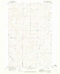 1965 Berry School1968 Print · USGSMcCone and Prairie counties appear here in the mid-1960s, showing a traditional Montana ranching landscape. Genealogists and local historians can locate rural hubs like Berry School, Watkins Ch, and Watkins Cem along the Redwater River.
Showing maps 1-25 of 473
Top cities of McCone County
Frequently asked questions
- What are the different types of historical maps available for McCone County?
- What is the oldest map of McCone County?
- Where can I purchase historical maps of McCone County for my home or office?
- Where can I download high-res historical maps of McCone County?
- Are there historical topographic maps available for McCone County?
- Is there historical aerial imagery available for McCone County?
- Where are historical maps of McCone County sourced from?