1960s Maps of McCone County, Montana
Explore 9 historic maps of McCone County from the 1960s. These maps offer a rare glimpse into what life looked like during the 1960s — showing old roads, neighborhoods, homes, and landmarks that have changed or disappeared over time.
Whether you're researching your family's past, planning a metal detecting trip, or studying how McCone County's landscape evolved across the 1960s, these high-resolution maps are a powerful tool for exploring the history of this region.
- Focus on a specific era: All maps on this page are from the 1960s, giving you a focused view of this time period.
- See what’s changed: Compare century-old streets, trails, and buildings to today's modern landscape using overlays and satellite layers.
- Research with precision: Use these maps for genealogy, historical research, land use analysis, or educational projects.
- View, download, or print: Maps are fully viewable online in high resolution, and can be downloaded or printed for your own records.
Start exploring McCone County's history through authentic maps from the 1960s. This is your window into the past.
McCone County, MT maps
(9)- 1964 Map of Jordan
 1964 Jordan1964 Print · USGSGarfield County and the surrounding Montana prairie are captured in the mid-1950s as the Fort Peck Reservoir reshapes the northern landscape. Local historians can trace the locations of rural schoolhouses like South First Creek School and remote ranching outposts such as Brusett and Van Norman.
 - 1965 Map of Hedstrom Lake, 1968 Print
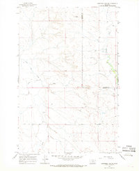
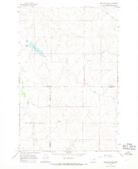 1965 Hedstrom Lake1968 Print · USGSEastern Montana's high plains are documented here in the mid-sixties, capturing the remote intersection of McCone, Prairie, and Garfield counties. Researchers can trace the drainage of Skull Creek and locate family landmarks like Red Butte or the small Cem near the northern border.
 - 1965 Map of Heitz School, 1968 Print
 1965 Heitz School1968 Print · USGSThe ranching country of Prairie and McCone counties is documented here in the mid-1960s, showing a remote landscape of the Montana plains. Researchers can locate the site of the Heitz School and trace cattle-country landmarks like Redwater Well and Chalk Butte.
 - 1965 Map of Watkins SE, 1968 Print
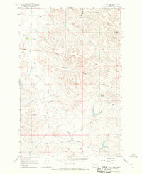
 1965 Watkins SE1968 Print · USGSEastern Montana rangeland at the mid-century shows a landscape of expansive ranches and vital water sources. Trace the divide between Mc Cone Co and Prairie Co or locate the remote Morton Spring and Lisk Creek.
 - 1965 Map of Watkins, 1968 Print
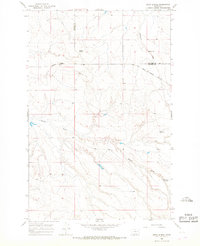
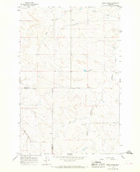
 1965 Watkins1968 Print · USGSEastern Montana ranching country is captured here in the mid-sixties, spanning the border of McCone and Prairie counties. Researchers can trace local water management and early roads near Watkins, Lisk Creek Dam, and the winding Redwater River.
 - 1965 Map of Hedstrom Lake NW, 1968 Print
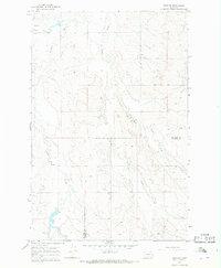
 1965 Hedstrom Lake NW1968 Print · USGSEastern Montana ranching country in the mid-1960s is preserved here, showing the sparse but vital infrastructure of the high plains. Researchers can locate isolated landmarks like Twin Buttes, trace the primitive Two Furrow Road, and identify a lone Grave.
 - 1965 Map of Berry School, 1968 Print
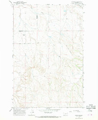
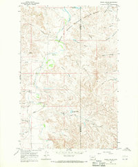
 1965 Berry School1968 Print · USGSMcCone and Prairie counties appear here in the mid-1960s, showing a traditional Montana ranching landscape. Genealogists and local historians can locate rural hubs like Berry School, Watkins Ch, and Watkins Cem along the Redwater River.
 - 1967 Map of Coal Creek, 1970 Print
 1967 Coal Creek1970 Print · USGSGarfield County ranching country and the rugged Big Dry Creek basin are frozen in time in this late-sixties survey. Researchers can trace the local landscape through landmarks like White Buttes, the Big Picnic Area, and a lone pioneer Cem.
 - 1967 Map of Frank Coulee, 1970 Print
 1967 Frank Coulee1970 Print · USGSEastern Montana ranching country is documented here in the late sixties, where the wildlife range meets the breaks of the Missouri. Locate the Van Norman Sch and trace isolated landmarks like Indian Rocks, Standing Rock, and Cedar Bed Ground Reservoir.2 unique versions available
End of results
Showing maps 1-9 of 9
Top cities of McCone County
Frequently asked questions
- What are the different types of historical maps available for McCone County?
- What is the oldest map of McCone County?
- Where can I purchase historical maps of McCone County for my home or office?
- Where can I download high-res historical maps of McCone County?
- Are there historical topographic maps available for McCone County?
- Is there historical aerial imagery available for McCone County?
- Where are historical maps of McCone County sourced from?