2020s Maps of Alberton, Montana
Explore 4 historic maps of Alberton from the 2020s. These maps offer a rare glimpse into what life looked like during the 2020s — showing old roads, neighborhoods, homes, and landmarks that have changed or disappeared over time.
Whether you're researching your family's past, planning a metal detecting trip, or studying how Alberton's landscape evolved across the 2020s, these high-resolution maps are a powerful tool for exploring the history of this region.
- Focus on a specific era: All maps on this page are from the 2020s, giving you a focused view of this time period.
- See what’s changed: Compare century-old streets, trails, and buildings to today's modern landscape using overlays and satellite layers.
- Research with precision: Use these maps for genealogy, historical research, land use analysis, or educational projects.
- View, download, or print: Maps are fully viewable online in high resolution, and can be downloaded or printed for your own records.
Start exploring Alberton's history through authentic maps from the 2020s. This is your window into the past.
Alberton, MT maps
(4)- 2020 Map of Petty Mountain, 2020 Print
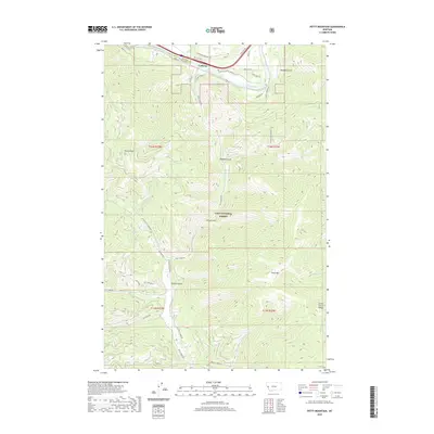 2020 Petty Mountain2020 Print · USGSCovers Alberton, including Lothrop, Missoula County, and other nearby areas
 - 2020 Map of Alberton, 2020 Print
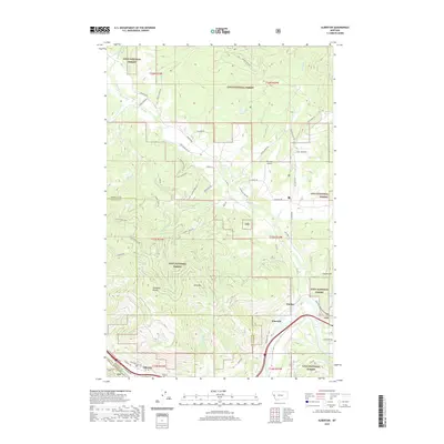 2020 Alberton2020 Print · USGSCovers Alberton, including Soudan, Ninemile, and other nearby areas
 - 2024 Map of Petty Mountain, 2024 Print
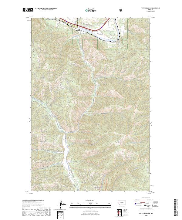 2024 Petty Mountain2024 Print · USGSThe Clark Fork river valley and the Bitterroot Mountains meet in this contemporary survey of the Missoula and Mineral county line. Local historians and hikers can trace the geography of Lothrop and high-altitude landmarks like Petty Mtn and the Grave Creek Range.
 - 2024 Map of Alberton, 2024 Print
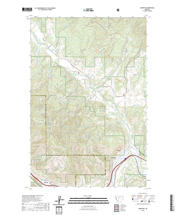 2024 Alberton2024 Print · USGSThe Alberton area of western Montana is documented here at the intersection of the Clark Fork river and the BNSF Railway. Researchers can trace old mountain roads and trails like Chisholm Trail Rd and Old Coyote Rd through the Lolo National Forest.
End of results
Showing maps 1-4 of 4
Frequently asked questions
- What are the different types of historical maps available for Alberton?
- What is the oldest map of Alberton?
- Where can I purchase historical maps of Alberton for my home or office?
- Where can I download high-res historical maps of Alberton?
- Are there historical topographic maps available for Alberton?
- Is there historical aerial imagery available for Alberton?
- Where are historical maps of Alberton sourced from?