Old Maps of Alberton, Montana for Academic Research
Study the evolution of Alberton with 23 high-resolution historic maps. Whether you're teaching, researching, or modeling changes in land use, these maps provide essential visual documentation of urban, environmental, and geographic change.
- Analyze long-term change: Track patterns in development, transportation, and natural features.
- Ideal for environmental or urban studies: Support academic projects with primary historical map data.
- Use in the classroom or lab: Educators and researchers rely on these maps to bring historical context to life.
These maps are a powerful tool for teaching, research, and visualizing how Alberton has changed over the decades.
Alberton, MT maps
(23)- 1912 Map of Missoula
 1912 Missoula1912 Print · USGSWestern Montana at the end of the frontier era shows a landscape of growing rail hubs and remote mountain outposts. Researchers can trace early river crossings like Alberts Ferry, the grounds of Ft Missoula, and vanished schools such as Big Flat School.4 unique versions available
 - 1956 Map of Wallace, 1966 Print
 1956 Wallace1966 Print · USGSWestern Montana and the Idaho panhandle meet in this mid-century survey of the Bitterroot and Cabinet Mountains. Genealogists and historians can trace the rail-and-river economy through the Northern Pacific line and settlements like Thompson Falls or St. Ignatius.3 unique versions available
 - 1956 Map of Hamilton, 1970 Print
 1956 Hamilton1970 Print · USGSThe Bitterroot Valley and surrounding high country are captured here during the mid-fifties, showing the region's transition into a modern forest-and-rail hub. Genealogists and historians can trace family-named sites and early infrastructure from Fort Missoula to towns like Stevensville and Darby along the Northern Pacific line.2 unique versions available
 - 1959 Map of Hamilton
 1959 Hamilton1959 Print · USGSThe Bitterroot Valley and surrounding wilderness are captured in the late fifties, showing a landscape defined by forestry and river-based settlement. Researchers can trace the Lolo Trail or locate historical points like Fort Missoula and the Fred Burr Reservoir.
 - 1959 Map of Alberton, 1961 Print
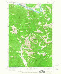
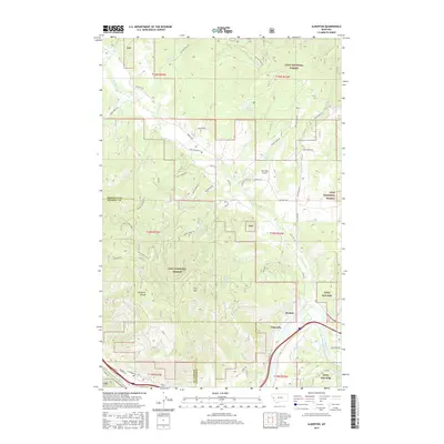
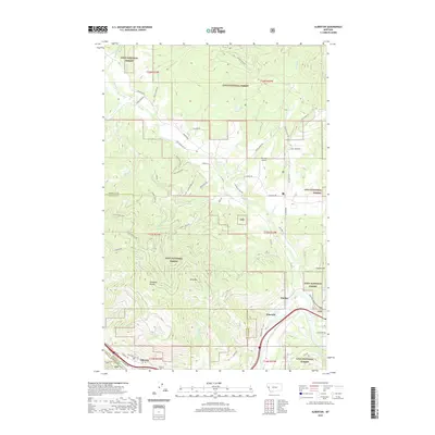
 1959 Alberton1961 Print · USGSAs the mid-century timber and rail economies peaked, this area of western Montana balanced remote wilderness with vital transport lines. Genealogists and historians can trace the Northern Pacific rail line and local landmarks like the Favorite Mine and the Ninemile Community Hall.2 unique versions available
 - 1960 Map of Wallace
 1960 Wallace1960 Print · USGSNorthwestern Montana and the Idaho panhandle are captured in the late fifties, showing the vast Flathead Indian Reservation and the mining districts of the Bitterroot Range. Researchers can trace the rail lines of the Northern Pacific or locate early sites like the Morning Mine and the National Bison Range.
 - 1960 Map of Hamilton
 1960 Hamilton1960 Print · USGSThe Bitterroot Valley and surrounding high country are captured here during the late fifties, showing the region's transition into a modern forest and rail corridor. Researchers can trace the path of the Northern Pacific through Missoula or locate landmarks like Fort Missoula and Lake Como.
 - 1964 Map of Hamilton
 1964 Hamilton1964 Print · USGSThe Bitterroot Valley and its surrounding peaks are captured in detail during the mid-1960s, showing the early infrastructure of the Northern Rockies. Genealogists and historians can trace family roots in Hamilton and Stevensville or follow the historic Lolo Trail and Nez Perce Trail.
 - 1964 Map of Petty Mountain, 1967 Print
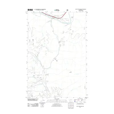
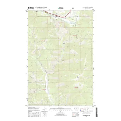
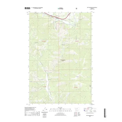
 1964 Petty Mountain1967 Print · USGSMissoula and Mineral counties are defined by the Clark Fork river and dual rail lines during the mid-sixties. Trace the historical routes of the Northern Pacific through Alberton or locate the Copper Smith Mine tucked within the Lolo National Forest.
 - 1981 Map of Missoula West
 1981 Missoula West1981 Print · USGSThe Bitterroot Valley and the rugged Bitterroot Range are captured here in the early 1980s, documenting the expansion of Missoula and its outlying timber and river towns. Researchers can trace the Burlington Northern rail corridors or locate remote landmarks like Lolo Hot Springs and Lolo Pass.2 unique versions available
 - 1984 Map of Alberton
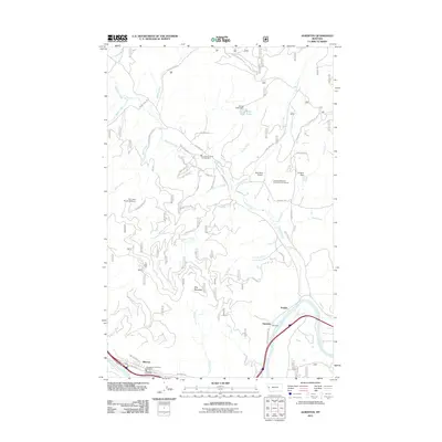
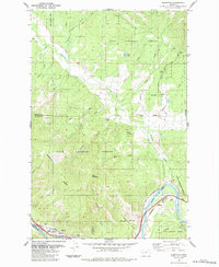 1984 Alberton1984 Print · USGSSettled along the Clark Fork river in the 1980s, the Alberton area shows a landscape of timber management and rail infrastructure. Researchers can trace the Old Railroad Grade, locate the Ninemile Ranger Sta, or find the secluded Kreis Lake.
 - 1999 Map of Alberton, 2003 Print
 1999 Alberton2003 Print · USGSThe Mineral County mountainside meets the Clark Fork valley at the close of the twentieth century. Researchers can trace the legacy of forest management and early transport through the Ninemile Remount Depot, the CCC Campsite, and the winding Discovery Trail.
 - 1999 Map of Petty MountaIn, 2003 Print
 1999 Petty MountaIn2003 Print · USGSMissoula and Mineral Counties at the close of the century reveal a landscape of deep timber and mountain ranching. Researchers can trace historic extraction at the Coppersmith Mine, navigate the Clark Fork riverbank near Lothrop, or locate family sites like the Circle S Ranch.
 - 2011 Map of Petty Mountain, 2011 Print
 2011 Petty Mountain2011 Print · USGSCovers Alberton, including Lothrop, Missoula County, and other nearby areas
 - 2011 Map of Alberton, 2011 Print
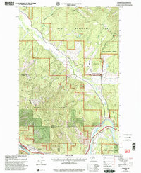
 2011 Alberton2011 Print · USGSCovers Alberton, including Soudan, Ninemile, and other nearby areas
 - 2014 Map of Alberton, 2014 Print
 2014 Alberton2014 Print · USGSCovers Alberton, including Soudan, Ninemile, and other nearby areas
 - 2014 Map of Petty Mountain, 2014 Print
 2014 Petty Mountain2014 Print · USGSCovers Alberton, including Lothrop, Missoula County, and other nearby areas
 - 2017 Map of Petty Mountain, 2017 Print
 2017 Petty Mountain2017 Print · USGSCovers Alberton, including Lothrop, Missoula County, and other nearby areas
 - 2017 Map of Alberton, 2017 Print
 2017 Alberton2017 Print · USGSCovers Alberton, including Soudan, Ninemile, and other nearby areas
 - 2020 Map of Petty Mountain, 2020 Print
 2020 Petty Mountain2020 Print · USGSCovers Alberton, including Lothrop, Missoula County, and other nearby areas
 - 2020 Map of Alberton, 2020 Print
 2020 Alberton2020 Print · USGSCovers Alberton, including Soudan, Ninemile, and other nearby areas
 - 2024 Map of Petty Mountain, 2024 Print
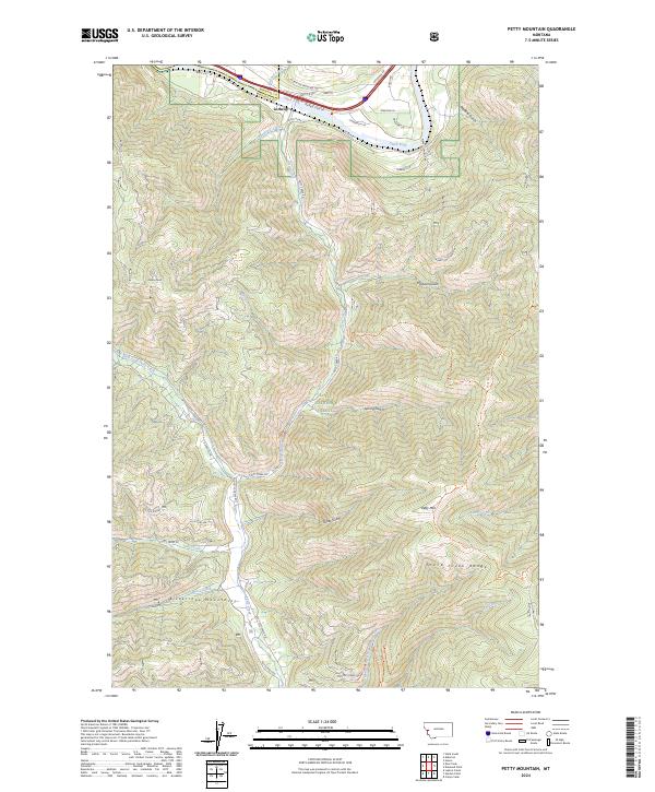 2024 Petty Mountain2024 Print · USGSThe Clark Fork river valley and the Bitterroot Mountains meet in this contemporary survey of the Missoula and Mineral county line. Local historians and hikers can trace the geography of Lothrop and high-altitude landmarks like Petty Mtn and the Grave Creek Range.
 - 2024 Map of Alberton, 2024 Print
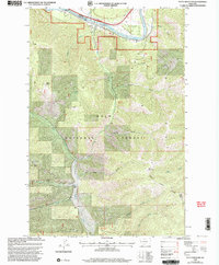
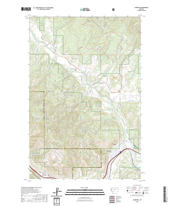 2024 Alberton2024 Print · USGSThe Alberton area of western Montana is documented here at the intersection of the Clark Fork river and the BNSF Railway. Researchers can trace old mountain roads and trails like Chisholm Trail Rd and Old Coyote Rd through the Lolo National Forest.
End of results
Showing maps 1-23 of 23
Frequently asked questions
- What are the different types of historical maps available for Alberton?
- What is the oldest map of Alberton?
- Where can I purchase historical maps of Alberton for my home or office?
- Where can I download high-res historical maps of Alberton?
- Are there historical topographic maps available for Alberton?
- Is there historical aerial imagery available for Alberton?
- Where are historical maps of Alberton sourced from?