Old Maps of Toole, Montana for Academic Research
Study the evolution of Toole with 13 high-resolution historic maps. Whether you're teaching, researching, or modeling changes in land use, these maps provide essential visual documentation of urban, environmental, and geographic change.
- Analyze long-term change: Track patterns in development, transportation, and natural features.
- Ideal for environmental or urban studies: Support academic projects with primary historical map data.
- Use in the classroom or lab: Educators and researchers rely on these maps to bring historical context to life.
These maps are a powerful tool for teaching, research, and visualizing how Toole has changed over the decades.
Toole, MT maps
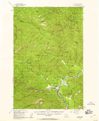
(13)- 1918 Map of St Regis, 1946 Print
 1918 St Regis1946 Print · USGSMineral County, Montana, was a bustling corridor for mining and rail traffic during the early twentieth century. Researchers can trace the path of the Northern Pacific through St Regis or locate remote sites like the Gold Crown Mine and Gold Nugget Cabin.
 - 1919 Map of St. Regis
 1919 St. Regis1919 Print · USGSThe Montana-Idaho borderlands were a hub of mountain mining and transcontinental railroading during the early twentieth century. Genealogists and historians can locate remote settlements like DeBorgia and Henderson or trace old mining operations such as the Saltese Consolidated Mine and Gold Crown Mine.
 - 1956 Map of St Regis, 1958 Print
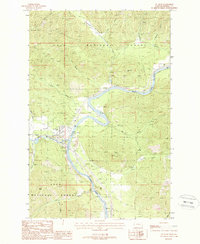
 1956 St Regis1958 Print · USGSMineral County in the mid-fifties is defined by the vital rail and river junction at the foot of the Coeur d'Alene Mountains. Genealogists and historians can trace early transport routes like Mullan Road and find remote stations such as Camel's Hump Lookout Sta and Toole.3 unique versions available
 - 1956 Map of Wallace, 1966 Print
 1956 Wallace1966 Print · USGSWestern Montana and the Idaho panhandle meet in this mid-century survey of the Bitterroot and Cabinet Mountains. Genealogists and historians can trace the rail-and-river economy through the Northern Pacific line and settlements like Thompson Falls or St. Ignatius.3 unique versions available
 - 1960 Map of Wallace
 1960 Wallace1960 Print · USGSNorthwestern Montana and the Idaho panhandle are captured in the late fifties, showing the vast Flathead Indian Reservation and the mining districts of the Bitterroot Range. Researchers can trace the rail lines of the Northern Pacific or locate early sites like the Morning Mine and the National Bison Range.
 - 1988 Map of St Regis
 1988 St Regis1988 Print · USGSThe confluence of the Clark Fork and St Regis River in the late eighties reveals a landscape of transit and forest management. Researchers can trace the Old RR Grade and locate local landmarks like the St Regis Cem and the Fish Hatchery.
 - 1994 Map of Wallace
 1994 Wallace1994 Print · USGSThe Bitterroot Mountains and the mining heart of the Silver Valley are captured here in the mid-1990s. Researchers can locate active and historic mineral operations such as the Argentine Mine and Last Chance Mines, while tracing the Milwaukee Road through the high passes.
 - 1999 Map of Saint Regis, 2003 Print
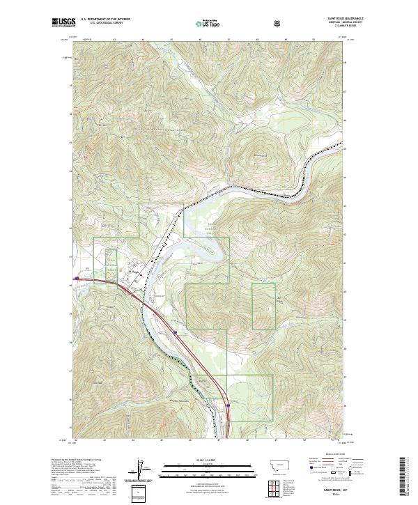
 1999 Saint Regis2003 Print · USGSThe mountain town of St Regis appears at the turn of the millennium as a vital forestry and travel hub along the Clark Fork. Researchers can trace the local infrastructure of the era, from the St Regis Work Center and Heliport to the town Cem.
 - 2011 Map of Saint Regis, 2011 Print
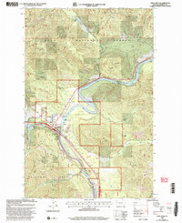
 2011 Saint Regis2011 Print · USGSCovers Toole, including Saint Regis, Mineral County, and other nearby areas
 - 2014 Map of Saint Regis, 2014 Print
 2014 Saint Regis2014 Print · USGSCovers Toole, including Saint Regis, Mineral County, and other nearby areas
 - 2017 Map of Saint Regis, 2017 Print
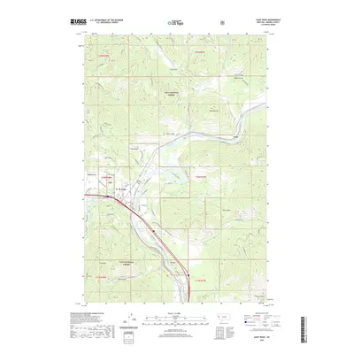
 2017 Saint Regis2017 Print · USGSCovers Toole, including Saint Regis, Mineral County, and other nearby areas
 - 2020 Map of Saint Regis, 2020 Print
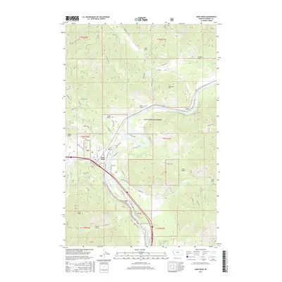
 2020 Saint Regis2020 Print · USGSCovers Toole, including Saint Regis, Mineral County, and other nearby areas
 - 2024 Map of Saint Regis, 2024 Print
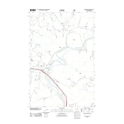
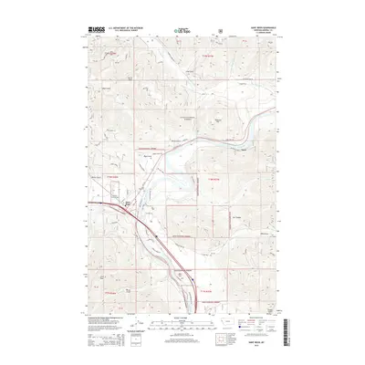
 2024 Saint Regis2024 Print · USGSMineral County's river valleys come alive in this survey of the area where the Saint Regis River meets the Clark Fork. Researchers can trace old routes like Old US Hwy 10 and find local landmarks from St. Regis to the riverside settlement of Toole.
End of results
Showing maps 1-13 of 13
Top cities near Toole
Frequently asked questions
- What are the different types of historical maps available for Toole?
- What is the oldest map of Toole?
- Where can I purchase historical maps of Toole for my home or office?
- Where can I download high-res historical maps of Toole?
- Are there historical topographic maps available for Toole?
- Is there historical aerial imagery available for Toole?
- Where are historical maps of Toole sourced from?