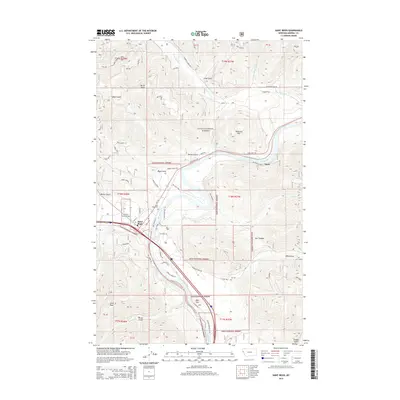
2014 Map of Saint Regis
USGS Topo · Published 2014About this map
Saint Regis sits at a critical junction of mountain valleys and river bends, dominated by the sweeping curve of the Clark Fork. The settlement's layout is defined by the geography of the surrounding Lolo National Forest, with roads like Old Mill Loop and Trestle Creek Dr hinting at the area's timber and transport history. The terrain is deeply incised by numerous gulches and creeks, including Butler Gulch and Tamarack Cr, which drain into the main river valley.
Find a feature on this map
42 named features on this map. Tap any name to fly to it.
Don’t see what you’re looking for? This feature index may not catch every label — zoom into the map to look around manually.
Map Details
Editions of this 2014 Saint Regis Map
This is the sole edition of this map. No revisions or reprints were ever made.
Other maps of this area

1918 · St Regis
USGS Topo · 1:125,000

1919 · St. Regis
USGS Topo · 1:125,000

1956 · St Regis
USGS Topo · 1:62,500

1956 · Wallace
USGS Topo · 1:250,000

1957 · Illinois Peak
USGS Topo · 1:62,500

1959 · Plains
USGS Topo · 1:62,500

1960 · Wallace
USGS Topo · 1:250,000

1960 · Superior
USGS Topo · 1:62,500
1985 · Superior
USGS Topo · 1:24,000
1985 · Plains
USGS Topo · 1:24,000