1960s Maps of Pondera County, Montana
Explore 30 historic maps of Pondera County from the 1960s. These maps offer a rare glimpse into what life looked like during the 1960s — showing old roads, neighborhoods, homes, and landmarks that have changed or disappeared over time.
Whether you're researching your family's past, planning a metal detecting trip, or studying how Pondera County's landscape evolved across the 1960s, these high-resolution maps are a powerful tool for exploring the history of this region.
- Focus on a specific era: All maps on this page are from the 1960s, giving you a focused view of this time period.
- See what’s changed: Compare century-old streets, trails, and buildings to today's modern landscape using overlays and satellite layers.
- Research with precision: Use these maps for genealogy, historical research, land use analysis, or educational projects.
- View, download, or print: Maps are fully viewable online in high resolution, and can be downloaded or printed for your own records.
Start exploring Pondera County's history through authentic maps from the 1960s. This is your window into the past.
Pondera County, MT maps
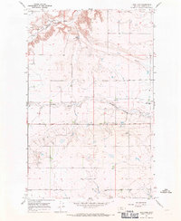
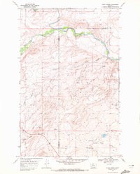
(30)- 1960 Map of Cut Bank, 1968 Print
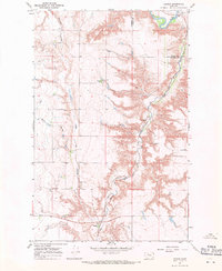
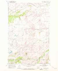
 1960 Cut Bank1968 Print · USGSThe high peaks of the Rockies meet the eastern plains in the 1960s, showing the intersection of federal lands and the Blackfeet Indian Reservation. Trace the path of the Great Northern railway and find local landmarks like the Blackfoot Boarding School and Family Mission Cem.3 unique versions available
 - 1963 Map of Cut Bank
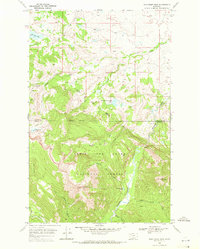
 1963 Cut Bank1963 Print · USGSNorthern Montana’s mountain passes and high plains are captured here in the early 1960s. Genealogists and historians can trace the Great Northern rail stops from Browning to Ethridge or locate the remote outposts at Polebridge and Babb.
 - 1964 Map of Cut Bank
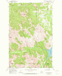
 1964 Cut Bank1964 Print · USGSGlacier National Park and the Blackfeet Indian Reservation meet in the early sixties at the triple divide of North America. Researchers can trace the Great Northern Railway through mountain passes and locate local landmarks like the Blackfoot Boarding School and Apgar Village.
 - 1967 Map of Conrad, 1970 Print
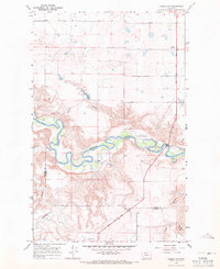
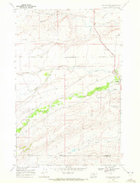
 1967 Conrad1970 Print · USGSThe High Plains of Pondera and Toole County are captured in the late sixties, where the historic Whoop Up Trail crosses a rugged landscape. Genealogists and historians can locate rural landmarks like Union Sch, Higgins Sch, and Conrad Butte.2 unique versions available
 - 1967 Map of Naismith, 1970 Print
 1967 Naismith1970 Print · USGSToole County's high plains meet the winding Marias River in the late 1960s, showing a landscape shaped by rail and water. Local researchers can trace the development of Shelby through its parks and Marias Fairgrounds, or locate the isolated Underdahl Ranch along the river's deep oxbows.
 - 1967 Map of Conrad Butte, 1970 Print
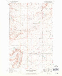
 1967 Conrad Butte1970 Print · USGSThe northern Montana plains in the 1960s are defined by the winding Marias River and the historic path of the Whoop Up Trail. Genealogists and historians can locate rural landmarks like Union Sch and Higgins Sch among the high benches.
 - 1967 Map of Brady, 1970 Print
 1967 Brady1970 Print · USGSThe community of Brady and its surrounding plains are captured in the late sixties as the local economy balanced rail commerce and oil extraction. Trace the path of the Great Northern railway alongside the historical Lewis and Clark Trail and identify local infrastructure like Storage Bins.
 - 1967 Map of Fowler Coulee SW, 1970 Print
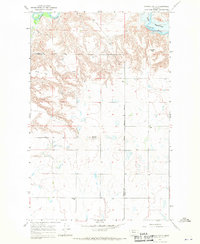
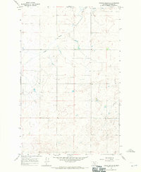
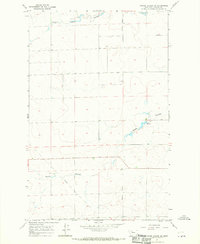 1967 Fowler Coulee SW1970 Print · USGSPondera County during the mid-1960s was a landscape defined by the intersection of natural coulees and the rigid survey grid. Researchers can trace the winding course of South Pondera Coulee and Rocky Coulee as they cut through the township lines near the Principal Meridian.
 - 1967 Map of Pioneer School, 1971 Print
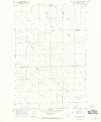
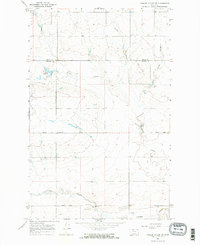
 1967 Pioneer School1971 Print · USGSPondera County's high plains are captured in the late sixties as a landscape of irrigation and education. Researchers can trace the rural schoolhouse at Pioneer School, follow the path of Bullhead Road, or locate historic Gravel Pits among the coulees.
 - 1967 Map of Fowler Coulee NW, 1971 Print
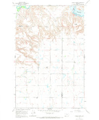
 1967 Fowler Coulee NW1971 Print · USGSThe Montana plains north of Conrad are captured in the late sixties as the section line roads began to formalize local travel. Researchers can trace the path of Sollid Road across the county line or follow the complex drainages of Fowler Coulee and Pondera Coulee.2 unique versions available
 - 1967 Map of Conrad SW, 1971 Print
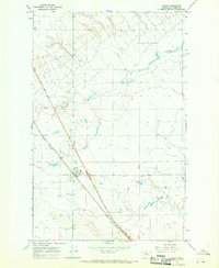
 1967 Conrad SW1971 Print · USGSThe Montana high plains in the late sixties reveal a landscape of seasonal drainages and essential rail links. You can trace the path of the Great Northern railroad and the winding South Pondera Coulee near the Eyraud Lakes.
 - 1967 Map of Letz Lake, 1971 Print
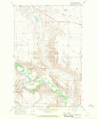
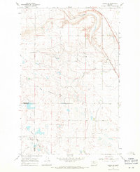
 1967 Letz Lake1971 Print · USGSPondera County during the late sixties shows a landscape shaped by the Marias River and the industrial presence of the Great Northern railroad. Genealogists and historians can locate rural landmarks like Golden Valley Sch, Letz Lake, and various gravel operations.
 - 1967 Map of Ledger NW, 1971 Print
 1967 Ledger NW1971 Print · USGSThe Marias River valley at the Toole and Pondera county line is captured here in the late sixties. Researchers can trace the Lewis and Clark Trail past Williamson Park and follow the rugged breaks of Schultz Coulee.
 - 1967 Map of Fowler Coulee SE, 1971 Print
 1967 Fowler Coulee SE1971 Print · USGSPondera County's cattle-grazing country is captured here in the late sixties, showing the vast township grids and watercourses. Researchers can trace land boundaries and drainage patterns across Rocky Coulee and Pondera Coulee.
 - 1967 Map of Fowler Coulee NE, 1971 Print
 1967 Fowler Coulee NE1971 Print · USGSThe Montana high plains at the boundary of Toole and Pondera Counties come into focus in the mid-1960s. Genealogists and local historians can trace rural life through landmarks like Christenson Sch, the Hall Community Hall, and Fowler Reservoir.2 unique versions available
 - 1967 Map of Ledger, 1971 Print
 1967 Ledger1971 Print · USGSPondera County's high plains were a landscape of rail-fed settlements and river breaks in the late sixties. Genealogists and researchers can trace the Great Northern line through Ledger and Fowler, or locate the Fort Conrad Historical Monument near the river.
 - 1968 Map of Half Dome Crag, 1971 Print
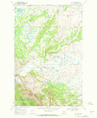
 1968 Half Dome Crag1971 Print · USGSThe Blackfeet Reservation and Glacier National Park borders meet in this 1960s wilderness survey. Local historians and hikers can trace the remote Palookaville (Site) and high peaks like Half Dome Crag and Little Plume Peak.2 unique versions available
 - 1968 Map of Swift Reservoir, 1971 Print
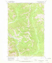
 1968 Swift Reservoir1971 Print · USGSThe Montana Rocky Mountain Front meets the plains in the late 1960s, showing a land of massive peaks and critical water storage. Trace the Blackfeet Indian Reservation Boundary as it skirts Swift Reservoir and the heights of Feather Woman Mountain.2 unique versions available
 - 1968 Map of Fish Lake, 1972 Print
 1968 Fish Lake1972 Print · USGSPondera County at the edge of the Rockies in the late 1960s shows a rugged landscape defined by the Blackfeet Indian Reservation boundary. Genealogists and researchers can trace the location of the Fish Lake Sch and industrial sites like the Swift Dam and Gravel Pit.
 - 1968 Map of Rocky Ridge, 1972 Print
 1968 Rocky Ridge1972 Print · USGSNorthern Montana at the edge of the Rockies in the late sixties shows a landscape of deep coulees and early irrigation. Genealogists and researchers can trace the Main Canal and locate historical landmarks like Hagans Crossing and Rocky Ridge.
 - 1968 Map of Gooseberry Park, 1972 Print
 1968 Gooseberry Park1972 Print · USGSThe high Montana backcountry along the Continental Divide is captured here in the late sixties, just years after the wilderness act. Trace historic pack routes past high-altitude clearings like Wapiti Park and landmarks like Slideout Peak.2 unique versions available
 - 1968 Map of Morningstar Mountain, 1972 Print
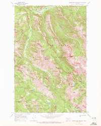 1968 Morningstar Mountain1972 Print · USGSThe high peaks of the northern Rockies are surveyed here in the late sixties, where the Continental Divide splits two national forests. Trace the remote routes through Muskrat Pass and Badger Pass or locate alpine waters like Emerald Lake and Blue Lake.3 unique versions available
 - 1968 Map of Dupuyer West, 1972 Print
 1968 Dupuyer West1972 Print · USGSThe high Montana prairie meets the foothills of the Rockies in the late sixties, showing a landscape defined by ranching and historic routes. Trace the path of the Lewis and Clark Trail and locate family landmarks such as Dupuyer Cem and Dupuyer.
 - 1968 Map of Scoffin Butte, 1972 Print
 1968 Scoffin Butte1972 Print · USGSThe northern Montana plains meet the reservation border in the late sixties, a landscape defined by ranching and wide-open rangeland. Genealogists can locate the rural Terryahn School and trace water rights along Birch Creek and the Tedson Reservoir.2 unique versions available
 - 1968 Map of Hyde Creek, 1972 Print
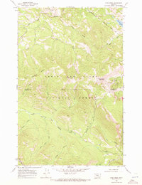 1968 Hyde Creek1972 Print · USGSThe northern Montana high country comes alive in this late sixties survey of the Lewis and Clark National Forest. Researchers can trace the Blackfeet Indian Reservation Boundary or locate landmarks like the Badger Guard Station and Mount Baldy.2 unique versions available
Showing maps 1-25 of 30
Top cities of Pondera County
Frequently asked questions
- What are the different types of historical maps available for Pondera County?
- What is the oldest map of Pondera County?
- Where can I purchase historical maps of Pondera County for my home or office?
- Where can I download high-res historical maps of Pondera County?
- Are there historical topographic maps available for Pondera County?
- Is there historical aerial imagery available for Pondera County?
- Where are historical maps of Pondera County sourced from?