1970s Maps of Prairie County, Montana
Explore 11 historic maps of Prairie County from the 1970s. These maps offer a rare glimpse into what life looked like during the 1970s — showing old roads, neighborhoods, homes, and landmarks that have changed or disappeared over time.
Whether you're researching your family's past, planning a metal detecting trip, or studying how Prairie County's landscape evolved across the 1970s, these high-resolution maps are a powerful tool for exploring the history of this region.
- Focus on a specific era: All maps on this page are from the 1970s, giving you a focused view of this time period.
- See what’s changed: Compare century-old streets, trails, and buildings to today's modern landscape using overlays and satellite layers.
- Research with precision: Use these maps for genealogy, historical research, land use analysis, or educational projects.
- View, download, or print: Maps are fully viewable online in high resolution, and can be downloaded or printed for your own records.
Start exploring Prairie County's history through authentic maps from the 1970s. This is your window into the past.
Prairie County, MT maps
(11)- 1972 Map of Hendrickson Coulee, 1975 Print
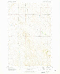
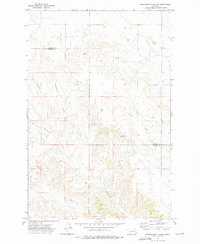 1972 Hendrickson Coulee1975 Print · USGSThe high plains of the Dawson and Prairie County border are captured here in the early seventies, showcasing a landscape of complex natural drainages. Researchers can trace family-named landmarks and water sources like Hendrickson Coulee, Dickhoff Coulee, and Bad Route Creek.
 - 1972 Map of Calypso, 1975 Print
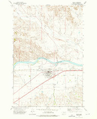
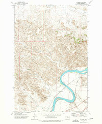 1972 Calypso1975 Print · USGSPrairie County's riverfront and rail corridors are captured in the early 1970s as the river winds through the plains. Local historians can trace the paths of the Milwaukee Road and Burlington Northern near Calypso and Sheridan Butte.
 - 1972 Map of Papps Reservoir, 1975 Print
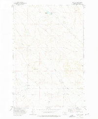
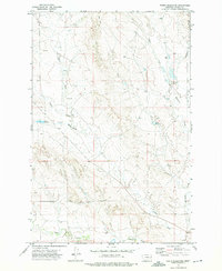 1972 Papps Reservoir1975 Print · USGSPrairie County rangeland comes into focus during the early 1970s, showing a landscape defined by water management and resource exploration. Trace the drainages of Cedar Creek and Brackett Creek while locating Papps Reservoir and local wells.
 - 1972 Map of Mc Clure Reservoir, 1975 Print
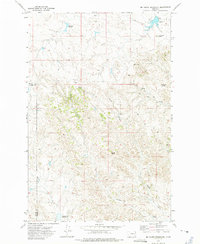 1972 Mc Clure Reservoir1975 Print · USGSHigh plains ranching country along the Prairie and Custer County line is documented here in the early seventies. Researchers can trace remote water sources and cattle trails like Bootlegger Spring, Mc Clure Reservoir, and the Calypso Trail.
 - 1972 Map of Diamond G Creek, 1975 Print
 1972 Diamond G Creek1975 Print · USGSPrairie and Dawson counties meet here in the early 1970s across an expanse of Montana ranch land and coulees. Researchers can trace water development and family-named landmarks like Spade Well, McQuoid Coulee, and Diamond G Creek.
 - 1972 Map of Mc Cloud, 1975 Print
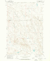
 1972 Mc Cloud1975 Print · USGSPrairie County ranching country is captured in the early 1970s, showing a landscape defined by intermittent water and high-plains landmarks. Researchers can trace the drainage of Plenty Creek and locate sites like the Homestead Reservoir and Mc Cloud.
 - 1972 Map of Physic Creek, 1976 Print
 1972 Physic Creek1976 Print · USGSThe borderlands of Prairie and Custer counties come into focus in the early 1970s, showing a landscape shaped by ranching and water management. Researchers can locate remote land improvements and water sources like Swede Dam, Ingersol Buttes, and the Physic Creek Reservoir.
 - 1972 Map of Fallon SW, 1976 Print
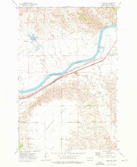 1972 Fallon SW1976 Print · USGSThe Yellowstone River valley in the early 1970s served as a bustling transportation corridor for two major railroads. Researchers can trace the path of the Burlington Northern past the settlement of Fallon or locate the Fallon Cem and the waters of Coal Creek Reservoir.2 unique versions available
 - 1972 Map of Terry, 1976 Print
 1972 Terry1976 Print · USGSThe Yellowstone River corridor in the early 1970s reveals a bustling rail hub at Terry. Genealogists and historians can trace family landmarks like Prairie Cem, the town Rodeo Ground, and the Patterson Airport.
 - 1972 Map of South Fork Reservoir, 1976 Print
 1972 South Fork Reservoir1976 Print · USGSPrairie County ranching and water management come into focus in the early 1970s. Trace the seasonal waterways and infrastructure around South Fork Reservoir, Clark Reservoir, and Morris Spring.
 - 1979 Map of Angela
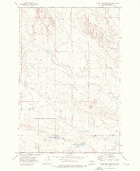
 1979 Angela1979 Print · USGSEastern Montana rangeland at the end of the seventies reveals a vast network of watercourses and isolated ranching outposts. Trace family land near Angela or locate remote landmarks like Steamboat Rock, Dinosaur Dam, and the intersection of four different county lines.
End of results
Showing maps 1-11 of 11
Top cities of Prairie County
Frequently asked questions
- What are the different types of historical maps available for Prairie County?
- What is the oldest map of Prairie County?
- Where can I purchase historical maps of Prairie County for my home or office?
- Where can I download high-res historical maps of Prairie County?
- Are there historical topographic maps available for Prairie County?
- Is there historical aerial imagery available for Prairie County?
- Where are historical maps of Prairie County sourced from?