1980s Maps of Prairie County, Montana
Explore 23 historic maps of Prairie County from the 1980s. These maps offer a rare glimpse into what life looked like during the 1980s — showing old roads, neighborhoods, homes, and landmarks that have changed or disappeared over time.
Whether you're researching your family's past, planning a metal detecting trip, or studying how Prairie County's landscape evolved across the 1980s, these high-resolution maps are a powerful tool for exploring the history of this region.
- Focus on a specific era: All maps on this page are from the 1980s, giving you a focused view of this time period.
- See what’s changed: Compare century-old streets, trails, and buildings to today's modern landscape using overlays and satellite layers.
- Research with precision: Use these maps for genealogy, historical research, land use analysis, or educational projects.
- View, download, or print: Maps are fully viewable online in high resolution, and can be downloaded or printed for your own records.
Start exploring Prairie County's history through authentic maps from the 1980s. This is your window into the past.
Prairie County, MT maps
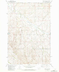
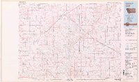
(23)- 1980 Map of Terry, 1981 Print
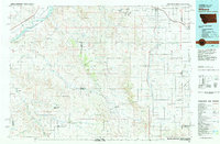
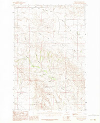
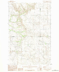
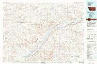 1980 Terry1981 Print · USGSEastern Montana's rail and river networks are preserved here as they appeared in the early eighties. Genealogists and historians can trace the paths of two major railroads through Terry and Kinsey or locate family landmarks near Broadview Bench and Eagle Butte.
 - 1981 Map of Mildred NE
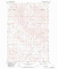
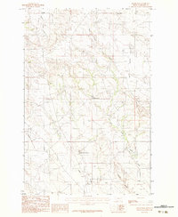
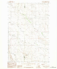
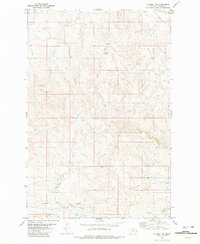 1981 Mildred NE1981 Print · USGSPrairie County ranchland and seasonal waterways are captured here just after the mid-1970s field checks. Researchers can trace the essential water sources of the High Plains, including Buckley Dam, Shad Spring, and a named Flowing Well.
 - 1981 Map of Loony Hollow
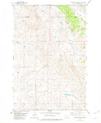
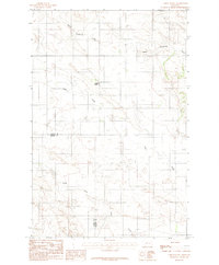
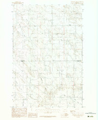
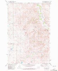 1981 Loony Hollow1981 Print · USGSEastern Montana ranching country is captured here in the early 1980s along the Milwaukee Road corridor. Genealogists and historians can trace the Prairie-Custer County line or locate isolated landmarks like a lone Grave and Archdale Reservoir.
 - 1981 Map of Ismay North
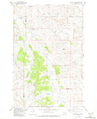
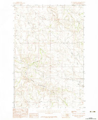
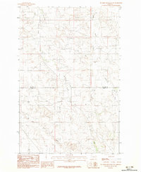
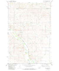 1981 Ismay North1981 Print · USGSCuster and Prairie Counties are captured here in the early eighties, centered on the railroad town of Ismay. Researchers can trace the Milwaukee Road line as it follows O'Fallon Creek past local landmarks like the Storage Bin and various Flowing Wells.
 - 1981 Map of Dorothy Draw
 1981 Dorothy Draw1981 Print · USGSThe borderlands of Prairie and Fallon County are captured here in the early eighties, showing a landscape defined by ranching infrastructure and intermittent waterways. Researchers can trace the courses of Cabin Creek and Dorothy Draw or locate specific sites like the Gravel Pit and several Flowing Well locations.
 - 1981 Map of Ayer Spring NE
 1981 Ayer Spring NE1981 Print · USGSEastern Montana in the early eighties shows an industrial landscape shaped by energy production at the Wibaux and Fallon county lines. Trace oil history through the South Pine Oil Field and the central Pine Unit or Gas Plant.
 - 1981 Map of Ayer Spring
 1981 Ayer Spring1981 Print · USGSEastern Montana rangeland at the borders of Prairie, Custer, and Fallon counties is documented here in the early eighties. Researchers can trace land use through the network of Well sites and water sources like Ayer Spring and Pennel Creek.
 - 1981 Map of Mildred
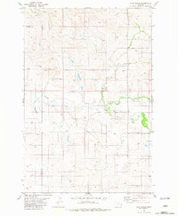
 1981 Mildred1981 Print · USGSMildred and the surrounding Prairie County ranch lands are captured here in the early eighties as the railroad still traced the valley floor. Genealogists and historians can locate the local Cem and trace the paths of O Fallon Creek and the Chicago Milwaukee St Paul and Pacific line.
 - 1981 Map of Wibaux, 1982 Print
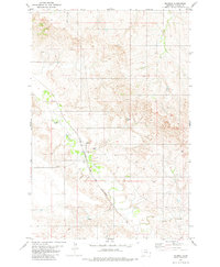
 1981 Wibaux1982 Print · USGSThe Montana and North Dakota borderlands come into focus in the early 1980s, showcasing a landscape shaped by the BURLINGTON NORTHERN railroad and the Yellowstone River. Researchers can trace the rail corridor through Wibaux and Yates or locate isolated landmarks like Graveyard Hill and Johnstone Dam.
 - 1982 Map of Simons Butte
 1982 Simons Butte1982 Print · USGSThe eastern Montana plains at the start of the 1980s are defined here by the divide between Dawson Co and Prairie Co. Researchers can trace the remote drainage of Cabin Creek and locate local landmarks like Simons Butte and a small rural Cem.
 - 1982 Map of Graveyard Hill SW
 1982 Graveyard Hill SW1982 Print · USGSPrairie and Dawson counties were centers of energy and ranching in the early 1980s, as shown in this detailed topographic record. Genealogists and historians can trace the North Pine Oil Field infrastructure alongside Ash Creek and the Labelle Ditch.
 - 1982 Map of Graveyard Hill
 1982 Graveyard Hill1982 Print · USGSEastern Montana at the start of the 1980s reveals a landscape defined by the intersection of three counties and the energy industry. Genealogists and historians can trace the extent of the South Pine Oil Field and find local landmarks like Graveyard Hill and Mount McKinley.
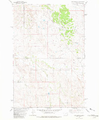
 - 1982 Map of Circle
 1982 Circle1982 Print · USGSEastern Montana ranching country and the town of Circle are captured here in the early eighties. Genealogists and local historians can trace the Burlington Northern rail corridor and find rural landmarks like Crazy Butte, Lindsay, and Brockway.
 - 1983 Map of Becker Dam
 1983 Becker Dam1983 Print · USGSPrairie County ranchlands are documented here in the early eighties, showing a landscape shaped by remote water management and scattered outposts. Researchers can trace the drainage of Cedar Creek and locate landmarks like Olanda and Becker Dam.
 - 1983 Map of Union School
 1983 Union School1983 Print · USGSEastern Montana ranchlands near the county line are captured here in the early eighties. Genealogists and local historians can locate the central Union School and trace the winding paths of Upper Sevenmile Creek and Clear Creek.
 - 1983 Map of Big Sheep Mountain
 1983 Big Sheep Mountain1983 Print · USGSEastern Montana ranching country near the turn of the eighties is defined by the high prominence of Big Sheep Mountain. Trace local drainages and landmarks like Mud Spr, Cedar Creek, and a remote Radio Tower.
 - 1983 Map of North Coulee
 1983 North Coulee1983 Print · USGSPrairie County's rugged drainage systems are captured here in the early 1980s, revealing a complex network of coulees and creeks. Genealogists and local historians can trace the paths of Middle Fork Bad Route Creek, North Coulee, and Brackett Creek.
 - 1983 Map of Jordan
 1983 Jordan1983 Print · USGSGarfield County ranchlands and the high plains are captured here in the early eighties as the town of Jordan serves as the regional center. Genealogists and historians can trace family-named landmarks like Phillips Buttes or the remote settlement of Cohagen near Little Dry Creek.
 - 1983 Map of Forsyth
 1983 Forsyth1983 Print · USGSEastern Montana's high plains and river valleys come into focus in the early eighties as the rail-and-ranching economy centered on the Yellowstone River. Researchers can trace the development of small rail towns like Hysham, Angela, and Ingomar alongside the Burlington Northern line.
 - 1983 Map of Diamond G Butte
 1983 Diamond G Butte1983 Print · USGSThe Montana high plains at the Dawson and Prairie county line are captured here in the early 1980s. Trace the intricate drainage systems of Bad Route Creek and its many forks, or locate landmarks like Diamond G Butte and Mc Quoid Coulee across this rural landscape.
 - 1983 Map of Bearshack Creek
 1983 Bearshack Creek1983 Print · USGSMcCone and Prairie Counties are captured here in the early eighties, showing a landscape defined by ranching life and seasonal watersheds. Researchers can trace the drainages of Bearshack Creek and Dry Ash Creek or locate the landmark at Lower Summit.2 unique versions available
 - 1983 Map of Big Sheep Mountain NW
 1983 Big Sheep Mountain NW1983 Print · USGSThe eastern Montana plains at the start of the eighties show the quiet intersection of Mc Cone Co and Prairie Co. Researchers can trace the winding paths of Ash Creek and Pasture Creek across the county line.
 - 1983 Map of Diamond G Butte NW
 1983 Diamond G Butte NW1983 Print · USGSThe high plains of eastern Montana are captured here during the early eighties, showing the convergence of Prairie, McCone, and Dawson Counties. Researchers can trace the drainage networks of Bad Route Creek, Dry Ash Creek, and the South Fork Clear Creek.
End of results
Showing maps 1-23 of 23
Top cities of Prairie County
Frequently asked questions
- What are the different types of historical maps available for Prairie County?
- What is the oldest map of Prairie County?
- Where can I purchase historical maps of Prairie County for my home or office?
- Where can I download high-res historical maps of Prairie County?
- Are there historical topographic maps available for Prairie County?
- Is there historical aerial imagery available for Prairie County?
- Where are historical maps of Prairie County sourced from?