Old Maps of Prairie County, Montana for Metal Detecting
Plan your next treasure hunt with 331 historic maps of Prairie County. Find old homesites, ghost towns, trails, and gathering spots that may be lost to time — perfect for identifying promising metal detecting locations.
- Locate forgotten sites: Uncover places like long-lost settlements, abandoned rail lines, or gathering spots.
- Plan better hunts: Use map overlays combined with LiDAR or satellite views to narrow in on historically rich areas.
- Made for detectorists: Thousands of hobbyists use these maps to discover relics, coins, and hidden history.
Use these historic maps to boost your research and find new opportunities beneath the surface of Prairie County.
Prairie County, MT maps
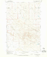
(331)- 1953 Map of Miles City, 1966 Print
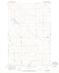
 1953 Miles City1966 Print · USGSEastern Montana and the North Dakota borderlands come alive in this mid-century survey of the Yellowstone River valley. Genealogists and historians can trace the rural network of the era through sites like Fertile Prairie School, St Johns Church, and the rail lines serving Ismay and Plevna.4 unique versions available
 - 1954 Map of Jordan, 1965 Print
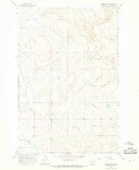
 1954 Jordan1965 Print · USGSGarfield County in the mid-fifties is a land of expansive ranches and isolated prairie schoolhouses. Researchers can trace rural genealogy and land use through landmarks like Regina School, Robertson Brothers Ranch, and the Charles M Russell National Wildlife Range.2 unique versions available
 - 1954 Map of Forsyth, 1966 Print
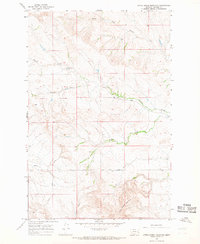
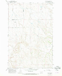
 1954 Forsyth1966 Print · USGSThe Yellowstone River valley and the northern high plains are captured here in the mid-1950s during a period of expanding energy and rail infrastructure. Genealogists and historians can trace rail sidings and cattle-country outposts like Ingomar, Vananda, and Angela.3 unique versions available
 - 1954 Map of Glendive, 1967 Print
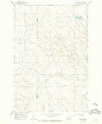
 1954 Glendive1967 Print · USGSEastern Montana at mid-century shows a landscape of river-valley commerce and remote prairie ranching. Researchers can trace the legacy of rural education and transport through sites like Prairie Elk School, the Great Northern rail lines, and Circle.2 unique versions available
 - 1956 Map of Jordan
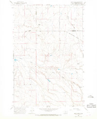
 1956 Jordan1956 Print · USGSCentral Montana ranching country and the massive Missouri River impoundment are captured here in the mid-fifties. Researchers can trace remote homesteading landmarks like Robertson Brothers Ranch and small rural hubs including Jordan, Brusett, and Cohagen.
 - 1957 Map of Miles City
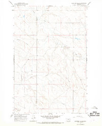
 1957 Miles City1957 Print · USGSEastern Montana and the North Dakota borderlands come alive in the mid-fifties as the rail and ranching economy peaks along the Yellowstone River. Genealogists and historians can trace numerous rural landmarks like St Phillips Church, Fertile Prairie School, and the Ostendorf Ranch.
 - 1957 Map of Glendive
 1957 Glendive1957 Print · USGSEastern Montana in the mid-1950s is defined by its deep river valleys and a sprawling network of rural school districts. You can trace the path of the Great Northern railroad and locate vanished local landmarks like Breezy Flat School and Newton Junction.
 - 1957 Map of Forsyth
 1957 Forsyth1957 Print · USGSSouth-central Montana in the late fifties is captured here through its dual-river geography and emergent energy economy. Researchers can trace the path of the Northern Pacific through Forsyth, locate the Ragged Point Oil Field, and find early sidings like Ahles Siding.
 - 1958 Map of Miles City
 1958 Miles City1958 Print · USGSEastern Montana ranching and rail life are documented here during the late fifties, centered on the confluence of the Yellowstone River and Powder River. Researchers can trace rural school locations like St Phillips Church and Chimney Creek School alongside dozens of named family ranches.
 - 1958 Map of Jordan
 1958 Jordan1958 Print · USGSGarfield County and the Missouri River country are shown here in the late fifties as the regional geography adjusted to the massive new reservoir. Genealogists and local historians can trace isolated homesteads and numerous rural schoolhouses like Iler School, Brusett, and the Robertson Brothers Ranch.
 - 1958 Map of Forsyth
 1958 Forsyth1958 Print · USGSMid-century Montana comes alive along the Yellowstone River and the competing transcontinental rail lines. Local historians can trace the legacy of the Northern Pacific through Forsyth or explore early oil developments at the Ragged Point Oil Field.
 - 1958 Map of Glendive
 1958 Glendive1958 Print · USGSEastern Montana and the North Dakota borderlands come alive in the late fifties, showing the agricultural heart of the Yellowstone valley. Trace the legacy of rural education through Kimmel School and Ridgelawn School or locate rail hubs in Glendive and Sidney.
 - 1964 Map of Jordan
 1964 Jordan1964 Print · USGSGarfield County and the surrounding Montana prairie are captured in the mid-1950s as the Fort Peck Reservoir reshapes the northern landscape. Local historians can trace the locations of rural schoolhouses like South First Creek School and remote ranching outposts such as Brusett and Van Norman.
 - 1965 Map of Hedstrom Lake, 1968 Print
 1965 Hedstrom Lake1968 Print · USGSEastern Montana's high plains are documented here in the mid-sixties, capturing the remote intersection of McCone, Prairie, and Garfield counties. Researchers can trace the drainage of Skull Creek and locate family landmarks like Red Butte or the small Cem near the northern border.
 - 1965 Map of Little Sheep Mountain, 1968 Print
 1965 Little Sheep Mountain1968 Print · USGSPrairie County ranching country is captured here in the mid-sixties, showing the remote landscape around Little Sheep Mountain. Researchers can trace old property lines and rural outposts like Devlin Ranch, Hawkins, and the path of Cherry Creek Road.
 - 1965 Map of Hedstrom Lake SE, 1968 Print
 1965 Hedstrom Lake SE1968 Print · USGSEastern Montana rangeland at the Garfield and Prairie county line is defined by its deep coulees and remote ranch roads. Trace the winding paths of Timber Creek and Beaver Coulee or follow the route of Big Sheep Mountain Road.
 - 1965 Map of Heitz School, 1968 Print
 1965 Heitz School1968 Print · USGSThe ranching country of Prairie and McCone counties is documented here in the mid-1960s, showing a remote landscape of the Montana plains. Researchers can locate the site of the Heitz School and trace cattle-country landmarks like Redwater Well and Chalk Butte.
 - 1965 Map of Twin Buttes School, 1968 Print
 1965 Twin Buttes School1968 Print · USGSEastern Montana ranching country is captured in the mid-sixties along the Prairie County and Custer County line. Researchers can locate remote landmarks like the Twin Buttes Sch, Hartwick Sch, and the Hamlick Reservoir.
 - 1965 Map of Combs Ranch, 1968 Print
 1965 Combs Ranch1968 Print · USGSPrairie County ranch lands are captured here in the mid-1960s, showing a landscape defined by seasonal water and isolated homesteads. Researchers can locate Combs Ranch, trace the winding course of Ash Creek, and find several remote water wells and a Radio Tower.
 - 1965 Map of Watkins SE, 1968 Print
 1965 Watkins SE1968 Print · USGSEastern Montana rangeland at the mid-century shows a landscape of expansive ranches and vital water sources. Trace the divide between Mc Cone Co and Prairie Co or locate the remote Morton Spring and Lisk Creek.
 - 1965 Map of Crow Rock, 1968 Print
 1965 Crow Rock1968 Print · USGSThe Prairie and Garfield County line in the mid-sixties reveals a landscape of isolated ranching and water management. Researchers can trace the development of Dinosaur Dam, locate the settlement of Crow Rock, and follow the drainages of Ash Creek and Whites Creek.
 - 1965 Map of Watkins, 1968 Print
 1965 Watkins1968 Print · USGSEastern Montana ranching country is captured here in the mid-sixties, spanning the border of McCone and Prairie counties. Researchers can trace local water management and early roads near Watkins, Lisk Creek Dam, and the winding Redwater River.
 - 1965 Map of Berry School, 1968 Print
 1965 Berry School1968 Print · USGSMcCone and Prairie counties appear here in the mid-1960s, showing a traditional Montana ranching landscape. Genealogists and local historians can locate rural hubs like Berry School, Watkins Ch, and Watkins Cem along the Redwater River.
 - 1965 Map of Morehouse Creek, 1969 Print
 1965 Morehouse Creek1969 Print · USGSEastern Montana rangeland at the mid-century reveals a territory defined by its watercourses and early ranching infrastructure. Researchers can trace the winding Custer Creek and its tributaries or locate old fence lines and the remote Caprock Road.
 - 1965 Map of Crow Rock SE, 1969 Print
 1965 Crow Rock SE1969 Print · USGSCuster County and the surrounding plains are captured in the mid-1960s, a period when rural schoolhouses and remote survey points still defined the landscape. Researchers can locate the Fairview Sch and trace watercourses like Crow Rock Creek and Wolf Creek.
Showing maps 1-25 of 331
Top cities of Prairie County
Frequently asked questions
- What are the different types of historical maps available for Prairie County?
- What is the oldest map of Prairie County?
- Where can I purchase historical maps of Prairie County for my home or office?
- Where can I download high-res historical maps of Prairie County?
- Are there historical topographic maps available for Prairie County?
- Is there historical aerial imagery available for Prairie County?
- Where are historical maps of Prairie County sourced from?