Old Maps of Sprole, Brockton District for Academic Research
Study the evolution of Sprole with 9 high-resolution historic maps. Whether you're teaching, researching, or modeling changes in land use, these maps provide essential visual documentation of urban, environmental, and geographic change.
- Analyze long-term change: Track patterns in development, transportation, and natural features.
- Ideal for environmental or urban studies: Support academic projects with primary historical map data.
- Use in the classroom or lab: Educators and researchers rely on these maps to bring historical context to life.
These maps are a powerful tool for teaching, research, and visualizing how Sprole has changed over the decades.
Sprole, Brockton District maps
(9)- 1912 Map of Poplar
 1912 Poplar1912 Print · USGSThe High Plains of northeastern Montana are captured here just before the first World War, centered on the confluence of two major waterways. Genealogists and historians can trace early railroad siding stops like Sprole and Arthur along the Great Northern line and through the Fort Peck Indian Reservation.
 - 1954 Map of Wolf Point, 1967 Print
 1954 Wolf Point1967 Print · USGSNortheastern Montana and the North Dakota borderlands are shown here in the mid-fifties, dominated by the Missouri River and the Fort Peck Indian Reservation. Genealogists and historians can trace the Great Northern rail line through river towns like Poplar and Culbertson or locate northern border outposts like the U S Custom Office at Raymond.2 unique versions available
 - 1958 Map of Wolf Point
 1958 Wolf Point1958 Print · USGSNortheastern Montana is shown during the mid-fifties, featuring the extensive Fort Peck Indian Reservation and the Missouri River valley. Researchers can trace the Great Northern railroad through Wolf Point or locate sites like Slab Crossing and the Coal Mine near Medicine Lake.
 - 1972 Map of Sprole, 1976 Print
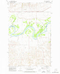 1972 Sprole1976 Print · USGSThe Missouri River valley at the Roosevelt and Richland county line is captured here in the early 1970s. Trace the rural rail-and-river economy through landmarks like the Sprole Storage Bins, the Burlington Northern line, and White Shield Island.2 unique versions available
 - 2011 Map of Sprole, 2011 Print
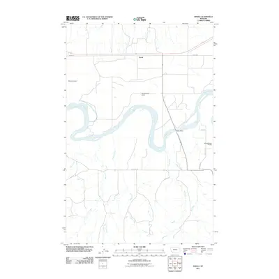 2011 Sprole2011 Print · USGSCovers Sprole, including Brockton District, Roosevelt County, and other nearby areas
 - 2014 Map of Sprole, 2014 Print
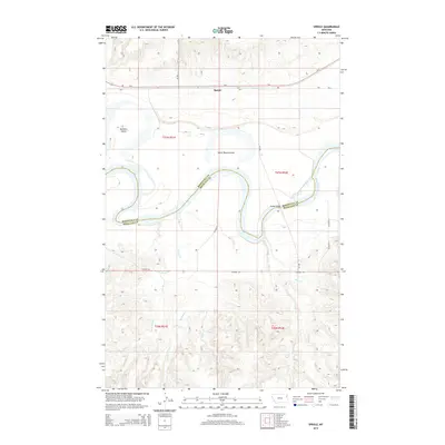 2014 Sprole2014 Print · USGSCovers Sprole, including Brockton District, Roosevelt County, and other nearby areas
 - 2017 Map of Sprole, 2017 Print
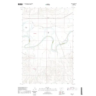
 2017 Sprole2017 Print · USGSCovers Sprole, including Brockton District, Roosevelt County, and other nearby areas
 - 2020 Map of Sprole, 2020 Print
 2020 Sprole2020 Print · USGSCovers Sprole, including Brockton District, Roosevelt County, and other nearby areas
 - 2024 Map of Sprole, 2024 Print
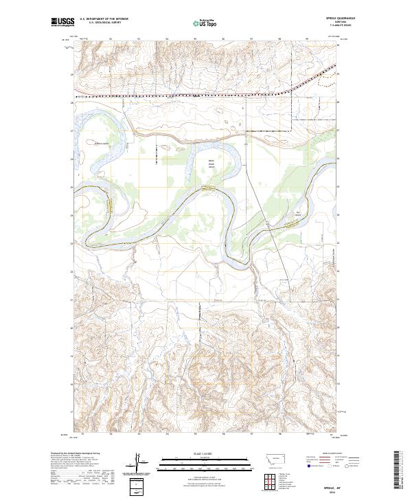 2024 Sprole2024 Print · USGSThe Missouri River border between Roosevelt and Richland counties remains a landscape of shifting islands and deep coulees in this contemporary survey. Historians and researchers can trace the vicinity of Sprole and the drainages of Schoolhouse Coulee and White Shield Island.
End of results
Showing maps 1-9 of 9
Top cities near Sprole
- Poplar District historical maps
- Poplar historical maps
- Brockton District historical maps
- Brockton historical maps
Frequently asked questions
- What are the different types of historical maps available for Sprole?
- What is the oldest map of Sprole?
- Where can I purchase historical maps of Sprole for my home or office?
- Where can I download high-res historical maps of Sprole?
- Are there historical topographic maps available for Sprole?
- Is there historical aerial imagery available for Sprole?
- Where are historical maps of Sprole sourced from?