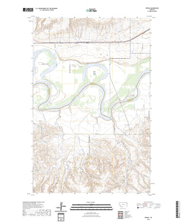
2024 Map of Sprole
USGS Topo · Published 2024About this map
The Missouri River carves a winding path through the borderlands of Roosevelt and Richland counties, shaping a landscape defined by significant riverine features. This modern topographic record highlights several large islands within the channel, including Skinners Island, White Shield Island, and Ivys Island, which illustrate the river's shifting nature in this part of Montana. The settlement of Sprole serves as a central point along the northern rail and road corridor, situated near the head of several significant drainage systems.
Find a feature on this map
24 named features on this map. Tap any name to fly to it.
Don’t see what you’re looking for? This feature index may not catch every label — zoom into the map to look around manually.
Map Details
Editions of this 2024 Sprole Map
This is the sole edition of this map. No revisions or reprints were ever made.
Other maps of this area

1909 · Glendive
USGS Topo · 1:250,000

1912 · Poplar
USGS Topo · 1:62,500

1914 · Brockton
USGS Topo · 1:62,500

1954 · Glendive
USGS Topo · 1:250,000

1954 · Wolf Point
USGS Topo · 1:250,000

1957 · Glendive
USGS Topo · 1:250,000

1958 · Wolf Point
USGS Topo · 1:250,000

1958 · Glendive
USGS Topo · 1:250,000

1972 · Poplar
USGS Topo · 1:24,000

1972 · Poplar NE
USGS Topo · 1:24,000