Old Maps of Poplar, Poplar District for Hiking & Exploration
Hike through history with 9 historic maps of Poplar. Explore old trails, ghost towns, and forgotten backroads — perfect for outdoor adventurers and local explorers.
- Rediscover forgotten places: Map out old mining camps, roads, and footpaths that no longer exist on modern maps.
- Layer with modern tools: Combine with LiDAR or satellite views to plan hikes through historical terrain.
- Made for exploration: Popular among hikers, overlanders, and local history lovers.
Use these maps to find adventure and explore the hidden past of Poplar.
Poplar, Poplar District maps
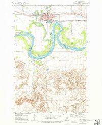
(9)- 1912 Map of Poplar
 1912 Poplar1912 Print · USGSThe High Plains of northeastern Montana are captured here just before the first World War, centered on the confluence of two major waterways. Genealogists and historians can trace early railroad siding stops like Sprole and Arthur along the Great Northern line and through the Fort Peck Indian Reservation.
 - 1954 Map of Wolf Point, 1967 Print
 1954 Wolf Point1967 Print · USGSNortheastern Montana and the North Dakota borderlands are shown here in the mid-fifties, dominated by the Missouri River and the Fort Peck Indian Reservation. Genealogists and historians can trace the Great Northern rail line through river towns like Poplar and Culbertson or locate northern border outposts like the U S Custom Office at Raymond.2 unique versions available
 - 1958 Map of Wolf Point
 1958 Wolf Point1958 Print · USGSNortheastern Montana is shown during the mid-fifties, featuring the extensive Fort Peck Indian Reservation and the Missouri River valley. Researchers can trace the Great Northern railroad through Wolf Point or locate sites like Slab Crossing and the Coal Mine near Medicine Lake.
 - 1972 Map of Poplar, 1975 Print
 1972 Poplar1975 Print · USGSThe confluence of the Missouri and Poplar Rivers is captured in the early seventies, centered on the hub of Poplar within the reservation. Trace the Burlington Northern rail line and local landmarks like the Arthur Sch and the Poplar Airport.2 unique versions available
 - 2011 Map of Poplar, 2011 Print
 2011 Poplar2011 Print · USGSCovers Poplar, including Poplar District, Brockton District, and other nearby areas
 - 2014 Map of Poplar, 2014 Print
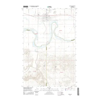
 2014 Poplar2014 Print · USGSCovers Poplar, including Poplar District, Brockton District, and other nearby areas
 - 2017 Map of Poplar, 2017 Print
 2017 Poplar2017 Print · USGSCovers Poplar, including Poplar District, Brockton District, and other nearby areas
 - 2020 Map of Poplar, 2020 Print
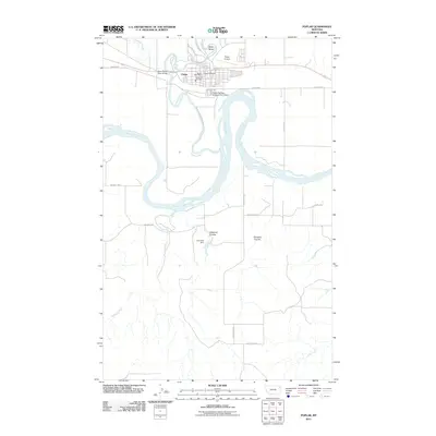
 2020 Poplar2020 Print · USGSCovers Poplar, including Poplar District, Brockton District, and other nearby areas
 - 2024 Map of Poplar, 2024 Print
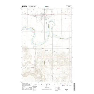
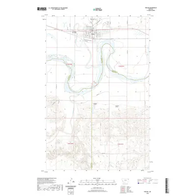
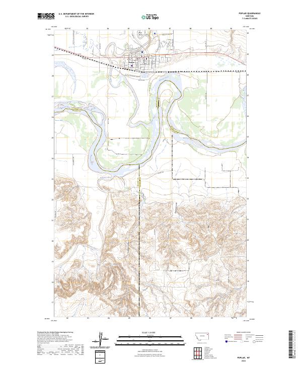 2024 Poplar2024 Print · USGSPoplar stands at the strategic meeting of the Missouri and Poplar Rivers during this modern era of eastern Montana history. Local researchers can trace the town's layout and find sites like Poplar Cem, Boys Bend, and the mouth of the Redwater River.
End of results
Showing maps 1-9 of 9
Top cities near Poplar
Frequently asked questions
- What are the different types of historical maps available for Poplar?
- What is the oldest map of Poplar?
- Where can I purchase historical maps of Poplar for my home or office?
- Where can I download high-res historical maps of Poplar?
- Are there historical topographic maps available for Poplar?
- Is there historical aerial imagery available for Poplar?
- Where are historical maps of Poplar sourced from?