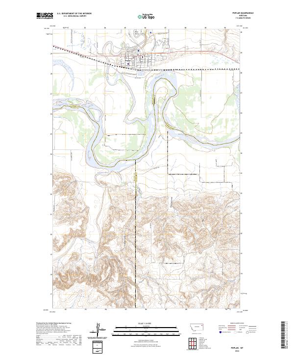
2024 Map of Poplar
USGS Topo · Published 2024About this map
Poplar serves as the primary hub of this landscape, situated at the confluence of the Poplar River and the mighty Missouri River. The town's grid is dense with residential streets such as George Washington St and Medicine Bear Rd, reflecting its role as a regional center within Roosevelt County. Just north of the main settlement lies the Poplar Cem, a significant site for local family history research.
Find a feature on this map
49 named features on this map. Tap any name to fly to it.
Don’t see what you’re looking for? This feature index may not catch every label — zoom into the map to look around manually.
Map Details
Editions of this 2024 Poplar Map
This is the sole edition of this map. No revisions or reprints were ever made.
Other maps of this area

1912 · Chelsea
USGS Topo · 1:62,500

1912 · Poplar
USGS Topo · 1:62,500

1954 · Glendive
USGS Topo · 1:250,000

1954 · Wolf Point
USGS Topo · 1:250,000

1957 · Glendive
USGS Topo · 1:250,000

1958 · Wolf Point
USGS Topo · 1:250,000

1958 · Glendive
USGS Topo · 1:250,000

1972 · Poplar
USGS Topo · 1:24,000

1972 · Chelsea
USGS Topo · 1:24,000

1972 · Poplar NE
USGS Topo · 1:24,000
Featured Places
- Poplar District, MT
- Poplar, Poplar District
- Brockton District, MT
- Roosevelt County, MT
- McCone County, MT