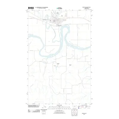
2011 Map of Poplar
USGS Topo · Published 2011About this map
The town of Poplar serves as the focal point of this Roosevelt County survey, situated at the confluence of the Poplar River and the sweeping curves of the Missouri River. The township's civic and infrastructure layout is clearly defined, featuring the Poplar Post Office, Poplar Vol Fire Dept, and the Poplar Airport north of the main settlement. Local navigation is anchored by the West Poplar River Bridge and the Old Ferry Rd, reflecting the historical importance of river crossings in this part of Montana.
Find a feature on this map
24 named features on this map. Tap any name to fly to it.
Don’t see what you’re looking for? This feature index may not catch every label — zoom into the map to look around manually.
Map Details
Editions of this 2011 Poplar Map
This is the sole edition of this map. No revisions or reprints were ever made.
Other maps of this area

1912 · Chelsea
USGS Topo · 1:62,500

1912 · Poplar
USGS Topo · 1:62,500

1954 · Glendive
USGS Topo · 1:250,000

1954 · Wolf Point
USGS Topo · 1:250,000

1957 · Glendive
USGS Topo · 1:250,000

1958 · Wolf Point
USGS Topo · 1:250,000

1958 · Glendive
USGS Topo · 1:250,000

1972 · Poplar
USGS Topo · 1:24,000

1972 · Chelsea
USGS Topo · 1:24,000

1972 · Poplar NE
USGS Topo · 1:24,000
Featured Places
- Poplar District, MT
- Poplar, Poplar District
- Brockton District, MT
- Roosevelt County, MT
- McCone County, MT