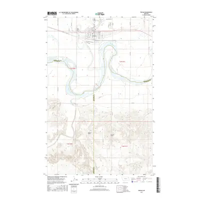
2017 Map of Poplar
USGS Topo · Published 2017About this map
Poplar sits at the confluence of two major waterways, where the Poplar River flows into the Missouri River in northeastern Montana. This 2017 survey shows the settlement's street grid and its connection to the Poplar Community Coll, alongside the Poplar Cem and several Bureau of Indian Affairs routes. The landscape is defined by its hydrology and dramatic terrain breaks, including Boys Bend and the winding course of the Redwater River to the south. Further inland, the map captures the transition from river valleys to high plains through features like Hubbard Coulee and Glendive Coulee. The presence of the West Poplar River Bridge and various arterial roads like Burlington Rd and Poplar Park Rd illustrates the transport network supporting this tribal and regional center near the borders of Roosevelt, McCone, and Richland counties.
Find a feature on this map
50 named features on this map. Tap any name to fly to it.
Don’t see what you’re looking for? This feature index may not catch every label — zoom into the map to look around manually.
Map Details
Editions of this 2017 Poplar Map
This is the sole edition of this map. No revisions or reprints were ever made.
Other maps of this area

1912 · Chelsea
USGS Topo · 1:62,500

1912 · Poplar
USGS Topo · 1:62,500

1954 · Glendive
USGS Topo · 1:250,000

1954 · Wolf Point
USGS Topo · 1:250,000

1957 · Glendive
USGS Topo · 1:250,000

1958 · Wolf Point
USGS Topo · 1:250,000

1958 · Glendive
USGS Topo · 1:250,000

1972 · Poplar
USGS Topo · 1:24,000

1972 · Chelsea
USGS Topo · 1:24,000

1972 · Poplar NE
USGS Topo · 1:24,000
Featured Places
- Poplar District, MT
- Poplar, Poplar District
- Brockton District, MT
- Roosevelt County, MT
- McCone County, MT