1990s Maps of Rosebud County, Montana
Explore 11 historic maps of Rosebud County from the 1990s. These maps offer a rare glimpse into what life looked like during the 1990s — showing old roads, neighborhoods, homes, and landmarks that have changed or disappeared over time.
Whether you're researching your family's past, planning a metal detecting trip, or studying how Rosebud County's landscape evolved across the 1990s, these high-resolution maps are a powerful tool for exploring the history of this region.
- Focus on a specific era: All maps on this page are from the 1990s, giving you a focused view of this time period.
- See what’s changed: Compare century-old streets, trails, and buildings to today's modern landscape using overlays and satellite layers.
- Research with precision: Use these maps for genealogy, historical research, land use analysis, or educational projects.
- View, download, or print: Maps are fully viewable online in high resolution, and can be downloaded or printed for your own records.
Start exploring Rosebud County's history through authentic maps from the 1990s. This is your window into the past.
Rosebud County, MT maps
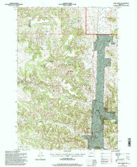
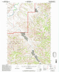
(11)- 1995 Map of King Mountain, 1998 Print
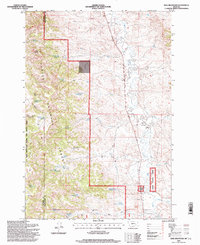 1995 King Mountain1998 Print · USGSPowder River and Rosebud Counties are documented here in the mid-nineties, showing the rugged ranching and forest lands of southeastern Montana. Genealogists and historians can trace the network of water sources and isolated sites like Genie, Paget, and the King Mountain Hiking and Riding Area.
 - 1995 Map of Browns Mountain, 1998 Print
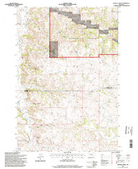
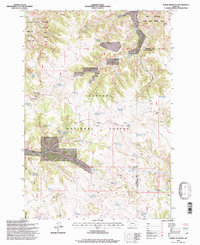
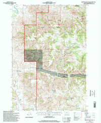 1995 Browns Mountain1998 Print · USGSThe Tongue River breaks of Rosebud County are shown here in the mid-1990s as a landscape of forest management and ranching. Genealogists and historians can locate family landmarks like Bones Ranch and Gilliland Ranch among the springs and gulches of Custer National Forest.
 - 1995 Map of Ashland, 1998 Print
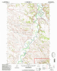 1995 Ashland1998 Print · USGSThe Tongue River valley in the mid-1990s reveals a unique intersection of tribal lands and national forest near Ashland, Montana. Researchers can trace the grounds of the St Labre Mission and explore the rugged coulees of the Northern Cheyenne Indian Reservation.
 - 1995 Map of Birney Day School, 1998 Print
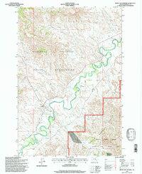 1995 Birney Day School1998 Print · USGSEastern Montana in the 1990s reveals a landscape shaped by the Tongue River and the Northern Cheyenne Indian Reservation. Genealogists and historians can trace the community of Birney, locating the Birney Day School, a Cem, and the intricate Cheyenne Ditch.
 - 1995 Map of Fort Howes, 1998 Print
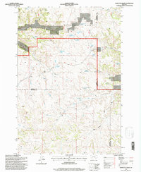
 1995 Fort Howes1998 Print · USGSPowder River County during the mid-nineties shows a landscape of national forest lands and cattle country defined by the Otter Creek valley. Local historians can locate the Fort Howes (Historical Site), the Otter Creek School, and numerous named springs used for ranching.
 - 1995 Map of Cook Creek Reservoir, 1998 Print
 1995 Cook Creek Reservoir1998 Print · USGSPowder River County, Montana, is shown in the mid-1990s as a landscape of managed forest and high-plains water sources. Researchers can trace the drainages of Cook Mountain to find local landmarks like Colbert Coulee Well and the Cook Creek Reservoir.
 - 1995 Map of Hamilton Draw, 1998 Print
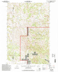
 1995 Hamilton Draw1998 Print · USGSThe high plains of Rosebud County during the 1990s are defined by the intersection of three county lines and managed forest lands. Genealogists and historians can trace the vital water sources and ranching infrastructure of the era, from Tooley Spring to the Round Cow Reservoir.
 - 1995 Map of Stroud Creek, 1998 Print
 1995 Stroud Creek1998 Print · USGSSoutheast Montana ranching country and the timbered draws of the Custer National Forest are documented here in the late twentieth century. Researchers can locate the historic OW Ranch and trace remote water sources like Rim Rock Spring and Haywood Reservoir.
 - 1995 Map of Green Creek, 1998 Print
 1995 Green Creek1998 Print · USGSThe Northern Cheyenne Indian Reservation and Custer National Forest meet in the mid-1990s along the winding Tongue River. Researchers can trace the ranching and water infrastructure of the era through sites like Bull Ranch, O'Dell Windmill, and the East Fork Reservoir.
 - 1995 Map of Poker Jim Butte, 1998 Print
 1995 Poker Jim Butte1998 Print · USGSSoutheastern Montana's high plains and forest lands are captured in the mid-nineties, showing a landscape defined by ranching water works and conservation. Researchers can trace remote water sources like Emma Kraft Springs and landmarks such as Poker Jim Butte or the Hagen Debris Dam.
 - 1995 Map of Willow Crossing, 1998 Print
 1995 Willow Crossing1998 Print · USGSPowder River County ranching and mining lands are captured here in the mid-1990s, where the Rosebud County line meets the national forest. Trace local history at the Willow Crossing Cem or locate industrial sites like the Coal Creek Mine and Red Shale hills.
End of results
Showing maps 1-11 of 11
Top cities of Rosebud County
Frequently asked questions
- What are the different types of historical maps available for Rosebud County?
- What is the oldest map of Rosebud County?
- Where can I purchase historical maps of Rosebud County for my home or office?
- Where can I download high-res historical maps of Rosebud County?
- Are there historical topographic maps available for Rosebud County?
- Is there historical aerial imagery available for Rosebud County?
- Where are historical maps of Rosebud County sourced from?