1980s Maps of Silver Bow County, Montana
Explore 16 historic maps of Silver Bow County from the 1980s. These maps offer a rare glimpse into what life looked like during the 1980s — showing old roads, neighborhoods, homes, and landmarks that have changed or disappeared over time.
Whether you're researching your family's past, planning a metal detecting trip, or studying how Silver Bow County's landscape evolved across the 1980s, these high-resolution maps are a powerful tool for exploring the history of this region.
- Focus on a specific era: All maps on this page are from the 1980s, giving you a focused view of this time period.
- See what’s changed: Compare century-old streets, trails, and buildings to today's modern landscape using overlays and satellite layers.
- Research with precision: Use these maps for genealogy, historical research, land use analysis, or educational projects.
- View, download, or print: Maps are fully viewable online in high resolution, and can be downloaded or printed for your own records.
Start exploring Silver Bow County's history through authentic maps from the 1980s. This is your window into the past.
Silver Bow County, MT maps
(16)- 1985 Map of Elk Park Pass, 1986 Print
 1985 Elk Park Pass1986 Print · USGSThe high Continental Divide country of Jefferson County comes alive in this mid-eighties survey of the Elk Park region. Genealogists and historians can trace an Old Railroad Grade through Woodville Canyon and locate mining sites like the Mine Dumps and prospects near Woodville.2 unique versions available
 - 1988 Map of Cattle Gulch
 1988 Cattle Gulch1988 Print · USGSThe high Montana backcountry in the late eighties reveals a landscape shaped by mining and timber. Genealogists and historians can trace the foundations of Vipond and Glendale, while locating specific industrial markers like the North Central Mine and Kilns.
 - 1989 Map of Butte South
 1989 Butte South1989 Print · USGSButte and its southern suburbs appear in the late 1980s as the city transitioned between its industrial peak and modern era. Genealogists can locate family sites among several burial grounds like Holy Cross Cemetery and Mountain View Cemetery or trace old neighborhoods near Williamsburg.2 unique versions available
 - 1989 Map of Waterloo
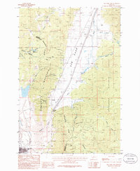
 1989 Waterloo1989 Print · USGSMadison County's river-bottom lands and mountain foothills are captured here in the late eighties as agriculture and mining shaped the local economy. Trace family ranching roots at Silver Bow Ranch or locate historical workings like the Ohio Lode Mine and Strawn Mine.
 - 1989 Map of Butte North
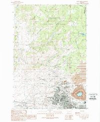 1989 Butte North1989 Print · USGSSilver Bow County’s mining heart is on full display in the late eighties, centered on the massive Berkeley Pit and the rugged high-country camps. Genealogists and industrial historians can trace the deep heritage of the Hill through labels like the Granite Mountain Mine, Walkerville, and Centerville.
 - 1989 Map of Warm Springs
 1989 Warm Springs1989 Print · USGSDeer Lodge County in the late eighties is defined by the heavy footprint of the mining industry and state institutions along the Clark Fork. Researchers can trace the layout of the Montana State Hospital and the extensive tailings management systems that reshaped the valley floor.
 - 1989 Map of Ramsay
 1989 Ramsay1989 Print · USGSThe mining and ranching country of Silver Bow County comes into focus in the late 1980s. Researchers can trace the industrial footprint of the Butte and Zenith Mine and find local landmarks like Chinaman Spring and Miles Crossing.
 - 1989 Map of Orofino Mountain
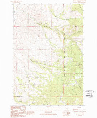 1989 Orofino Mountain1989 Print · USGSDeer Lodge and Silver Bow counties meet at this high-altitude mining district during the late twentieth century. Researchers can trace the extensive network of 4WD trails and resource sites like the Butte Pacific Mine, Lockhart Meadows, and Whitcraft.
 - 1989 Map of Lockhart Meadows
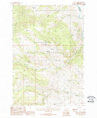
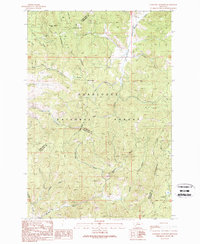 1989 Lockhart Meadows1989 Print · USGSMontana's high country is captured here in the late eighties as it straddles the continental crest within the national forest. Researchers can trace historic mining operations at the Champion Mine or locate early family-named landmarks like Strozzi and Olson Gulch.
 - 1989 Map of Mount Humbug
 1989 Mount Humbug1989 Print · USGSSilver Bow and Madison Counties are captured here in the late eighties, showing a landscape shaped by the Continental Divide and a long history of mineral exploration. Researchers can trace the layout of Moose Town, locate numerous Prospect sites, and explore the water systems of Basin Creek Reservoir.
 - 1989 Map of Tucker Creek
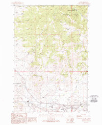
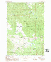
 1989 Tucker Creek1989 Print · USGSSilver Bow County during the late eighties shows a landscape of protected wilderness and active mineral exploration. Researchers can trace historic prospecting sites and remote infrastructure like the Fleecer FS Sta, South Fork Res, and Crazy Swede Creek.
 - 1989 Map of Buxton
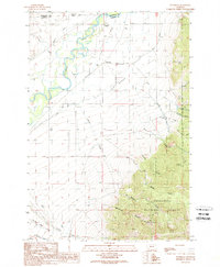
 1989 Buxton1989 Print · USGSSilver Bow County is captured here in the late eighties as a landscape of mountain forestry and legacy mining. Trace the Continental Divide through the Deerlodge National Forest or locate old sites at Buxton and Feeley.
 - 1989 Map of Silver Star
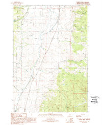
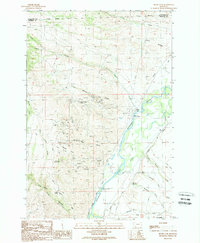 1989 Silver Star1989 Print · USGSMadison County mining history and river valley irrigation are on full display in the late eighties. Researchers can trace historic extraction sites like the Keystone Mine and Clipper Mine or locate family-named landmarks such as Bayers Lane and Ironrod Bridge.
 - 1989 Map of Table Mountain
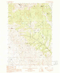 1989 Table Mountain1989 Print · USGSMadison and Silver Bow counties are captured here in the late eighties, documenting a rugged landscape of mining prospects and high forest peaks. Researchers can locate the Big Bonanza Mine, the Hells Canyon FS Station, and family-named landmarks like Seidensticker No 2 Spring.
 - 1989 Map of Opportunity
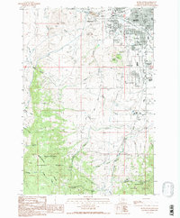
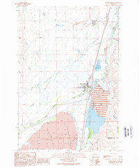
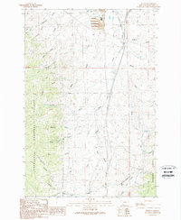
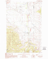 1989 Opportunity1989 Print · USGSThe Deer Lodge valley in the late eighties shows a landscape of industrial bypasses and small rail-side settlements. Trace the history of Opportunity or find sites like Crackerville, Gregson, and the Sunset Memorial Gardens Cem.
 - 1989 Map of Anaconda South
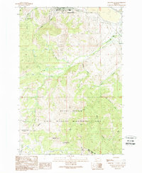 1989 Anaconda South1989 Print · USGSThe mining and smelting hub of Anaconda is captured in the late eighties, showing the transition from industrial city to the high peaks of the Continental Divide. Researchers can locate the Lincoln School, Cem, and remnants of the Anaconda Ralston Railroad Grade.
End of results
Showing maps 1-16 of 16
Top cities of Silver Bow County
Frequently asked questions
- What are the different types of historical maps available for Silver Bow County?
- What is the oldest map of Silver Bow County?
- Where can I purchase historical maps of Silver Bow County for my home or office?
- Where can I download high-res historical maps of Silver Bow County?
- Are there historical topographic maps available for Silver Bow County?
- Is there historical aerial imagery available for Silver Bow County?
- Where are historical maps of Silver Bow County sourced from?