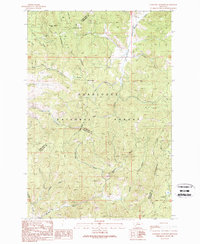
1989 Map of Lockhart Meadows
USGS Topo · Published 1989About this map
The Continental Divide winds through this high-altitude landscape within the Deer Lodge National Forest, marking the boundary between Deer Lodge and Jefferson Counties. The northern portion of the map is defined by early industrial activity at the Champion Mine, where multiple Mine Shafts and an Adit are located near Gospel Hill. This area, accessible by numerous 4 WD trails, highlights the rugged extraction history typical of the Montana mountains during the late 20th century.
Find a feature on this map
39 named features on this map. Tap any name to fly to it.
Don’t see what you’re looking for? This feature index may not catch every label — zoom into the map to look around manually.
Map Details
Editions of this 1989 Lockhart Meadows Map
This is the sole edition of this map. No revisions or reprints were ever made.
Other maps of this area

1889 · Helena
USGS Topo · 1:250,000

1893 · Helena
USGS Topo · 1:250,000

1899 · Boulder
USGS Topo · 1:125,000

1899 · Helena
USGS Topo · 1:250,000

1903 · Helena
USGS Topo · 1:250,000

1947 · Butte
USGS Topo · 1:250,000

1954 · Elk Park
USGS Topo · 1:62,500

1954 · Basin
USGS Topo · 1:62,500

1958 · Butte
USGS Topo · 1:250,000

1959 · Butte North
USGS Topo · 1:62,500