1990s Maps of Stillwater County, Montana
Explore 14 historic maps of Stillwater County from the 1990s. These maps offer a rare glimpse into what life looked like during the 1990s — showing old roads, neighborhoods, homes, and landmarks that have changed or disappeared over time.
Whether you're researching your family's past, planning a metal detecting trip, or studying how Stillwater County's landscape evolved across the 1990s, these high-resolution maps are a powerful tool for exploring the history of this region.
- Focus on a specific era: All maps on this page are from the 1990s, giving you a focused view of this time period.
- See what’s changed: Compare century-old streets, trails, and buildings to today's modern landscape using overlays and satellite layers.
- Research with precision: Use these maps for genealogy, historical research, land use analysis, or educational projects.
- View, download, or print: Maps are fully viewable online in high resolution, and can be downloaded or printed for your own records.
Start exploring Stillwater County's history through authentic maps from the 1990s. This is your window into the past.
Stillwater County, MT maps
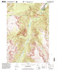
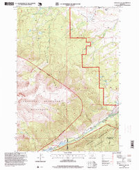
(14)- 1992 Map of Gardiner, 1993 Print
 1992 Gardiner1993 Print · USGSThe northern gateway to Yellowstone and the high peaks of the Absaroka Range are captured here in the early nineties. Researchers can trace historic settlements like Jardine and Chico Hot Springs or locate the North Entrance near Gardiner.2 unique versions available
 - 1993 Map of Harlowton
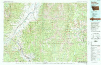
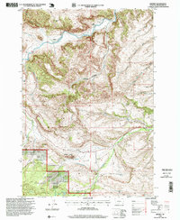
 1993 Harlowton1993 Print · USGSCentral Montana's river valleys and high plains are captured here in the 1990s as the agricultural landscape evolved. Genealogists can trace family holdings near Springwater Colony or follow the Old Railroad Grade through Harlowton and Shawmut.
 - 1996 Map of Mackay Ranch, 1999 Print
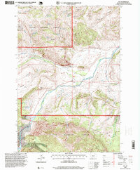
 1996 Mackay Ranch1999 Print · USGSThe foothills of the Absaroka Range meet Carbon County ranchlands in the late twentieth century. Researchers can trace historic water rights and family land use through features like the Mackay Ranch, Roscoe Cem, and the Peabody Ditch.
 - 1996 Map of Little Park Mountain, 1999 Print
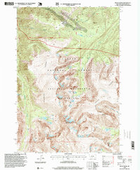
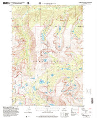
 1996 Little Park Mountain1999 Print · USGSThe high Beartooth Range comes into focus in the mid-nineties, showing the glacial remnants and high-altitude water systems of the Montana backcountry. Researchers can trace the drainage patterns of the Stillwater River or locate the remote Wolf Glacier and Grasshopper Lakes.
 - 1996 Map of Cathedral Point, 1999 Print
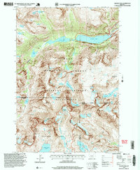
 1996 Cathedral Point1999 Print · USGSStillwater County is defined by the high elevations of the Absaroka-Beartooth range in the mid-nineties. Wilderness travelers and historians can trace the paths of the Stillwater River past Woodbine Falls and the remote Beartooth Ranch.
 - 1996 Map of Meyer Mountain, 1999 Print
 1996 Meyer Mountain1999 Print · USGSThe Montana high country near the Stillwater River is captured here in the mid-1990s, showing a landscape of intense forest management and wilderness preservation. Trace the old service routes around the Meyers Creek Work Center, the small outpost at Limestone, and local landforms like Horseman Flats.
 - 1996 Map of Emerald Lake, 1999 Print
 1996 Emerald Lake1999 Print · USGSStillwater and Carbon counties meet in this high-altitude Montana landscape during the late twentieth century, where forest management gives way to protected wilderness. You can trace early school sites and ranching outposts like Bedford School and Hash Ranch or locate remote high-mountain waters including Crater Lake and Emerald Lake.
 - 1996 Map of Beehive, 1999 Print
 1996 Beehive1999 Print · USGSIn the mid-nineties, the Stillwater River valley remained a landscape of isolated ranching settlements and forest access. Researchers can trace the layout of Beehive, locate the Beehive School, and find historical water infrastructure like the Lewis Hudson-Fowler Ditch.
 - 1996 Map of Nye, 1999 Print
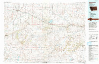
 1996 Nye1999 Print · USGSStillwater County ranching and forest lands are captured in the late nineties as the river network transitions through the Beartooth foothills. Researchers can trace local landmarks like Buffalo Jump, the Cem at Nye, and old tracks near Horseman Flats.
 - 1996 Map of Pinnacle Mountain, 1999 Print
 1996 Pinnacle Mountain1999 Print · USGSThe high Montana backcountry of the mid-1990s is captured here, centered on the meeting point of three counties. Hikers and historians can trace routes through Columbine Pass or locate remote alpine waters such as Lake of the Woods and Marten Lake.
 - 1996 Map of Mount Wood, 1999 Print
 1996 Mount Wood1999 Print · USGSHigh in the Beartooth Range during the late nineties, this landscape shows the rugged alpine basins of Stillwater County. Trace the glacial drainages of Fishtail Creek and locate remote features like Mount Wood and the lonely Mine Shaft.
 - 1996 Map of Tumble Mountain, 1999 Print
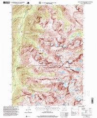
 1996 Tumble Mountain1999 Print · USGSThe high alpine lakes and peaks of the Montana wilderness are captured here in the late 1990s. Hikers and researchers can trace the intricate network of water bodies like Lake Surrender, Wounded Man Lake, and the summit of Tumble Mountain.
 - 1996 Map of Granite Peak, 1999 Print
 1996 Granite Peak1999 Print · USGSHigh in the Beartooth Range during the late twentieth century, this survey tracks the permanent ice and alpine waters of Montana's highest point. Researchers can locate remote features like the Montana Power Dam, Sky Top Glacier, and the aptly named Froze to Death Mountain.2 unique versions available
 - 1996 Map of Alpine, 1999 Print
 1996 Alpine1999 Print · USGSThe Beartooth Wilderness in the mid-1990s was a landscape of high-altitude glacial lakes and isolated settlements. Researchers can trace the drainages of West Rosebud Lake and East Rosebud Lake while locating the remote Phantom Glacier and Alpine trailhead.
End of results
Showing maps 1-14 of 14
Top cities of Stillwater County
Frequently asked questions
- What are the different types of historical maps available for Stillwater County?
- What is the oldest map of Stillwater County?
- Where can I purchase historical maps of Stillwater County for my home or office?
- Where can I download high-res historical maps of Stillwater County?
- Are there historical topographic maps available for Stillwater County?
- Is there historical aerial imagery available for Stillwater County?
- Where are historical maps of Stillwater County sourced from?