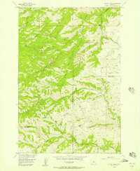
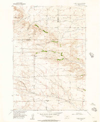
1950s Maps of Stillwater County, Montana
Explore 45 historic maps of Stillwater County from the 1950s. These maps offer a rare glimpse into what life looked like during the 1950s — showing old roads, neighborhoods, homes, and landmarks that have changed or disappeared over time.
Whether you're researching your family's past, planning a metal detecting trip, or studying how Stillwater County's landscape evolved across the 1950s, these high-resolution maps are a powerful tool for exploring the history of this region.
- Focus on a specific era: All maps on this page are from the 1950s, giving you a focused view of this time period.
- See what’s changed: Compare century-old streets, trails, and buildings to today's modern landscape using overlays and satellite layers.
- Research with precision: Use these maps for genealogy, historical research, land use analysis, or educational projects.
- View, download, or print: Maps are fully viewable online in high resolution, and can be downloaded or printed for your own records.
Start exploring Stillwater County's history through authentic maps from the 1950s. This is your window into the past.
Stillwater County, MT maps
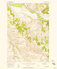
(45)- 1954 Map of Sliderock Mountain, 1956 Print
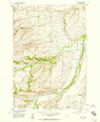
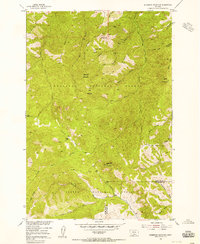 1954 Sliderock Mountain1956 Print · USGSSweet Grass and Stillwater Counties were centers of mountain mining and forest management in the mid-fifties. Researchers can trace the high-country activity of prospecting sites like Iron Mountain Mine and remote outposts such as Wepler Cabin.3 unique versions available
 - 1954 Map of Billings, 1963 Print
 1954 Billings1963 Print · USGSThe Yellowstone valley during the mid-fifties shows a landscape of thriving rail towns and high-mountain outposts. Genealogists and historians can trace old homesteads and mining routes near Red Lodge, Bearcreek, and along the Bighorn River.4 unique versions available
 - 1954 Map of Roundup, 1966 Print
 1954 Roundup1966 Print · USGSCentral Montana in the mid-1960s showcases a landscape of high-plains agriculture and vital rail connections. Researchers can trace historic routes through Harlowton and Roundup while locating landmarks like Judith Cemetery and Deadmans Basin Reservoir.2 unique versions available
 - 1955 Map of Bozeman
 1955 Bozeman1955 Print · USGSBozeman and the upper Missouri River headwaters are captured here during the mid-fifties, showing the vital rail and river networks of southwestern Montana. Local historians can trace the routes of the Northern Pacific railroad through Livingston and locate smaller settlements like Trident, Anceney, and Jardine.
 - 1955 Map of Antelope Point, 1957 Print
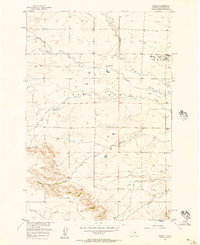
 1955 Antelope Point1957 Print · USGSStillwater County ranching country is captured here in the mid-fifties, showing a landscape of scattered schoolhouses and prairie creeks. You can trace early township life through the Antelope Point Sch and family-named landmarks like Lindemulder Hill.2 unique versions available
 - 1955 Map of Sandborn Creek, 1957 Print
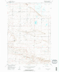
 1955 Sandborn Creek1957 Print · USGSThe Stillwater River valley is shown in the mid-fifties during a period of expanding irrigation and rural settlement. Genealogists can locate family-named infrastructure like the Mendenhall Ditch or the Spring Creek Sch.2 unique versions available
 - 1955 Map of Reed Point, 1957 Print
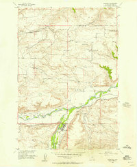
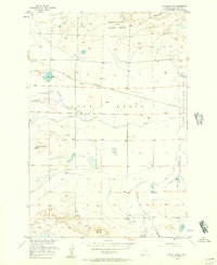
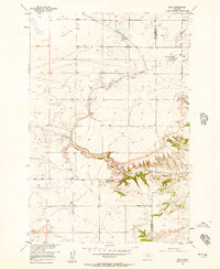
 1955 Reed Point1957 Print · USGSThe Yellowstone River valley is captured here in the mid-1950s, showing the vital rail-and-water corridor through Stillwater County. Genealogists and historians can trace the local community at Reed Point, the White Beaver Sch, and the Sectionhouse along the Northern Pacific line.2 unique versions available
 - 1955 Map of Springtime, 1957 Print
 1955 Springtime1957 Print · USGSStillwater County life in the mid-fifties centered on the Yellowstone River and the Northern Pacific rail line. Genealogists and local historians can trace the rural landscape from Springtime to Craver, including the site of the Countryman Creek Sch.2 unique versions available
 - 1955 Map of Wildcat Draw, 1957 Print
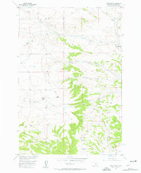
 1955 Wildcat Draw1957 Print · USGSSweet Grass and Stillwater counties are captured here in the mid-1950s, showing a high-country landscape managed by the National Forest Service. Researchers can locate remote dwellings like Yates Cabin or trace early access routes along Wildcat Draw and Trout Creek.3 unique versions available
 - 1955 Map of Russell Gulch, 1957 Print
 1955 Russell Gulch1957 Print · USGSThe borderlands of Stillwater and Sweet Grass counties are captured here in the mid-fifties, detailing a ranching landscape centered on the Lake Basin. Researchers can locate rural landmarks like the Cedar Creek School and trace the paths of Russell Gulch and East White Beaver Creek.
 - 1955 Map of Whitebird School, 1957 Print
 1955 Whitebird School1957 Print · USGSThe Stillwater River valley in the mid-1950s is a landscape of high ridges and vital irrigation systems. Genealogists and local historians can trace the Whitebird School and Porter settlement alongside the Shane Ditch and Whitebird Ditch.2 unique versions available
 - 1955 Map of Absarokee, 1957 Print
 1955 Absarokee1957 Print · USGSIn the mid-1950s, the Stillwater River valley was a complex landscape of irrigation networks and rural communities. You can trace early family-named infrastructure and landmarks like Albert Johnson Bridge, the Riverside Inn, and the Sylvester Easly Ditch.2 unique versions available
 - 1955 Map of Cow Face Hill, 1957 Print
 1955 Cow Face Hill1957 Print · USGSStillwater and Sweet Grass counties are captured here in the mid-1950s as a landscape of ranching and historical transit. Researchers can trace the legendary Bozeman Trail or locate the Stone Breastwork (Indian Battlesite) and rural Stockade Sch.2 unique versions available
 - 1955 Map of Stephens Hill, 1958 Print
 1955 Stephens Hill1958 Print · USGSThe rural borders of Sweet Grass and Stillwater counties are captured here in the mid-fifties, showing a landscape shaped by survey markers and natural drainages. Genealogists and local historians can trace the paths of White Beaver Creek and Wullum Gulch near Stephens Hill.
 - 1956 Map of Emerald Lake, 1957 Print
 1956 Emerald Lake1957 Print · USGSThe Stillwater and Carbon County borderlands are captured here in the mid-fifties as high-alpine wilderness met early ranching life. Genealogists and historians can trace family-named sites like the Bedford School, Hash Ranch, and Bedford Ranch at the forest's edge.3 unique versions available
 - 1956 Map of Columbus West, 1957 Print
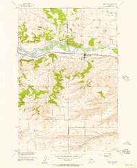
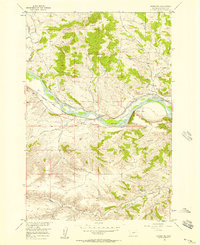
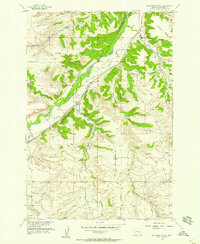
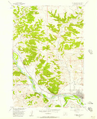 1956 Columbus West1957 Print · USGSThe Stillwater Valley comes into focus in the mid-1950s at the junction of the Yellowstone River and the Northern Pacific. Trace the irrigation canals and rail sidings that shaped Columbus and nearby Carlton.2 unique versions available
 - 1956 Map of Fishtail, 1957 Print
 1956 Fishtail1957 Print · USGSFishtail and the surrounding ranchlands are documented here in the mid-fifties at the edge of the Beartooth foothills. Researchers can trace the complex irrigation network of Magee Ditch and West Rosebud Ditch or locate the Twin Butte Sch.2 unique versions available
 - 1956 Map of Rapelje, 1957 Print
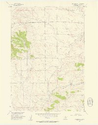
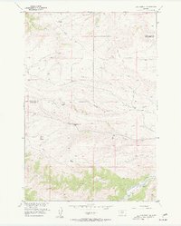
 1956 Rapelje1957 Print · USGSStillwater County ranching and rail-side life are captured here in the mid-fifties, centered on the settlement of Rapelje within the Lake Basin. Researchers can trace the era's local industry and geography through features like the Strip Mine, Busteed, and the Rapelje Cem.2 unique versions available
 - 1956 Map of Hunter Lake, 1957 Print
 1956 Hunter Lake1957 Print · USGSStillwater County mid-century ranching and resource extraction are recorded here as the landscape transitions toward the Lake Basin. Researchers can locate remote rural institutions like Peterson Sch and early energy developments at Oil Wells and Oil Tanks.2 unique versions available
 - 1956 Map of Battle Butte, 1957 Print
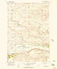
 1956 Battle Butte1957 Print · USGSThe Stillwater County prairie in the mid-1950s reveals a ranching landscape centered on the Northern Pacific rail line and the Lake Basin. Researchers can trace the early boundaries of the Hailstone National Wildlife Refuge and locate landmarks like Battle Butte.
 - 1956 Map of Shane Ridge, 1957 Print
 1956 Shane Ridge1957 Print · USGSThe Stillwater County river valley and surrounding uplands are captured here in the mid-1950s. Genealogists and historians can trace rural schoolhouse locations like Standard Sch and Shane Creek Sch or follow the path of the Northern Pacific.2 unique versions available
 - 1956 Map of Horse Butte, 1957 Print
 1956 Horse Butte1957 Print · USGSStillwater County in the mid-fifties reveals a landscape shaped by both natural drainages and early industrial development. Researchers can trace the water network from Cove Ditch to Horse Creek, and locate local landmarks like the Strip Mine and Horse Butte.2 unique versions available
 - 1956 Map of Molt, 1957 Print
 1956 Molt1957 Print · USGSStillwater County ranching and rail life are documented here in the mid-1950s as the high plains meet the canyon breaks. Genealogists can locate the Luckey Homestead and Lazy K T Ranch or trace the Northern Pacific line through Molt.2 unique versions available
 - 1956 Map of Alpine, 1957 Print
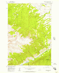
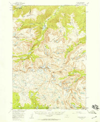 1956 Alpine1957 Print · USGSThe Beartooth Range at the mid-century is captured here in immense detail, showing the glacial peaks and alpine lakes of the Montana-Wyoming border. Trace high-altitude landmarks like the Mystic Lake Hydroelectric Plant, the settlement at Alpine, and the rugged paths of the Arch Creek Trail.3 unique versions available
 - 1956 Map of Wheat Basin, 1957 Print
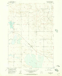 1956 Wheat Basin1957 Print · USGSStillwater County in the mid-1950s is captured here as a landscape of broad prairie basins and seasonal lakes. Genealogists and historians can trace the Northern Pacific rail line through Wheat Basin and locate early oil wells and Big Lake.
Showing maps 1-25 of 45
Top cities of Stillwater County
Frequently asked questions
- What are the different types of historical maps available for Stillwater County?
- What is the oldest map of Stillwater County?
- Where can I purchase historical maps of Stillwater County for my home or office?
- Where can I download high-res historical maps of Stillwater County?
- Are there historical topographic maps available for Stillwater County?
- Is there historical aerial imagery available for Stillwater County?
- Where are historical maps of Stillwater County sourced from?