Old Maps of Stillwater County, Montana for Academic Research
Study the evolution of Stillwater County with 381 high-resolution historic maps. Whether you're teaching, researching, or modeling changes in land use, these maps provide essential visual documentation of urban, environmental, and geographic change.
- Analyze long-term change: Track patterns in development, transportation, and natural features.
- Ideal for environmental or urban studies: Support academic projects with primary historical map data.
- Use in the classroom or lab: Educators and researchers rely on these maps to bring historical context to life.
These maps are a powerful tool for teaching, research, and visualizing how Stillwater County has changed over the decades.
Stillwater County, MT maps
(381)- 1889 Map of Big Snowy Mountain
 1889 Big Snowy Mountain1889 Print · USGSCentral Montana in the late 1880s was a land of critical mountain passes and emerging frontier outposts. You can trace early settlement patterns and cattle country geography through historic sites like Ubet, Bercail, and Melville near the Musselshell River.
 - 1891 Map of Livingston
 1891 Livingston1891 Print · USGSUpper Yellowstone River country is documented here in the late nineteenth century as the railroad transformed the valley. Genealogists and historians can trace rail-stop towns like Cokedale, the military grounds at Ft. Ellis, and the Old Crow Agency.
 - 1891 Map of Big Timber
 1891 Big Timber1891 Print · USGSMontana ranching country and the Yellowstone valley are captured here in the late nineteenth century. Trace the early Northern Pacific Railroad line through Big Timber and Greycliff, or locate the Harrison Ferry crossing.
 - 1892 Map of Stillwater
 1892 Stillwater1892 Print · USGSThe Yellowstone valley in the late nineteenth century was a corridor of rapid transition as the railroad moved westward alongside the Crow Indian Reservation. Researchers can trace early river crossings and pioneer settlements such as Merrill, Stillwater, and the Ford at Youngs Point.4 unique versions available
 - 1893 Map of Livingston
 1893 Livingston1893 Print · USGSThe Montana mountain country and the gateway to the national park are captured here in the late nineteenth century. Trace the industrial rail corridor through Livingston to mining sites like Coke and the historic Old Crow Agency.5 unique versions available
 - 1893 Map of Big Snowy Mountain
 1893 Big Snowy Mountain1893 Print · USGSCentral Montana in the late frontier era reveals a landscape shaped by the massive Big Snowy Mountain and the headwaters of major rivers. Researchers can trace early settlements and transit points like Ubet, Judith Gap, and the remote outpost of Bercail.4 unique versions available
 - 1893 Map of Big Timber
 1893 Big Timber1893 Print · USGSBig Timber and the Yellowstone valley appear here during the expansion of the rail-and-river economy in the late nineteenth century. Researchers can trace the original Northern Pacific Railroad route and locate early river crossings like Harrison Ferry and settlements at Greycliff.4 unique versions available
 - 1898 Map of Granite Mountain District
 1898 Granite Mountain District1898 Print · USGSThe Beartooth Range appears here in the late nineteenth century during a specialized survey for regional coal and electric companies. Researchers can trace early mountain pathways through Goose Lake Pass and locate major summits like Granite Peak and Mt Dewey.
 - 1932 Map of Red Lodge No 2
 1932 Red Lodge No 21932 Print · USGSCarbon County ranching country is documented in detail during the early 1930s, showing a landscape organized around mountain streams and rural post offices. Genealogists can locate family-named landmarks and country schools like Inderland Sch, Jackson Sch, and the community at Fishtail.
 - 1932 Map of Red Lodge No 1
 1932 Red Lodge No 11932 Print · USGSCarbon County ranching and early energy infrastructure are on display in this early 1930s survey of the northern Beartooth foothills. Genealogists and historians can trace the rail corridor between Roberts and Boyd or locate industrial sites like the Gas Control Sta.
 - 1932 Map of Nye No 1
 1932 Nye No 11932 Print · USGSStillwater and Carbon counties appear here in the early 1930s, as ranching settlements met the mountain wilderness. Genealogists and local historians can trace the foundations of Fishtail, locate the Dean PO, and follow trails into the Beartooth National Forest.
 - 1932 Map of Nye No 2
 1932 Nye No 21932 Print · USGSStillwater County’s high country comes into focus in the early 1930s, showing the early infrastructure of the national forests. Genealogists and historians can locate the Nye PO, trace the irrigation networks of Horseman Flats, and find remote landmarks like Beartooth Ranch.
 - 1939 Map of Mt Wood, 1941 Print
 1939 Mt Wood1941 Print · USGSStillwater County comes alive in the late thirties, documenting a rugged mining and ranching frontier within the Custer National Forest. Genealogists and historians can trace local landmarks like Nye, the Benbow Mine, and the Limestone Sch.4 unique versions available
 - 1941 Map of Mt. Wood
 1941 Mt. Wood1941 Print · USGSStillwater County and the Custer National Forest are mapped here in the early 1940s, showing a landscape defined by mountain mining and river valley ranching. Researchers can locate the Nye Cem, the Benbow Mine, and high-country landmarks like Beartooth Ranch.
 - 1941 Map of Mt Douglas, 1958 Print
 1941 Mt Douglas1958 Print · USGSHigh-altitude Montana ranching and resource extraction are captured here at the start of the 1940s. Genealogists and historians can trace early land use at Clydehurst Ranch, the Gish Mine, and the Fourmile Guard Station.4 unique versions available
 - 1942 Map of Cutoff Mtn, 1959 Print
 1942 Cutoff Mtn1959 Print · USGSThe Absaroka-Beartooth wilderness along the Montana-Wyoming border is captured here in the early 1940s. Researchers can trace the high-country trails and sites like the Independence Mine, Silver Tip Ranch, and the Cooke Ranger Sta.4 unique versions available
 - 1943 Map of Mt Douglas
 1943 Mt Douglas1943 Print · USGSHigh-altitude Montana ranching and forestry are documented here in the early 1940s, before modern road networks reached these alpine basins. Researchers can locate remote outposts like Clydehurst Ranch or trace the backcountry administrative boundaries near Fourmile Guard Station and Snowy Peak.2 unique versions available
 - 1944 Map of Cutoff Mtn
 1944 Cutoff Mtn1944 Print · USGSThe northern gateway to Yellowstone and the high Absaroka wilderness are documented in the early 1940s, just as the park’s modern boundaries were being refined. Trace the historic Northeast Entrance, the remote Silver Tip Ranch, and the high-altitude Independence Mine.2 unique versions available
 - 1947 Map of Bozeman, 1948 Print
 1947 Bozeman1948 Print · USGSBozeman and the surrounding mountain ranges are captured here just after the war, showing the vital rail and river networks of southwestern Montana. Genealogists and historians can trace routes to early settlements like Virginia City, Gallatin Gateway, and the mountain community of Jardine.
 - 1948 Map of Bozeman, 1951 Print
 1948 Bozeman1951 Print · USGSSouthern Montana in the late 1940s is shown as a high-country crossroads of rail lines and river headwaters. Genealogists and historians can trace old town sites like Virginia City and McLeod alongside the Northern Pacific and Milwaukee Road railroads.
 - 1954 Map of Sliderock Mountain, 1956 Print
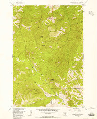 1954 Sliderock Mountain1956 Print · USGSSweet Grass and Stillwater Counties were centers of mountain mining and forest management in the mid-fifties. Researchers can trace the high-country activity of prospecting sites like Iron Mountain Mine and remote outposts such as Wepler Cabin.3 unique versions available
 - 1954 Map of Billings, 1963 Print
 1954 Billings1963 Print · USGSThe Yellowstone valley during the mid-fifties shows a landscape of thriving rail towns and high-mountain outposts. Genealogists and historians can trace old homesteads and mining routes near Red Lodge, Bearcreek, and along the Bighorn River.4 unique versions available
 - 1954 Map of Roundup, 1966 Print
 1954 Roundup1966 Print · USGSCentral Montana in the mid-1960s showcases a landscape of high-plains agriculture and vital rail connections. Researchers can trace historic routes through Harlowton and Roundup while locating landmarks like Judith Cemetery and Deadmans Basin Reservoir.2 unique versions available
 - 1955 Map of Bozeman
 1955 Bozeman1955 Print · USGSBozeman and the upper Missouri River headwaters are captured here during the mid-fifties, showing the vital rail and river networks of southwestern Montana. Local historians can trace the routes of the Northern Pacific railroad through Livingston and locate smaller settlements like Trident, Anceney, and Jardine.
 - 1955 Map of Antelope Point, 1957 Print
 1955 Antelope Point1957 Print · USGSStillwater County ranching country is captured here in the mid-fifties, showing a landscape of scattered schoolhouses and prairie creeks. You can trace early township life through the Antelope Point Sch and family-named landmarks like Lindemulder Hill.2 unique versions available
Showing maps 1-25 of 381
Top cities of Stillwater County
Frequently asked questions
- What are the different types of historical maps available for Stillwater County?
- What is the oldest map of Stillwater County?
- Where can I purchase historical maps of Stillwater County for my home or office?
- Where can I download high-res historical maps of Stillwater County?
- Are there historical topographic maps available for Stillwater County?
- Is there historical aerial imagery available for Stillwater County?
- Where are historical maps of Stillwater County sourced from?