1930s Maps of Toole County, Montana
Explore 3 historic maps of Toole County from the 1930s. These maps offer a rare glimpse into what life looked like during the 1930s — showing old roads, neighborhoods, homes, and landmarks that have changed or disappeared over time.
Whether you're researching your family's past, planning a metal detecting trip, or studying how Toole County's landscape evolved across the 1930s, these high-resolution maps are a powerful tool for exploring the history of this region.
- Focus on a specific era: All maps on this page are from the 1930s, giving you a focused view of this time period.
- See what’s changed: Compare century-old streets, trails, and buildings to today's modern landscape using overlays and satellite layers.
- Research with precision: Use these maps for genealogy, historical research, land use analysis, or educational projects.
- View, download, or print: Maps are fully viewable online in high resolution, and can be downloaded or printed for your own records.
Start exploring Toole County's history through authentic maps from the 1930s. This is your window into the past.
Toole County, MT maps
(3)- 1934 Map of Valier, 1962 Print
 1934 Valier1962 Print · USGSThe northern Montana plains come alive in the 1930s as a hub of irrigation and rail at the edge of the Blackfeet Indian Reservation. Genealogists can trace family holdings and local landmarks like Belgian Ch, Valier, and the Montana Western railroad terminus.2 unique versions available
 - 1937 Map of Valier
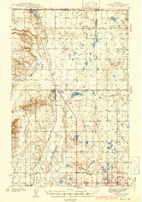
 1937 Valier1937 Print · USGSPondera County’s irrigation-driven agriculture is in full bloom during the mid-1930s as the Montana Western railroad serves the prairie. Genealogists can locate family holdings like Parker Ranch and trace the many local school districts such as Winginaw Valley Sch or Lone Tree Sch.2 unique versions available
 - 1939 Map of Sunburst, 1941 Print
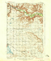
 1939 Sunburst1941 Print · USGSToole County's oil boom and border-town life are preserved in this late 1930s survey of the northern Montana plains. Trace the early petroleum economy through Ohio Camp and Texas Pacific Camp or find family roots at Willshaw Sch.3 unique versions available
End of results
Showing maps 1-3 of 3
Top cities of Toole County
Frequently asked questions
- What are the different types of historical maps available for Toole County?
- What is the oldest map of Toole County?
- Where can I purchase historical maps of Toole County for my home or office?
- Where can I download high-res historical maps of Toole County?
- Are there historical topographic maps available for Toole County?
- Is there historical aerial imagery available for Toole County?
- Where are historical maps of Toole County sourced from?