1960s Maps of Toole County, Montana
Explore 28 historic maps of Toole County from the 1960s. These maps offer a rare glimpse into what life looked like during the 1960s — showing old roads, neighborhoods, homes, and landmarks that have changed or disappeared over time.
Whether you're researching your family's past, planning a metal detecting trip, or studying how Toole County's landscape evolved across the 1960s, these high-resolution maps are a powerful tool for exploring the history of this region.
- Focus on a specific era: All maps on this page are from the 1960s, giving you a focused view of this time period.
- See what’s changed: Compare century-old streets, trails, and buildings to today's modern landscape using overlays and satellite layers.
- Research with precision: Use these maps for genealogy, historical research, land use analysis, or educational projects.
- View, download, or print: Maps are fully viewable online in high resolution, and can be downloaded or printed for your own records.
Start exploring Toole County's history through authentic maps from the 1960s. This is your window into the past.
Toole County, MT maps
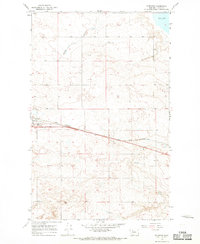
(28)- 1960 Map of Cut Bank, 1968 Print
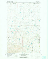
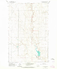
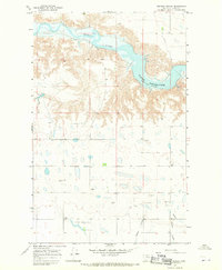
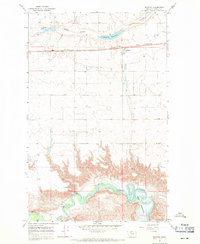
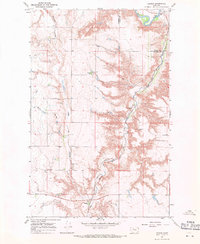
 1960 Cut Bank1968 Print · USGSThe high peaks of the Rockies meet the eastern plains in the 1960s, showing the intersection of federal lands and the Blackfeet Indian Reservation. Trace the path of the Great Northern railway and find local landmarks like the Blackfoot Boarding School and Family Mission Cem.3 unique versions available
 - 1962 Map of Whitlash, 1964 Print
 1962 Whitlash1964 Print · USGSThe Montana-Alberta border country comes into focus in the early 1960s, showing a high-plains landscape defined by ranching and petroleum. Genealogists and historians can locate the Whitlash Cem, the North Sch, and family sites like Demarest Ranch.2 unique versions available
 - 1962 Map of Cameron Lake, 1964 Print
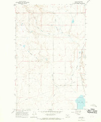
 1962 Cameron Lake1964 Print · USGSThe northern Montana high plains come into focus in the early sixties, showing a landscape defined by ranching and resource extraction. Genealogists and historians can trace family-named sites like Scalese Ranch and Gold Butte alongside signs of early industry at the Placer Mine.2 unique versions available
 - 1962 Map of Hawthorne School, 1964 Print
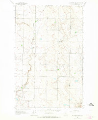
 1962 Hawthorne School1964 Print · USGSToole County ranching and energy lands are captured here in the early sixties, showing the sparse infrastructure of the high plains. Researchers can locate the Hawthorne Sch site, the remote Landing Field, and local routes like Morton Road.
 - 1962 Map of Berkholder Reservoir, 1964 Print
 1962 Berkholder Reservoir1964 Print · USGSToole and Liberty Counties are documented in the early sixties as a network of coulees and remote ranchlands. Researchers can trace rural landmarks and family-named routes like Grandview Cem, Price, and Cavitt Road.
 - 1962 Map of Mc Carters Lake, 1964 Print
 1962 Mc Carters Lake1964 Print · USGSToole County's high plains are mapped here in the early sixties, showing the intersection of rural education and the energy industry. Researchers can trace the Devon Gas Field infrastructure, the North Devon Sch, and the shoreline of Mc Carters Lake.
 - 1962 Map of Fey Lakes, 1964 Print
 1962 Fey Lakes1964 Print · USGSThe Montana-Alberta borderlands at the start of the sixties reveal a landscape of high-plains ranching and energy extraction. Trace the early Oil and Gas Field near Fey Lakes, or locate family sites like the Gold Butte Cem and the A Fey Ranch.
 - 1962 Map of Mc Carters Lake SE, 1964 Print
 1962 Mc Carters Lake SE1964 Print · USGSThe Montana high plains near the Liberty County line appear as a working landscape of ranching and early energy infrastructure in the early sixties. Researchers can trace rural landmarks like the Greenhill Sch, Cavitt Road, and the Childress Reservoir.
 - 1962 Map of Grassy Butte, 1964 Print
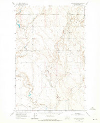
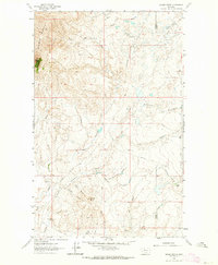 1962 Grassy Butte1964 Print · USGSToole County ranching and early energy development are captured here in the early sixties. Genealogists and historians can trace family landholdings like the Hartsook Ranch and notable landmarks such as Gold Butte and Alkali Spring.2 unique versions available
 - 1963 Map of Cut Bank
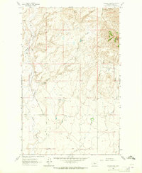
 1963 Cut Bank1963 Print · USGSNorthern Montana’s mountain passes and high plains are captured here in the early 1960s. Genealogists and historians can trace the Great Northern rail stops from Browning to Ethridge or locate the remote outposts at Polebridge and Babb.
 - 1964 Map of Cut Bank
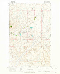
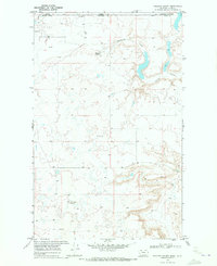
 1964 Cut Bank1964 Print · USGSGlacier National Park and the Blackfeet Indian Reservation meet in the early sixties at the triple divide of North America. Researchers can trace the Great Northern Railway through mountain passes and locate local landmarks like the Blackfoot Boarding School and Apgar Village.
 - 1966 Map of Ethridge, 1969 Print
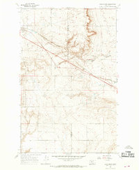
 1966 Ethridge1969 Print · USGSToole County plains life in the mid-1960s is defined by the heavy rail traffic and emerging energy infrastructure north of the Marias River. Trace the growth of Ethridge along the Great Northern tracks and locate several early Gas Well sites and the local Landing Strip.
 - 1966 Map of Ethridge NW, 1969 Print
 1966 Ethridge NW1969 Print · USGSToole County's high plains and resource economy are captured here during the mid-1960s. Genealogists and industrial historians can trace early petroleum sites like Oil Wells and Gas Wells, as well as the path of the Pipeline through Sand Coulee.
 - 1966 Map of Aloe, 1969 Print
 1966 Aloe1969 Print · USGSToole County's high plains appear in the mid-1960s as a landscape of remote rail sidings and deep seasonal coulees. Genealogists and historians can trace the Great Northern tracks past Aloe or locate landmarks like Aloe Lake and Potter Coulee.
 - 1966 Map of Boru Spring, 1969 Print
 1966 Boru Spring1969 Print · USGSThe high plains of the Glacier and Toole county border are captured here in the mid-1960s. Genealogists and researchers can trace the Great Northern rail line and locate the Marias Sch and numerous gas wells.
 - 1967 Map of Central School, 1970 Print
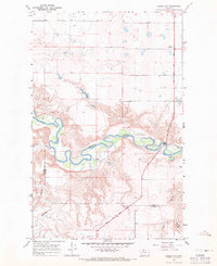
 1967 Central School1970 Print · USGSNorthern Montana's plains meet the waters of the Marias River in the late sixties. Genealogists can trace rural life through landmarks like Central Sch, Nickol Sch, and the Omholt Cem.
 - 1967 Map of Naismith, 1970 Print
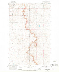
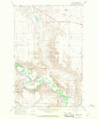 1967 Naismith1970 Print · USGSToole County's high plains meet the winding Marias River in the late 1960s, showing a landscape shaped by rail and water. Local researchers can trace the development of Shelby through its parks and Marias Fairgrounds, or locate the isolated Underdahl Ranch along the river's deep oxbows.
 - 1967 Map of Conrad Butte, 1970 Print
 1967 Conrad Butte1970 Print · USGSThe northern Montana plains in the 1960s are defined by the winding Marias River and the historic path of the Whoop Up Trail. Genealogists and historians can locate rural landmarks like Union Sch and Higgins Sch among the high benches.
 - 1967 Map of South Devon School, 1970 Print
 1967 South Devon School1970 Print · USGSToole County's high plains are documented here in the late sixties, showing the vital transit corridor of the Great Northern railroad. Researchers can locate the South Devon Sch, the Telstad Pumping Sta, and remote Coulee drainage systems.
 - 1967 Map of Dunkirk, 1971 Print
 1967 Dunkirk1971 Print · USGSToole County's high plains and river breaks are captured here in the late sixties, centered on the Great Northern railroad. Researchers can locate the small community of Dunkirk, a local Cem, and the winding course of the Marias River.
 - 1967 Map of Fowler Coulee NW, 1971 Print
 1967 Fowler Coulee NW1971 Print · USGSThe Montana plains north of Conrad are captured in the late sixties as the section line roads began to formalize local travel. Researchers can trace the path of Sollid Road across the county line or follow the complex drainages of Fowler Coulee and Pondera Coulee.2 unique versions available
 - 1967 Map of Ledger NW, 1971 Print
 1967 Ledger NW1971 Print · USGSThe Marias River valley at the Toole and Pondera county line is captured here in the late sixties. Researchers can trace the Lewis and Clark Trail past Williamson Park and follow the rugged breaks of Schultz Coulee.
 - 1967 Map of Fowler Coulee NE, 1971 Print
 1967 Fowler Coulee NE1971 Print · USGSThe Montana high plains at the boundary of Toole and Pondera Counties come into focus in the mid-1960s. Genealogists and local historians can trace rural life through landmarks like Christenson Sch, the Hall Community Hall, and Fowler Reservoir.2 unique versions available
 - 1967 Map of Ledger, 1971 Print
 1967 Ledger1971 Print · USGSPondera County's high plains were a landscape of rail-fed settlements and river breaks in the late sixties. Genealogists and researchers can trace the Great Northern line through Ledger and Fowler, or locate the Fort Conrad Historical Monument near the river.
 - 1968 Map of Hillside Colony, 1972 Print
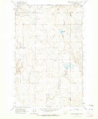
 1968 Hillside Colony1972 Print · USGSToole County, Montana, sits along the international border in the late sixties, where agricultural settlements meet an active petroleum industry. Genealogists and historians can locate Hillside Colony and Rim Rock Colony or trace the Oil Field and Buckley Coulee.
Showing maps 1-25 of 28
Top cities of Toole County
Frequently asked questions
- What are the different types of historical maps available for Toole County?
- What is the oldest map of Toole County?
- Where can I purchase historical maps of Toole County for my home or office?
- Where can I download high-res historical maps of Toole County?
- Are there historical topographic maps available for Toole County?
- Is there historical aerial imagery available for Toole County?
- Where are historical maps of Toole County sourced from?