Old Maps of Toole County, Montana for Academic Research
Study the evolution of Toole County with 313 high-resolution historic maps. Whether you're teaching, researching, or modeling changes in land use, these maps provide essential visual documentation of urban, environmental, and geographic change.
- Analyze long-term change: Track patterns in development, transportation, and natural features.
- Ideal for environmental or urban studies: Support academic projects with primary historical map data.
- Use in the classroom or lab: Educators and researchers rely on these maps to bring historical context to life.
These maps are a powerful tool for teaching, research, and visualizing how Toole County has changed over the decades.
Toole County, MT maps
(313)- 1909 Map of Cut Bank, 1955 Print
 1909 Cut Bank1955 Print · USGSHigh plains settlement and rail expansion define this Teton County landscape during the early twentieth century. Genealogists can trace the early rail stops of the Great Northern at Cut Bank, Ethridge, and Simla near the Blackfeet Indian Reservation boundary.
 - 1912 Map of Cut Bank
 1912 Cut Bank1912 Print · USGSNorthern Montana’s high plains and the Blackfeet Indian Reservation are captured here during the height of the homesteading era. Genealogists and historians can trace the early path of the Great Northern R R through Cut Bank and Simla.3 unique versions available
 - 1920 Map of Dupuyer
 1920 Dupuyer1920 Print · USGSHigh plains ranching and early irrigation projects define this 1920s survey of the Montana frontier. Genealogists and historians can trace the early rail stops and homestead hubs at Valier, Pendroy, and Manson along the Montana Western R. R. line.
 - 1920 Map of Conrad
 1920 Conrad1920 Print · USGSNorthern Montana plains at the height of the homesteading era are captured here during a period of rapid rail-led growth. Researchers can trace early postal locations like Omholt P. O. and the junction of the Great Northern R. R. in towns like Conrad and Brady.
 - 1934 Map of Valier, 1962 Print
 1934 Valier1962 Print · USGSThe northern Montana plains come alive in the 1930s as a hub of irrigation and rail at the edge of the Blackfeet Indian Reservation. Genealogists can trace family holdings and local landmarks like Belgian Ch, Valier, and the Montana Western railroad terminus.2 unique versions available
 - 1937 Map of Valier
 1937 Valier1937 Print · USGSPondera County’s irrigation-driven agriculture is in full bloom during the mid-1930s as the Montana Western railroad serves the prairie. Genealogists can locate family holdings like Parker Ranch and trace the many local school districts such as Winginaw Valley Sch or Lone Tree Sch.2 unique versions available
 - 1939 Map of Sunburst, 1941 Print
 1939 Sunburst1941 Print · USGSToole County's oil boom and border-town life are preserved in this late 1930s survey of the northern Montana plains. Trace the early petroleum economy through Ohio Camp and Texas Pacific Camp or find family roots at Willshaw Sch.3 unique versions available
 - 1943 Map of Antelope Coulee, 1945 Print
 1943 Antelope Coulee1945 Print · USGSToole County ranching life is documented here during the mid-forties, showing a landscape shaped by drainage coulees and the grid of the Principal Meridian. Genealogists can locate family landmarks such as Frandsen Ranch, Bennett Ranch, and the Fairview Sch.2 unique versions available
 - 1943 Map of Shelby, 1946 Print
 1943 Shelby1946 Print · USGSToole County ranching and rail life are documented here during the 1940s as the regional economy transitioned between cattle and oil. Genealogists can trace family holdings like Roberts Ranch and Holstad Ranch or locate early rural school sites such as Aloe Sch.2 unique versions available
 - 1945 Map of West Butte, 1946 Print
 1945 West Butte1946 Print · USGSThe Montana borderlands near the Sweetgrass Hills come to life in this mid-century survey of Toole County. Genealogists and historians can trace family-named sites like Roscoe Ranch and rural landmarks such as O'Loughlin School or the Mcdermott Mine.4 unique versions available
 - 1954 Map of Shelby, 1967 Print
 1954 Shelby1967 Print · USGSNorthern Montana's Hi-Line is captured in the mid-fifties, showing a landscape shaped by the Great Northern rail and early oil development. Trace family roots in Shelby and Conrad, or locate rural landmarks like Goose Bill Butte and the Rocky Boys Indian Reservation.3 unique versions available
 - 1958 Map of Shelby
 1958 Shelby1958 Print · USGSNorthern Montana’s high plains and the Sweetgrass Hills come to life in the late fifties as the Tiber Dam begins to reshape the Marias River valley. Genealogists and historians can trace rail-town lineages along the Great Northern line and locate sites like the Hull Coal Mine or Sweet Grass.
 - 1960 Map of Cut Bank, 1968 Print
 1960 Cut Bank1968 Print · USGSThe high peaks of the Rockies meet the eastern plains in the 1960s, showing the intersection of federal lands and the Blackfeet Indian Reservation. Trace the path of the Great Northern railway and find local landmarks like the Blackfoot Boarding School and Family Mission Cem.3 unique versions available
 - 1962 Map of Whitlash, 1964 Print
 1962 Whitlash1964 Print · USGSThe Montana-Alberta border country comes into focus in the early 1960s, showing a high-plains landscape defined by ranching and petroleum. Genealogists and historians can locate the Whitlash Cem, the North Sch, and family sites like Demarest Ranch.2 unique versions available
 - 1962 Map of Cameron Lake, 1964 Print
 1962 Cameron Lake1964 Print · USGSThe northern Montana high plains come into focus in the early sixties, showing a landscape defined by ranching and resource extraction. Genealogists and historians can trace family-named sites like Scalese Ranch and Gold Butte alongside signs of early industry at the Placer Mine.2 unique versions available
 - 1962 Map of Hawthorne School, 1964 Print
 1962 Hawthorne School1964 Print · USGSToole County ranching and energy lands are captured here in the early sixties, showing the sparse infrastructure of the high plains. Researchers can locate the Hawthorne Sch site, the remote Landing Field, and local routes like Morton Road.
 - 1962 Map of Berkholder Reservoir, 1964 Print
 1962 Berkholder Reservoir1964 Print · USGSToole and Liberty Counties are documented in the early sixties as a network of coulees and remote ranchlands. Researchers can trace rural landmarks and family-named routes like Grandview Cem, Price, and Cavitt Road.
 - 1962 Map of Mc Carters Lake, 1964 Print
 1962 Mc Carters Lake1964 Print · USGSToole County's high plains are mapped here in the early sixties, showing the intersection of rural education and the energy industry. Researchers can trace the Devon Gas Field infrastructure, the North Devon Sch, and the shoreline of Mc Carters Lake.
 - 1962 Map of Fey Lakes, 1964 Print
 1962 Fey Lakes1964 Print · USGSThe Montana-Alberta borderlands at the start of the sixties reveal a landscape of high-plains ranching and energy extraction. Trace the early Oil and Gas Field near Fey Lakes, or locate family sites like the Gold Butte Cem and the A Fey Ranch.
 - 1962 Map of Mc Carters Lake SE, 1964 Print
 1962 Mc Carters Lake SE1964 Print · USGSThe Montana high plains near the Liberty County line appear as a working landscape of ranching and early energy infrastructure in the early sixties. Researchers can trace rural landmarks like the Greenhill Sch, Cavitt Road, and the Childress Reservoir.
 - 1962 Map of Grassy Butte, 1964 Print
 1962 Grassy Butte1964 Print · USGSToole County ranching and early energy development are captured here in the early sixties. Genealogists and historians can trace family landholdings like the Hartsook Ranch and notable landmarks such as Gold Butte and Alkali Spring.2 unique versions available
 - 1963 Map of Cut Bank
 1963 Cut Bank1963 Print · USGSNorthern Montana’s mountain passes and high plains are captured here in the early 1960s. Genealogists and historians can trace the Great Northern rail stops from Browning to Ethridge or locate the remote outposts at Polebridge and Babb.
 - 1964 Map of Cut Bank
 1964 Cut Bank1964 Print · USGSGlacier National Park and the Blackfeet Indian Reservation meet in the early sixties at the triple divide of North America. Researchers can trace the Great Northern Railway through mountain passes and locate local landmarks like the Blackfoot Boarding School and Apgar Village.
 - 1966 Map of Ethridge, 1969 Print
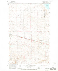 1966 Ethridge1969 Print · USGSToole County plains life in the mid-1960s is defined by the heavy rail traffic and emerging energy infrastructure north of the Marias River. Trace the growth of Ethridge along the Great Northern tracks and locate several early Gas Well sites and the local Landing Strip.
 - 1966 Map of Ethridge NW, 1969 Print
 1966 Ethridge NW1969 Print · USGSToole County's high plains and resource economy are captured here during the mid-1960s. Genealogists and industrial historians can trace early petroleum sites like Oil Wells and Gas Wells, as well as the path of the Pipeline through Sand Coulee.
Showing maps 1-25 of 313
Top cities of Toole County
Frequently asked questions
- What are the different types of historical maps available for Toole County?
- What is the oldest map of Toole County?
- Where can I purchase historical maps of Toole County for my home or office?
- Where can I download high-res historical maps of Toole County?
- Are there historical topographic maps available for Toole County?
- Is there historical aerial imagery available for Toole County?
- Where are historical maps of Toole County sourced from?