1960s Maps of Treasure County, Montana
Explore 14 historic maps of Treasure County from the 1960s. These maps offer a rare glimpse into what life looked like during the 1960s — showing old roads, neighborhoods, homes, and landmarks that have changed or disappeared over time.
Whether you're researching your family's past, planning a metal detecting trip, or studying how Treasure County's landscape evolved across the 1960s, these high-resolution maps are a powerful tool for exploring the history of this region.
- Focus on a specific era: All maps on this page are from the 1960s, giving you a focused view of this time period.
- See what’s changed: Compare century-old streets, trails, and buildings to today's modern landscape using overlays and satellite layers.
- Research with precision: Use these maps for genealogy, historical research, land use analysis, or educational projects.
- View, download, or print: Maps are fully viewable online in high resolution, and can be downloaded or printed for your own records.
Start exploring Treasure County's history through authentic maps from the 1960s. This is your window into the past.
Treasure County, MT maps
(14)- 1960 Map of Bighorn, 1962 Print
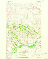
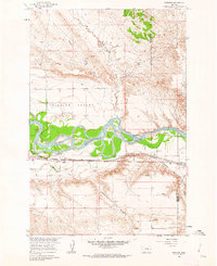
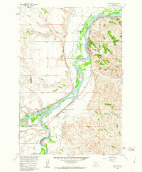 1960 Bighorn1962 Print · USGSThe confluence of the Yellowstone and Bighorn rivers in the early 1960s shows a landscape of vital irrigation ditches and rail lines. Researchers can trace the legacy of Pease Bottom through the Ft Pease (Site) and the tracks of the Northern Pacific railroad.5 unique versions available
 - 1960 Map of Hysham, 1962 Print
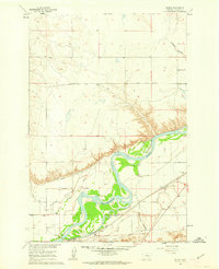
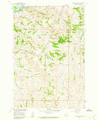
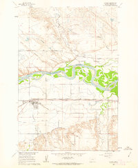 1960 Hysham1962 Print · USGSHysham and the surrounding Treasure County plains are documented here at the start of the 1960s, showing a landscape defined by river-driven irrigation. Local researchers can trace the Northern Pacific rail line and discover early landmarks like Memorial Vale Cem and Johnston.2 unique versions available
 - 1960 Map of Steie Ranch, 1962 Print
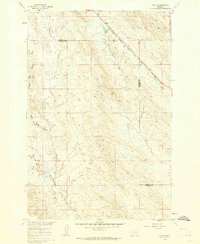
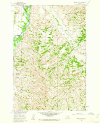
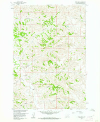
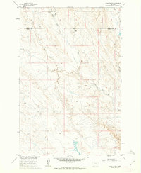 1960 Steie Ranch1962 Print · USGSBig sky ranching country along the Treasure and Rosebud county line is captured here just as the Missouri River Basin development program was underway. Researchers can locate the Steie Ranch and trace the drainage patterns of Froze to Death Creek and Geyser Spring Coulee.
 - 1960 Map of Vananda, 1962 Print
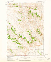
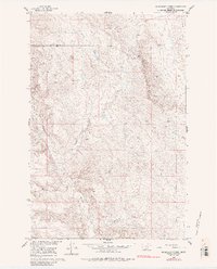
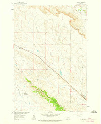 1960 Vananda1962 Print · USGSRailroad operations and ranching life intersect in the high plains of Rosebud and Treasure Counties at the dawn of the sixties. Genealogists and rail historians can trace the Milwaukee Road through Vananda and identify old Prospects along Cedar Ridge.2 unique versions available
 - 1960 Map of Custer, 1962 Print
 1960 Custer1962 Print · USGSThe Yellowstone River valley at the turn of the 1960s reveals a landscape of railroad engineering and irrigation efforts. Researchers can trace the path of the Northern Pacific, locate the Bighorn Tunnel, and explore the drainage network of Fivemile Hill.3 unique versions available
 - 1960 Map of Ahles, 1962 Print
 1960 Ahles1962 Print · USGSThe eastern Montana plains come into focus in the early sixties as the railroad era shapes the landscape. Trace the local geography along the Chicago Milwaukee St Paul and Pacific line near Ahles and the curiously named Starved to Death Creek.2 unique versions available
 - 1960 Map of Myers, 1962 Print
 1960 Myers1962 Print · USGSThe Yellowstone River valley of Treasure County comes alive in the early sixties, showing a landscape defined by irrigation and the railroad. Genealogists and local historians can locate the Rancher Ch and Rancher Sch, or trace the tracks of the Northern Pacific through Myers.2 unique versions available
 - 1960 Map of Rancher Cemetery, 1962 Print
 1960 Rancher Cemetery1962 Print · USGSTreasure County ranching country is captured here during the early sixties, showing the vast open spaces along the Yellowstone River valley. Genealogists and historians can locate Rancher Cemetery and trace the drainage patterns of Muggins Creek and Alkali Creek.2 unique versions available
 - 1960 Map of Marsh Coulee, 1962 Print
 1960 Marsh Coulee1962 Print · USGSThe Yellowstone River valley and the high ranch lands of Treasure and Big Horn counties are captured here in the early sixties. Genealogists and historians can trace local landmarks like Tullock Creek Sch, the Big Ox Bottom, and the Fountain of Youth.2 unique versions available
 - 1960 Map of Sanders, 1962 Print
 1960 Sanders1962 Print · USGSTreasure County during the early 1960s shows a landscape shaped by the river and the rail. Researchers can trace the path of the Northern Pacific through Sanders and explore local drainage like Six Mile to Death Creek.2 unique versions available
 - 1960 Map of Mission Creek, 1962 Print
 1960 Mission Creek1962 Print · USGSThe Yellowstone and Bighorn rivers met in 1960 at a critical junction of rail and ranching. Genealogists and local historians can trace the irrigation networks of the Waco Custer Canal or find family landmarks like Steele Ranch and Wolfe Ranch.3 unique versions available
 - 1960 Map of Eldering Ranch, 1962 Print
 1960 Eldering Ranch1962 Print · USGSThe Yellowstone River valley meets the Montana high plains in the early sixties, showing a landscape defined by ranching and rail. Genealogists and historians can locate the Eldering Ranch and trace the Northern Pacific railroad near Alkali Creek.3 unique versions available
 - 1960 Map of Hope Ranch, 1962 Print
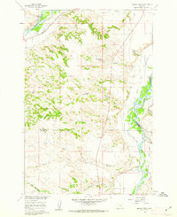
 1960 Hope Ranch1962 Print · USGSBig Sky ranching country comes into focus in this mid-century survey of the Treasure County high plains. Researchers can locate family landmarks like Hope Ranch and Anderson Ranch or trace the drainage paths of Thunder Creek and Hutchinson Creek.2 unique versions available
 - 1960 Map of Mc Konkey Creek, 1985 Print
 1960 Mc Konkey Creek1985 Print · USGSThe high plains of Treasure and Rosebud counties are captured here in the early sixties, showing a landscape defined by ranchland drainage and wide-open topography. Researchers can trace the winding paths of Willow Creek and Mc Konkey Creek or locate isolated markers like the early drill hole.
End of results
Showing maps 1-14 of 14
Top cities of Treasure County
Frequently asked questions
- What are the different types of historical maps available for Treasure County?
- What is the oldest map of Treasure County?
- Where can I purchase historical maps of Treasure County for my home or office?
- Where can I download high-res historical maps of Treasure County?
- Are there historical topographic maps available for Treasure County?
- Is there historical aerial imagery available for Treasure County?
- Where are historical maps of Treasure County sourced from?