Old Maps of Treasure County, Montana for Hiking & Exploration
Hike through history with 197 historic maps of Treasure County. Explore old trails, ghost towns, and forgotten backroads — perfect for outdoor adventurers and local explorers.
- Rediscover forgotten places: Map out old mining camps, roads, and footpaths that no longer exist on modern maps.
- Layer with modern tools: Combine with LiDAR or satellite views to plan hikes through historical terrain.
- Made for exploration: Popular among hikers, overlanders, and local history lovers.
Use these maps to find adventure and explore the hidden past of Treasure County.
Treasure County, MT maps
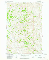
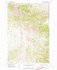
(197)- 1954 Map of Hardin, 1964 Print
 1954 Hardin1964 Print · USGSSoutheastern Montana is documented here during the mid-fifties, showing the vast tribal lands and historic battle sites before modern highway expansion. Researchers can trace the Chicago Burlington and Quincy rail line through Hardin or locate the Custer National Cemetery and Museum.2 unique versions available
 - 1954 Map of Forsyth, 1966 Print
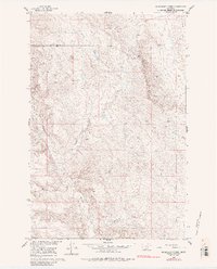
 1954 Forsyth1966 Print · USGSThe Yellowstone River valley and the northern high plains are captured here in the mid-1950s during a period of expanding energy and rail infrastructure. Genealogists and historians can trace rail sidings and cattle-country outposts like Ingomar, Vananda, and Angela.3 unique versions available
 - 1957 Map of Hardin
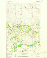
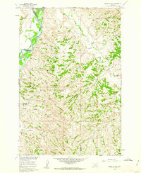
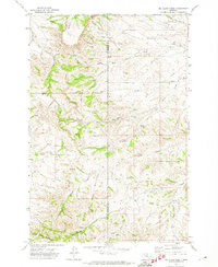
 1957 Hardin1957 Print · USGSSoutheastern Montana in the mid-fifties reveals a landscape shaped by tribal lands and the historic Bighorn river valleys. Researchers can trace the Chicago Burlington and Quincy RR through Hardin and locate the National Cemetery and Custer Battlefield Monument.
 - 1957 Map of Forsyth
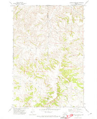
 1957 Forsyth1957 Print · USGSSouth-central Montana in the late fifties is captured here through its dual-river geography and emergent energy economy. Researchers can trace the path of the Northern Pacific through Forsyth, locate the Ragged Point Oil Field, and find early sidings like Ahles Siding.
 - 1958 Map of Forsyth
 1958 Forsyth1958 Print · USGSMid-century Montana comes alive along the Yellowstone River and the competing transcontinental rail lines. Local historians can trace the legacy of the Northern Pacific through Forsyth or explore early oil developments at the Ragged Point Oil Field.
 - 1958 Map of Hardin
 1958 Hardin1958 Print · USGSSoutheastern Montana in the mid-fifties presents a landscape defined by significant tribal lands and national monuments. Researchers can trace the geography of the Little Bighorn at Custer Battlefield National Monument and locate settlements like Lame Deer and Birney.
 - 1960 Map of Bighorn, 1962 Print
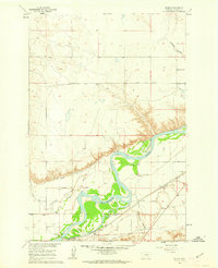
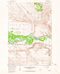
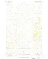
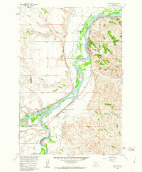 1960 Bighorn1962 Print · USGSThe confluence of the Yellowstone and Bighorn rivers in the early 1960s shows a landscape of vital irrigation ditches and rail lines. Researchers can trace the legacy of Pease Bottom through the Ft Pease (Site) and the tracks of the Northern Pacific railroad.5 unique versions available
 - 1960 Map of Hysham, 1962 Print
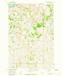
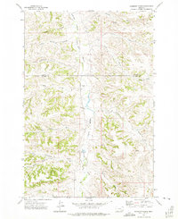
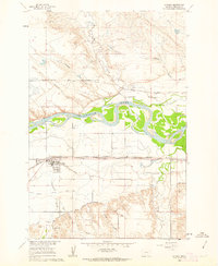 1960 Hysham1962 Print · USGSHysham and the surrounding Treasure County plains are documented here at the start of the 1960s, showing a landscape defined by river-driven irrigation. Local researchers can trace the Northern Pacific rail line and discover early landmarks like Memorial Vale Cem and Johnston.2 unique versions available
 - 1960 Map of Steie Ranch, 1962 Print
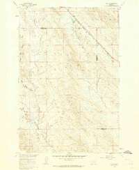
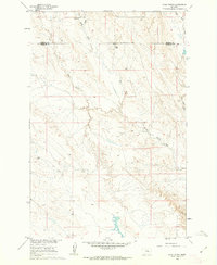 1960 Steie Ranch1962 Print · USGSBig sky ranching country along the Treasure and Rosebud county line is captured here just as the Missouri River Basin development program was underway. Researchers can locate the Steie Ranch and trace the drainage patterns of Froze to Death Creek and Geyser Spring Coulee.
 - 1960 Map of Vananda, 1962 Print
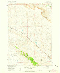 1960 Vananda1962 Print · USGSRailroad operations and ranching life intersect in the high plains of Rosebud and Treasure Counties at the dawn of the sixties. Genealogists and rail historians can trace the Milwaukee Road through Vananda and identify old Prospects along Cedar Ridge.2 unique versions available
 - 1960 Map of Custer, 1962 Print
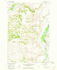
 1960 Custer1962 Print · USGSThe Yellowstone River valley at the turn of the 1960s reveals a landscape of railroad engineering and irrigation efforts. Researchers can trace the path of the Northern Pacific, locate the Bighorn Tunnel, and explore the drainage network of Fivemile Hill.3 unique versions available
 - 1960 Map of Ahles, 1962 Print
 1960 Ahles1962 Print · USGSThe eastern Montana plains come into focus in the early sixties as the railroad era shapes the landscape. Trace the local geography along the Chicago Milwaukee St Paul and Pacific line near Ahles and the curiously named Starved to Death Creek.2 unique versions available
 - 1960 Map of Myers, 1962 Print
 1960 Myers1962 Print · USGSThe Yellowstone River valley of Treasure County comes alive in the early sixties, showing a landscape defined by irrigation and the railroad. Genealogists and local historians can locate the Rancher Ch and Rancher Sch, or trace the tracks of the Northern Pacific through Myers.2 unique versions available
 - 1960 Map of Rancher Cemetery, 1962 Print
 1960 Rancher Cemetery1962 Print · USGSTreasure County ranching country is captured here during the early sixties, showing the vast open spaces along the Yellowstone River valley. Genealogists and historians can locate Rancher Cemetery and trace the drainage patterns of Muggins Creek and Alkali Creek.2 unique versions available
 - 1960 Map of Marsh Coulee, 1962 Print
 1960 Marsh Coulee1962 Print · USGSThe Yellowstone River valley and the high ranch lands of Treasure and Big Horn counties are captured here in the early sixties. Genealogists and historians can trace local landmarks like Tullock Creek Sch, the Big Ox Bottom, and the Fountain of Youth.2 unique versions available
 - 1960 Map of Sanders, 1962 Print
 1960 Sanders1962 Print · USGSTreasure County during the early 1960s shows a landscape shaped by the river and the rail. Researchers can trace the path of the Northern Pacific through Sanders and explore local drainage like Six Mile to Death Creek.2 unique versions available
 - 1960 Map of Mission Creek, 1962 Print
 1960 Mission Creek1962 Print · USGSThe Yellowstone and Bighorn rivers met in 1960 at a critical junction of rail and ranching. Genealogists and local historians can trace the irrigation networks of the Waco Custer Canal or find family landmarks like Steele Ranch and Wolfe Ranch.3 unique versions available
 - 1960 Map of Eldering Ranch, 1962 Print
 1960 Eldering Ranch1962 Print · USGSThe Yellowstone River valley meets the Montana high plains in the early sixties, showing a landscape defined by ranching and rail. Genealogists and historians can locate the Eldering Ranch and trace the Northern Pacific railroad near Alkali Creek.3 unique versions available
 - 1960 Map of Hope Ranch, 1962 Print
 1960 Hope Ranch1962 Print · USGSBig Sky ranching country comes into focus in this mid-century survey of the Treasure County high plains. Researchers can locate family landmarks like Hope Ranch and Anderson Ranch or trace the drainage paths of Thunder Creek and Hutchinson Creek.2 unique versions available
 - 1960 Map of Mc Konkey Creek, 1985 Print
 1960 Mc Konkey Creek1985 Print · USGSThe high plains of Treasure and Rosebud counties are captured here in the early sixties, showing a landscape defined by ranchland drainage and wide-open topography. Researchers can trace the winding paths of Willow Creek and Mc Konkey Creek or locate isolated markers like the early drill hole.
 - 1971 Map of Mc Clure Creek, 1974 Print
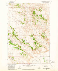
 1971 Mc Clure Creek1974 Print · USGSSouth-central Montana in the early seventies reveals a rugged high-country landscape near the Treasure and Rosebud County line. Trace the remote network of a Landing Strip and Jeep Trails winding through the Little Wolf Mountains and Robbie Creek.2 unique versions available
 - 1971 Map of Griffin Coulee SW, 1974 Print
 1971 Griffin Coulee SW1974 Print · USGSThe border of Treasure and Rosebud Counties comes into focus during the early 1970s, showing a landscape defined by ranching and resource exploration. Researchers can trace the paths of Beaver Creek, locate an early Drill Hole, and follow the West North Fork Trail Creek.
 - 1971 Map of Sarpy School, 1974 Print
 1971 Sarpy School1974 Print · USGSBig Horn and Rosebud Counties meet in this Montana cattle country during the early seventies, where the Little Wolf Mountains rise above the plains. Researchers can locate the Sarpy School and trace the paths of Black Hank Creek and East Fork Sarpy Creek.
 - 1971 Map of Griffin Coulee NW, 1975 Print
 1971 Griffin Coulee NW1975 Print · USGSThe ranchlands of eastern Montana are captured here in the early seventies as the Rosebud and Treasure county lines meet. Trace remote water sources and cattle-country landmarks like Dog Prairie, Reservation Creek, and Cache Coulee.
 - 1972 Map of Hammond Ranch, 1975 Print
 1972 Hammond Ranch1975 Print · USGSBig Horn and Treasure counties in the early 1970s showcase a landscape of isolated Montana ranching and intricate prairie drainages. Genealogists and local historians can trace family land holdings near Hammond Ranch, Redding Ranch, and the perennial waters of Tullock Creek.
Showing maps 1-25 of 197
Top cities of Treasure County
Frequently asked questions
- What are the different types of historical maps available for Treasure County?
- What is the oldest map of Treasure County?
- Where can I purchase historical maps of Treasure County for my home or office?
- Where can I download high-res historical maps of Treasure County?
- Are there historical topographic maps available for Treasure County?
- Is there historical aerial imagery available for Treasure County?
- Where are historical maps of Treasure County sourced from?