1980s Maps of Treasure County, Montana
Explore 6 historic maps of Treasure County from the 1980s. These maps offer a rare glimpse into what life looked like during the 1980s — showing old roads, neighborhoods, homes, and landmarks that have changed or disappeared over time.
Whether you're researching your family's past, planning a metal detecting trip, or studying how Treasure County's landscape evolved across the 1980s, these high-resolution maps are a powerful tool for exploring the history of this region.
- Focus on a specific era: All maps on this page are from the 1980s, giving you a focused view of this time period.
- See what’s changed: Compare century-old streets, trails, and buildings to today's modern landscape using overlays and satellite layers.
- Research with precision: Use these maps for genealogy, historical research, land use analysis, or educational projects.
- View, download, or print: Maps are fully viewable online in high resolution, and can be downloaded or printed for your own records.
Start exploring Treasure County's history through authentic maps from the 1980s. This is your window into the past.
Treasure County, MT maps
(6)- 1980 Map of Lame Deer
 1980 Lame Deer1980 Print · USGSHigh plains ranching and coal mining define this corner of Montana as the eighties began. Researchers can trace the rail lines of the Burlington Northern and locate sites like Colstrip, Jimtown, and the Big Sky Strip Mine.
 - 1980 Map of Weed Creek East
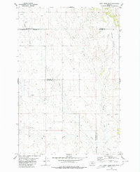 1980 Weed Creek East1980 Print · USGSBig Sky country at the intersection of Treasure, Rosebud, and Yellowstone counties shows a landscape of ranching and early energy exploration. Trace the terrain from Muggins Taylor Flat to the drainage at Weed Creek and find remote Landing Strips.
 - 1980 Map of Ruskosky Ridge
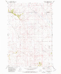 1980 Ruskosky Ridge1980 Print · USGSTreasure and Rosebud counties appear here in the early 1970s, showing a remote landscape of high plateaus and ranching infrastructure. Researchers can trace the drainage of Ruskosky Ridge through named landmarks like Bone Coulee and Taylor Flat.
 - 1980 Map of Mexican Buttes
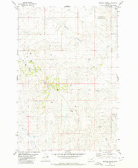 1980 Mexican Buttes1980 Print · USGSThe high plains of the Yellowstone and Treasure County border are captured here in the late seventies, showing a landscape defined by ranching and resource exploration. Trace old routes via the JEEP TRAIL or locate family landmarks like Mexican Buttes and Bender Hill.
 - 1981 Map of Hardin
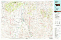 1981 Hardin1981 Print · USGSBig Horn County at the start of the eighties shows a landscape shaped by the Bighorn River and deep historical ties. Researchers can trace the grounds of Custer Battlefield National Monument or find small rail points like Toluca and Crow Agency.
 - 1983 Map of Forsyth
 1983 Forsyth1983 Print · USGSEastern Montana's high plains and river valleys come into focus in the early eighties as the rail-and-ranching economy centered on the Yellowstone River. Researchers can trace the development of small rail towns like Hysham, Angela, and Ingomar alongside the Burlington Northern line.
End of results
Showing maps 1-6 of 6
Top cities of Treasure County
Frequently asked questions
- What are the different types of historical maps available for Treasure County?
- What is the oldest map of Treasure County?
- Where can I purchase historical maps of Treasure County for my home or office?
- Where can I download high-res historical maps of Treasure County?
- Are there historical topographic maps available for Treasure County?
- Is there historical aerial imagery available for Treasure County?
- Where are historical maps of Treasure County sourced from?