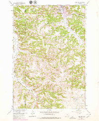
1980 Map of Lame Deer
USGS Topo · Published 1980About this map
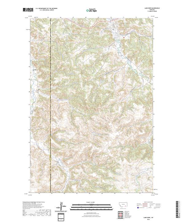
The Northern Cheyenne Indian Reservation and the industrial landscape of the Big Sky Strip Mine anchor this 1980 survey of southeastern Montana. The map illustrates a unique juxtaposition of federal lands, tribal sovereignty, and heavy industry during a period of coal expansion. Large-scale surface operations like the Lame Deer Strip Mine and the Coal Cr Mine are visible alongside the established community of Colstrip, while the southeastern portion of the map is defined by the wooded expanse of the Custer National Forest.
Find a feature on this map
42 named features on this map. Tap any name to fly to it.
Don’t see what you’re looking for? This feature index may not catch every label — zoom into the map to look around manually.
Map Details
Editions of this 1980 Lame Deer Map
This is the sole edition of this map. No revisions or reprints were ever made.
Historical Maps of Colstrip Through Time
7 maps found