Old Maps of Yellowstone County, Montana for Hiking & Exploration
Hike through history with 472 historic maps of Yellowstone County. Explore old trails, ghost towns, and forgotten backroads — perfect for outdoor adventurers and local explorers.
- Rediscover forgotten places: Map out old mining camps, roads, and footpaths that no longer exist on modern maps.
- Layer with modern tools: Combine with LiDAR or satellite views to plan hikes through historical terrain.
- Made for exploration: Popular among hikers, overlanders, and local history lovers.
Use these maps to find adventure and explore the hidden past of Yellowstone County.
Yellowstone County, MT maps
(472)- 1893 Map of Huntley
 1893 Huntley1893 Print · USGSThe Yellowstone River valley and the Crow Indian Reservation dominate this late nineteenth-century Montana landscape. Genealogists and researchers can trace the early rail corridor of the Northern Pacific Railroad through Huntley and the station at Clermont.6 unique versions available
 - 1894 Map of Fort Custer
 1894 Fort Custer1894 Print · USGSBig Horn County was still a frontier landscape in the 1890s, defined by the meeting of the Big Horn River and Little Big Horn R. You can trace the early railroad at Pompey Pillar Sta. and the grounds of the Fort Custer Military Reservation.4 unique versions available
 - 1954 Map of Billings, 1963 Print
 1954 Billings1963 Print · USGSThe Yellowstone valley during the mid-fifties shows a landscape of thriving rail towns and high-mountain outposts. Genealogists and historians can trace old homesteads and mining routes near Red Lodge, Bearcreek, and along the Bighorn River.4 unique versions available
 - 1954 Map of Hardin, 1964 Print
 1954 Hardin1964 Print · USGSSoutheastern Montana is documented here during the mid-fifties, showing the vast tribal lands and historic battle sites before modern highway expansion. Researchers can trace the Chicago Burlington and Quincy rail line through Hardin or locate the Custer National Cemetery and Museum.2 unique versions available
 - 1954 Map of Forsyth, 1966 Print
 1954 Forsyth1966 Print · USGSThe Yellowstone River valley and the northern high plains are captured here in the mid-1950s during a period of expanding energy and rail infrastructure. Genealogists and historians can trace rail sidings and cattle-country outposts like Ingomar, Vananda, and Angela.3 unique versions available
 - 1954 Map of Roundup, 1966 Print
 1954 Roundup1966 Print · USGSCentral Montana in the mid-1960s showcases a landscape of high-plains agriculture and vital rail connections. Researchers can trace historic routes through Harlowton and Roundup while locating landmarks like Judith Cemetery and Deadmans Basin Reservoir.2 unique versions available
 - 1956 Map of Comanche, 1957 Print
 1956 Comanche1957 Print · USGSYellowstone County ranching life is well-documented in the mid-1950s as the Great Northern railroad passes through Comanche. Genealogists and historians can trace the locations of the Popelka Ranch, Schroder Ranch, and the Pleasant Valley Sch.2 unique versions available
 - 1956 Map of Rattlesnake Butte, 1957 Print
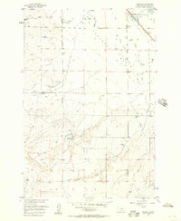
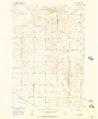
 1956 Rattlesnake Butte1957 Print · USGSYellowstone County's high plains in the mid-1950s reveal a landscape of irrigation canals and early rural infrastructure. Researchers can trace family-named routes like Drury Lane and locate vanished local landmarks such as the Progressive Sch and the Racetrack near Cline.2 unique versions available
 - 1956 Map of Acton, 1957 Print
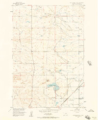
 1956 Acton1957 Print · USGSYellowstone County ranching and rail life are frozen in time during the mid-fifties, dominated by the Great Northern line. Researchers can locate the rural Coakley Ch, Fairview Sch, and the isolated community of Acton.2 unique versions available
 - 1956 Map of Molt, 1957 Print
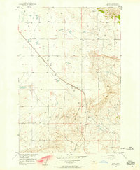
 1956 Molt1957 Print · USGSStillwater County ranching and rail life are documented here in the mid-1950s as the high plains meet the canyon breaks. Genealogists can locate the Luckey Homestead and Lazy K T Ranch or trace the Northern Pacific line through Molt.2 unique versions available
 - 1956 Map of Hickson Ranch, 1957 Print
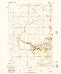
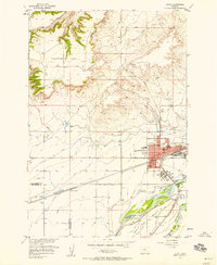
 1956 Hickson Ranch1957 Print · USGSYellowstone County ranching country is documented here in the mid-fifties during the Missouri River Basin development program. Researchers can locate family landmarks like Hickson Ranch and Mackey Ranch or trace Fivemile Creek.2 unique versions available
 - 1956 Map of Rock Spring, 1957 Print
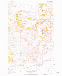
 1956 Rock Spring1957 Print · USGSThe Stillwater and Yellowstone county line area is shown here in the mid-fifties as a landscape of remote ranching and early aviation. You can trace the path of the Northern Pacific railroad past the Melby Hangar and locate the namesake Rock Spring.2 unique versions available
 - 1956 Map of Rimrock, 1958 Print
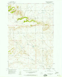
 1956 Rimrock1958 Print · USGSYellowstone County's high plains and river valley are seen here in the mid-fifties as irrigation and industry reshaped the frontier. Genealogists and researchers can trace local landmarks like Base Line Sch, the Great Northern rail line, and the rural settlement of Rimrock.3 unique versions available
 - 1956 Map of Silesia, 1958 Print
 1956 Silesia1958 Print · USGSSilesia and Rockvale served as vital hubs for the valley's irrigation and rail networks during the mid-fifties. Genealogists and historians can trace old homestead sites near White Horse Sch or locate the junction of the Northern Pacific and Chicago Burlington and Quincy railroads.
 - 1956 Map of Huntley, 1958 Print
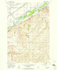
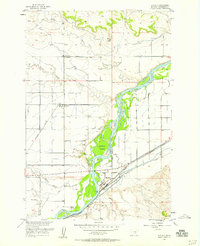 1956 Huntley1958 Print · USGSYellowstone County's river-and-rail corridor is captured here in the mid-fifties, showing the vital irrigation and transport systems near the Huntley junction. Genealogists and historians can locate the Scandia Sch, New Apostolic Ch, and family-named sites like Vermilion Ranch.3 unique versions available
 - 1956 Map of Two Pine School, 1958 Print
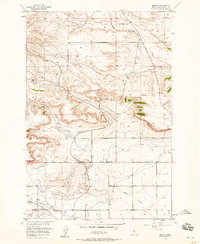
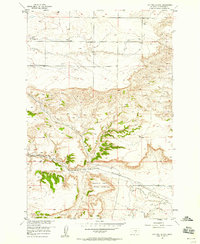 1956 Two Pine School1958 Print · USGSYellowstone County's rugged rimrocks and prairie plateaus are captured here in the mid-fifties, showing a landscape shaped by both nature and early industry. Trace the Northern Pacific rail line and look for local landmarks like the Two Pine School and the uniquely named Calamity Jane Horse Cache.2 unique versions available
 - 1956 Map of Laurel, 1958 Print
 1956 Laurel1958 Print · USGSThe Yellowstone River valley is captured here in the mid-fifties, showing the intersection of heavy industry and historic trails. Researchers can trace the massive Oil Refinery, the Northern Pacific line, and landmarks like St Anthonys Ch or the Buffalo Trail.2 unique versions available
 - 1956 Map of Park City, 1958 Print
 1956 Park City1958 Print · USGSPark City and the surrounding ranchlands are documented here in the mid-fifties, capturing the community as it functioned along the Northern Pacific line. Researchers can trace the local irrigation network via the Big Ditch or locate family sites near Pioneer Cem and the Historical Marker.2 unique versions available
 - 1956 Map of Yegen, 1958 Print
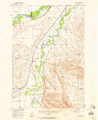
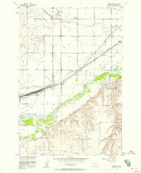
 1956 Yegen1958 Print · USGSThe Yellowstone River valley is captured here in the mid-fifties, showing a landscape defined by railroad expansion and complex irrigation systems. You can trace the rural roots of the region through landmarks like the Ross Spring Homestead, Holy Cross Cem, and the Montana Bible Institute.4 unique versions available
 - 1956 Map of Billings East, 1958 Print
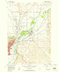 1956 Billings East1958 Print · USGSThe Billings area at the midpoint of the century reveals a landscape shaped by the Yellowstone River and early industry. Genealogists and local historians can trace school districts like Independent Dist 52 Sch or visit Boothill Cem.5 unique versions available
 - 1956 Map of Mossmain, 1958 Print
 1956 Mossmain1958 Print · USGSThe Yellowstone Valley in the mid-1950s was a bustling hub of rail transport and irrigated agriculture. Researchers can trace the massive rail infrastructure at Mossmain and Laurel Stockyards, or locate rural landmarks like Elder Grove School and Canyon Creek.3 unique versions available
 - 1957 Map of Hardin
 1957 Hardin1957 Print · USGSSoutheastern Montana in the mid-fifties reveals a landscape shaped by tribal lands and the historic Bighorn river valleys. Researchers can trace the Chicago Burlington and Quincy RR through Hardin and locate the National Cemetery and Custer Battlefield Monument.
 - 1957 Map of Forsyth
 1957 Forsyth1957 Print · USGSSouth-central Montana in the late fifties is captured here through its dual-river geography and emergent energy economy. Researchers can trace the path of the Northern Pacific through Forsyth, locate the Ragged Point Oil Field, and find early sidings like Ahles Siding.
 - 1957 Map of Billings
 1957 Billings1957 Print · USGSThe Yellowstone River valley and the rugged Beartooth Mountains meet in the mid-1950s near the growing hub of Billings. Genealogists and researchers can trace rail and ranching history through river towns like Columbus, the mining heritage of Red Lodge, and the vast Crow Indian Reservation.
 - 1957 Map of Billings West, 1958 Print
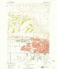 1957 Billings West1958 Print · USGSThe Yellowstone River valley and the towering Rimrocks define this Montana community during a period of rapid mid-century expansion. Researchers can trace the development of local institutions from Rocky Mountain College to the Naval Reserve Armory and the historic Mountview Cem.3 unique versions available
Showing maps 1-25 of 472
Top cities of Yellowstone County
Frequently asked questions
- What are the different types of historical maps available for Yellowstone County?
- What is the oldest map of Yellowstone County?
- Where can I purchase historical maps of Yellowstone County for my home or office?
- Where can I download high-res historical maps of Yellowstone County?
- Are there historical topographic maps available for Yellowstone County?
- Is there historical aerial imagery available for Yellowstone County?
- Where are historical maps of Yellowstone County sourced from?