1960s Maps of Yellowstone County, Montana
Explore 32 historic maps of Yellowstone County from the 1960s. These maps offer a rare glimpse into what life looked like during the 1960s — showing old roads, neighborhoods, homes, and landmarks that have changed or disappeared over time.
Whether you're researching your family's past, planning a metal detecting trip, or studying how Yellowstone County's landscape evolved across the 1960s, these high-resolution maps are a powerful tool for exploring the history of this region.
- Focus on a specific era: All maps on this page are from the 1960s, giving you a focused view of this time period.
- See what’s changed: Compare century-old streets, trails, and buildings to today's modern landscape using overlays and satellite layers.
- Research with precision: Use these maps for genealogy, historical research, land use analysis, or educational projects.
- View, download, or print: Maps are fully viewable online in high resolution, and can be downloaded or printed for your own records.
Start exploring Yellowstone County's history through authentic maps from the 1960s. This is your window into the past.
Yellowstone County, MT maps
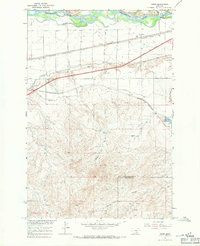
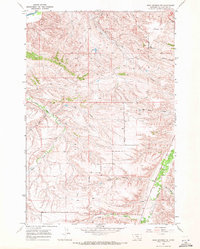
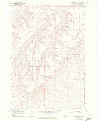
(32)- 1960 Map of Bighorn, 1962 Print
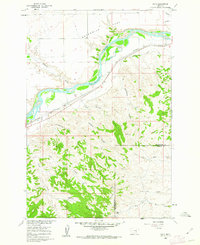
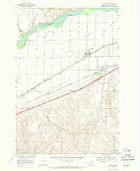
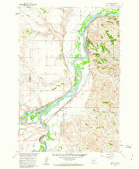 1960 Bighorn1962 Print · USGSThe confluence of the Yellowstone and Bighorn rivers in the early 1960s shows a landscape of vital irrigation ditches and rail lines. Researchers can trace the legacy of Pease Bottom through the Ft Pease (Site) and the tracks of the Northern Pacific railroad.5 unique versions available
 - 1960 Map of Coal Bank Creek, 1962 Print
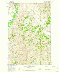
 1960 Coal Bank Creek1962 Print · USGSYellowstone County's high plains landscape is captured in the early sixties as part of the Missouri River Basin development. Researchers can trace the drainage patterns of Coal Bank Creek and the broad expanse of Sevenmile Flat across this ranching-era terrain.2 unique versions available
 - 1960 Map of Custer, 1962 Print
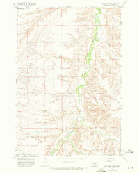
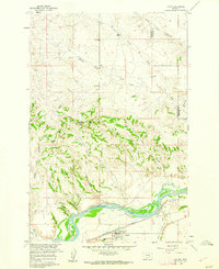 1960 Custer1962 Print · USGSThe Yellowstone River valley at the turn of the 1960s reveals a landscape of railroad engineering and irrigation efforts. Researchers can trace the path of the Northern Pacific, locate the Bighorn Tunnel, and explore the drainage network of Fivemile Hill.3 unique versions available
 - 1960 Map of Marsh Coulee, 1962 Print
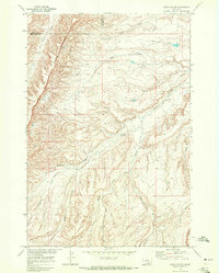
 1960 Marsh Coulee1962 Print · USGSThe Yellowstone River valley and the high ranch lands of Treasure and Big Horn counties are captured here in the early sixties. Genealogists and historians can trace local landmarks like Tullock Creek Sch, the Big Ox Bottom, and the Fountain of Youth.2 unique versions available
 - 1960 Map of Lemon Ranch, 1962 Print
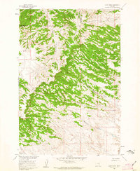 1960 Lemon Ranch1962 Print · USGSThe Big Horn County ranchlands are documented here in the early sixties, showing a landscape defined by timbered ridges and deep coulees. Researchers can trace remote routes like the Sorrel Horse Trail and find the namesake Lemon Ranch.2 unique versions available
 - 1960 Map of Waco, 1962 Print
 1960 Waco1962 Print · USGSThe Yellowstone river valley in the early sixties was a landscape of rail-fed ranching and rugged coulees. Researchers can trace the path of the Northern Pacific through Waco or locate family landmarks like the Kemph Ranch and Bergum Coulee.2 unique versions available
 - 1960 Map of Mission Creek, 1962 Print
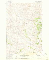
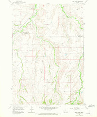
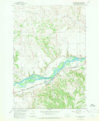
 1960 Mission Creek1962 Print · USGSThe Yellowstone and Bighorn rivers met in 1960 at a critical junction of rail and ranching. Genealogists and local historians can trace the irrigation networks of the Waco Custer Canal or find family landmarks like Steele Ranch and Wolfe Ranch.3 unique versions available
 - 1967 Map of Wagon Box Spring, 1971 Print
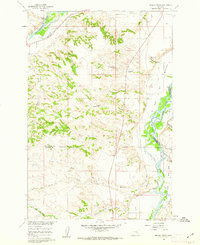
 1967 Wagon Box Spring1971 Print · USGSThe high country along the Big Horn and Yellowstone county line is captured in the late sixties as the Missouri River Basin project advanced. Researchers can trace land use through named landmarks like Wagon Box Spring, the heights of Pine Timber Ridge, and isolated Drill Hole locations.
 - 1967 Map of Nibbe, 1971 Print
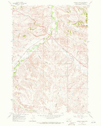
 1967 Nibbe1971 Print · USGSThe Yellowstone River valley is captured here in the late sixties, showing the vital intersection of pioneer history and mid-century irrigation. Trace the Lewis and Clark Trail alongside the rail lines at Nibbe and the landmark Pompeys Pillar.2 unique versions available
 - 1967 Map of Deep Creek, 1971 Print
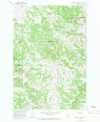
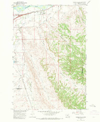
 1967 Deep Creek1971 Print · USGSBig Horn and Yellowstone counties meet in this 1960s survey of the Crow Indian Reservation before modern development. Genealogists can locate a remote Cem and trace name-bearing drainages like Smallpox Creek and Fourth of July Creek.3 unique versions available
 - 1967 Map of Big Marys Island, 1971 Print
 1967 Big Marys Island1971 Print · USGSYellowstone County in the late 1960s was defined by its relationship with the river and the rail. Trace the historic route of the Northern Pacific and the Huntley Trail, or explore the complex irrigation of the Pacific Clark and Lewis Main Canal.2 unique versions available
 - 1967 Map of Pryor, 1971 Print
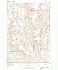
 1967 Pryor1971 Print · USGSBig Horn County and the Crow Indian Reservation come into focus during the late sixties, centered on the settlement of Pryor. Researchers can trace tribal history and family lineages through sites like the St Charles Mission Sch, Big Day Cem, and the Chief Plenty Coups Memorial State Park.2 unique versions available
 - 1967 Map of Worden, 1971 Print
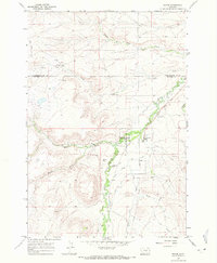
 1967 Worden1971 Print · USGSYellowstone County settlements thrive along the river valley in the late sixties, anchored by the rail corridor. Researchers can trace the Lewis and Clark Trail past Worden, Ballantine, and the Main Canal irrigation works.2 unique versions available
 - 1967 Map of Bull Mountain, 1971 Print
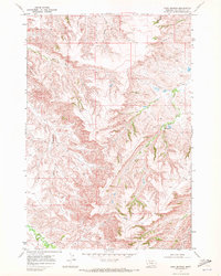
 1967 Bull Mountain1971 Print · USGSYellowstone County in the late sixties reveals a landscape shaped by the river and the rails. Genealogists and historians can trace the Northern Pacific line through Bull Mountain or locate the Waco Canal and Randalls Island.3 unique versions available
 - 1967 Map of Pompeys Pillar, 1971 Print
 1967 Pompeys Pillar1971 Print · USGSThe Yellowstone River valley is captured here in the late sixties, showcasing the intersection of historic trails and modern irrigation. Trace the path of the Lewis and Clark Trail past Pompeys Pillar and explore the branching networks of the Huntley Main Canal.2 unique versions available
 - 1967 Map of Mossmain SW, 1971 Print
 1967 Mossmain SW1971 Print · USGSSouth-central Montana in the late sixties reveals an active landscape of energy extraction along the county line. Researchers can trace the extent of the Mosser Dome Oil Field and follow the northern edge of the Crow Indian Res Bdy.
 - 1967 Map of Soda Springs NW, 1971 Print
 1967 Soda Springs NW1971 Print · USGSYellowstone County and the reservation boundary are captured in the late sixties as ranching roads and water drainages defined the rural life of the area. Researchers can find landmarks like Morin Sch, Indian Cave State Park, and the Billings Racetrack.3 unique versions available
 - 1967 Map of Pryor NW, 1971 Print
 1967 Pryor NW1971 Print · USGSCarbon County ranchlands meet the reservation line in the late sixties, showing a landscape defined by water and territory. Researchers can trace the path of the Crow Indian Reservation Boundary and drainage patterns of Wolf Creek and Willow Creek.
 - 1967 Map of Soda Springs, 1972 Print
 1967 Soda Springs1972 Print · USGSThe Crow Indian Reservation in the late 1960s is a landscape of complex drainage and remote springs. Genealogists and researchers can trace the course of East Fork Pryor Creek, locate the namesake Soda Springs, and follow the path of an early PIPELINE.
 - 1967 Map of Cottonwood Creek, 1972 Print
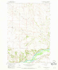
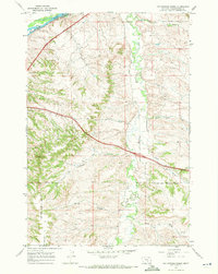 1967 Cottonwood Creek1972 Print · USGSYellowstone County in the late sixties shows the intersection of modern transit and traditional reservation lands. Genealogists and historians can trace the Crow Indian Reservation Boundary alongside the Burlington Northern rail and early Interstate 90.2 unique versions available
 - 1967 Map of Chilkoot Coulee, 1972 Print
 1967 Chilkoot Coulee1972 Print · USGSBig Horn County, Montana, was documented in the late 1960s as a land of open ranching and high ridges within the Crow Indian Reservation. Researchers can locate remote landmarks like the Schenk Ranch, a small Landing Strip, and the prominent Wild Horse Ridge.2 unique versions available
 - 1967 Map of Badbaby Coulee, 1972 Print
 1967 Badbaby Coulee1972 Print · USGSYellowstone County, Montana, was characterized by its deep coulees and open range in the late 1960s. Genealogists and local historians can trace family-named landmarks and water sources like Badbaby Coulee, Sue Jane Coulee, and Smitty Coulee.2 unique versions available
 - 1967 Map of Stratford Hill, 1972 Print
 1967 Stratford Hill1972 Print · USGSYellowstone County ranching country is documented here in the late sixties, just south of the Yellowstone River. Trace the Crow Indian Reservation Boundary and explore family-named landmarks like Stratford Hill and Wyman Creek.
 - 1967 Map of Vale Creek Ranch, 1972 Print
 1967 Vale Creek Ranch1972 Print · USGSYellowstone County ranchlands are documented here in the late sixties as they transition into the Crow Indian Reservation. Researchers can trace the layout of Vale Creek Ranch and locate remote water sources like Hamilton Spring and Monument Creek.
 - 1968 Map of Bear Coulee, 1972 Print
 1968 Bear Coulee1972 Print · USGSThe Montana plains within the Crow Indian Reservation are captured here in the late sixties, showing a landscape defined by seasonal water and high ridges. Researchers can trace the drainage of Wild Horse Ridge and follow names like Beauvais Creek and Bear Coulee.2 unique versions available
Showing maps 1-25 of 32
Top cities of Yellowstone County
Frequently asked questions
- What are the different types of historical maps available for Yellowstone County?
- What is the oldest map of Yellowstone County?
- Where can I purchase historical maps of Yellowstone County for my home or office?
- Where can I download high-res historical maps of Yellowstone County?
- Are there historical topographic maps available for Yellowstone County?
- Is there historical aerial imagery available for Yellowstone County?
- Where are historical maps of Yellowstone County sourced from?