
1960 Map of Coal Bank Creek
USGS Topo · Published 1962About this map
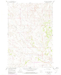
The Missouri River Basin development program shaped the surveying of this Montana landscape, where the seasonal drainage patterns of Yellowstone County are meticulously documented. The terrain is defined by a network of coulees and creeks that carve through the high plains, most notably where Coal Bank Creek and East Buffalo Creek converge toward the north. The topographical data reveals a transition from these winding watercourses to the broad, level expanse of Sevenmile Flat in the southern portion of the quadrangle.
Find a feature on this map
8 named features on this map. Tap any name to fly to it.
Don’t see what you’re looking for? This feature index may not catch every label — zoom into the map to look around manually.
Map Details
Editions of this 1960 Coal Bank Creek Map
2 editions found
Other maps of this area

1954 · Forsyth
USGS Topo · 1:250,000

1957 · Forsyth
USGS Topo · 1:250,000

1958 · Forsyth
USGS Topo · 1:250,000

1960 · Custer
USGS Topo · 1:24,000

1960 · Waco
USGS Topo · 1:24,000
1960 · Mission Creek
USGS Topo · 1:24,000
1967 · Bull Mountain
USGS Topo · 1:24,000

1979 · Hysham
USGS Topo · 1:100,000
1979 · Devils Kitchen
USGS Topo · 1:24,000

1980 · Mud Butte
USGS Topo · 1:24,000