
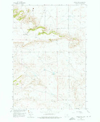
1956 Map of Hickson Ranch
USGS Topo · Published 1957About this map
Hickson Ranch and Mackey Ranch anchor this mid-century survey of the Yellowstone County landscape, conducted as part of a development program for the Missouri River Basin. The topography is defined by the winding course of Burnt Coulee and the broader valley of Fivemile Creek to the south. These seasonal watercourses dictate the placement of ranching operations and primitive infrastructure like Alexander Road. Several survey markers, including Wheat, Yucca, and GLO No 6, provide precise elevation data for researchers and surveyors. The map illustrates a sparse, working landscape where geography and land use are inextricably linked to the availability of water, evidenced by the scattered springs and occasional spillway infrastructure used to manage the arid environment.
Find a feature on this map
11 named features on this map. Tap any name to fly to it.
Don’t see what you’re looking for? This feature index may not catch every label — zoom into the map to look around manually.
Map Details
Editions of this 1956 Hickson Ranch Map
2 editions found
Other maps of this area

1893 · Huntley
USGS Topo · 1:125,000

1954 · Billings
USGS Topo · 1:250,000

1954 · Roundup
USGS Topo · 1:250,000

1956 · Rattlesnake Butte
USGS Topo · 1:24,000

1956 · Acton
USGS Topo · 1:24,000

1956 · Rimrock
USGS Topo · 1:24,000

1956 · Billings East
USGS Topo · 1:24,000

1957 · Billings
USGS Topo · 1:250,000

1957 · Billings West
USGS Topo · 1:24,000

1958 · Billings
USGS Topo · 1:250,000