Old Maps of Boone County, Nebraska for Academic Research
Study the evolution of Boone County with 124 high-resolution historic maps. Whether you're teaching, researching, or modeling changes in land use, these maps provide essential visual documentation of urban, environmental, and geographic change.
- Analyze long-term change: Track patterns in development, transportation, and natural features.
- Ideal for environmental or urban studies: Support academic projects with primary historical map data.
- Use in the classroom or lab: Educators and researchers rely on these maps to bring historical context to life.
These maps are a powerful tool for teaching, research, and visualizing how Boone County has changed over the decades.
Boone County, NE maps
(124)- 1899 Map of St. Paul
 1899 St. Paul1899 Print · USGSCentral Nebraska's river valleys and rail hubs are preserved here during the expansion of the late 1890s. Researchers can trace the development of St. Paul and Central City alongside curious landmarks like Mumpumpey Hill and the Burlington and Missouri River R. R.4 unique versions available
 - 1954 Map of Cedar Rapids, 1956 Print
 1954 Cedar Rapids1956 Print · USGSThe Cedar River valley in the mid-fifties shows a prosperous Nebraska rail-and-river landscape shaped by the Union Pacific. Genealogists and local historians can trace family roots at St Anthony Cem or locate rural landmarks like Standard Sch and Pilot Knob.3 unique versions available
 - 1954 Map of Spalding, 1956 Print
 1954 Spalding1956 Print · USGSGreeley County and its neighbors in the mid-1950s show a landscape defined by the Union Pacific rail line and the Cedar River. Genealogists and local historians can trace a dozen numbered school sites and several family burial grounds, including Dublin Cem and Grand View Cem.3 unique versions available
 - 1954 Map of Akron, 1956 Print
 1954 Akron1956 Print · USGSBoone County, Nebraska, is seen here during the mid-fifties, when small country schoolhouses and family cemeteries still dotted the prairie between farmsteads. Genealogists can locate specific homesteads near Akron and Primrose, or trace ancestors at Dennison Cem and Pleasant Valley Sch.3 unique versions available
 - 1954 Map of Wolbach NE, 1956 Print
 1954 Wolbach NE1956 Print · USGSCentral Nebraska in the mid-1950s is captured here at the junction of five counties, where the Old Indian Reservation Boundary still defines the land. Genealogists can trace rural family life through the locations of the Cloverdale Sch, Star Sch, and Olive Sch.
 - 1954 Map of Albion West, 1956 Print
 1954 Albion West1956 Print · USGSBoone County farm life and civic development are captured here in the mid-1950s, centered on the growing town of Albion. Researchers can trace old rural school districts like School No 44 and transport landmarks such as the Packard Landing Field.2 unique versions available
 - 1954 Map of Belgrade, 1956 Print
 1954 Belgrade1956 Print · USGSThe village of Belgrade and the surrounding river valley are captured here in the mid-1950s, showing a landscape defined by rail and water. Researchers can trace rural school locations like Fairview Sch, the Main Cem, and the path of the Union Pacific railroad.
 - 1954 Map of Belgrade NW, 1956 Print
 1954 Belgrade NW1956 Print · USGSThe rural borders of Nance and Boone Counties come alive in the mid-1950s, showing a landscape defined by small farmsteads and numerous country schoolhouses. Genealogists and local historians can locate early institutions like Redwing Cem, Peace Ch, and the historical Loup Ferry crossing.
 - 1954 Map of Cedar Rapids SE, 1956 Print
 1954 Cedar Rapids SE1956 Print · USGSBoone and Nance Counties are shown here in the mid-fifties, structured by the Cedar River and the Union Pacific railroad. Genealogists can locate several local landmarks, including Pinnacle Hill Ch, Ash Hollow Sch, and the Old Indian Boundary.2 unique versions available
 - 1954 Map of Spalding SE, 1956 Print
 1954 Spalding SE1956 Print · USGSThe Nebraska prairie at the Greeley and Boone County line is captured here in the mid-1950s. Family historians can trace rural school districts like Leo Valley Sch and Dewdrop Sch or locate ancestors at Enfield Cemetery.3 unique versions available
 - 1955 Map of Broken Bow
 1955 Broken Bow1955 Print · USGSCentral Nebraska in the mid-fifties is defined by the sweeping Sand Hills and the vital river valleys that supported its ranching and rail towns. Researchers can trace the rail corridors of the Union Pacific RR and locate settlements like Dannebrog, Broken Bow, and Brewster.5 unique versions available
 - 1955 Map of Fremont, 1966 Print
 1955 Fremont1966 Print · USGSEastern Nebraska and the Missouri River border are captured during the mid-fifties, just as the interstate system began to emerge. Researchers can trace the development of Omaha, locate the sprawling Offutt Air Force Base, or study the river-bound ecology of the De Soto National Wildlife Refuge.3 unique versions available
 - 1956 Map of Broken Bow
 1956 Broken Bow1956 Print · USGSCentral Nebraska during the mid-fifties reveals a region defined by its river-valley railroads and the rolling Sand Hills. Genealogists and local historians can trace the paths of the Chicago Burlington and Quincy through towns like Broken Bow, Merna, and Anselmo.
 - 1957 Map of Fremont
 1957 Fremont1957 Print · USGSEastern Nebraska and western Iowa thrive along the Platte and Missouri rivers during the mid-fifties. Genealogists can locate small rural schools like Fairview School and tracing the paths of the Union Pacific through towns like Albion and Humphrey.
 - 1958 Map of Fremont
 1958 Fremont1958 Print · USGSEastern Nebraska in the late fifties is captured here as a thriving corridor of river-valley commerce and rail transport. Researchers can trace the development of Omaha and Fremont or locate local landmarks like Midland College and Offutt Air Force Base.
 - 1958 Map of St. Edward, 1960 Print
 1958 St. Edward1960 Print · USGSThe community of St. Edward thrived alongside the Union Pacific railroad in the late fifties, surrounded by a landscape of township divisions and rural schoolhouses. Researchers can trace the Old Indian Boundary and locate local landmarks like Evergreen Cem and Big Cut Sch.3 unique versions available
 - 1958 Map of Albion East, 1960 Print
 1958 Albion East1960 Print · USGSBoone County, Nebraska, is seen here during the late 1950s as a thriving rail and agricultural hub along the Beaver Creek valley. Researchers can trace family roots through the many numbered schoolhouses like School No 74 and rural burial sites such as St Michael Cem.2 unique versions available
 - 1958 Map of St. Edward SW, 1960 Print
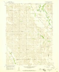 1958 St. Edward SW1960 Print · USGSThe rural plains of Boone County are captured in the late fifties, showing a landscape defined by Beaver Creek and the Union Pacific railroad. Researchers can trace numerous country schoolhouses like School No 66 and locate the historic Old Indian Boundary.3 unique versions available
 - 1960 Map of Spalding 2 NE, 1962 Print
 1960 Spalding 2 NE1962 Print · USGSThe rural borderlands of Wheeler and Antelope counties appear here as they were in the early 1960s, prior to widespread school consolidation. Genealogists can trace early landmarks like Park Ch and several district schools, such as Sunnyside Sch and School No 27.3 unique versions available
 - 1960 Map of Spalding 2 SE, 1962 Print
 1960 Spalding 2 SE1962 Print · USGSWheeler and Boone counties in the early sixties reveal a landscape of dispersed ranching townships and rural school districts. Genealogists and local historians can trace the locations of School No 39, School No 19, and the small Cem near the banks of Mud Creek.3 unique versions available
 - 1963 Map of Petersburg, 1964 Print
 1963 Petersburg1964 Print · USGSBoone County agricultural life is captured in the early sixties as the rail-and-river economy centered on Petersburg remained vital. Researchers can trace family roots at St Johns Cem, locate rural School No 56, or follow the Chicago and North Western rail line to Loretto.2 unique versions available
 - 1963 Map of Closter SW, 1964 Print
 1963 Closter SW1964 Print · USGSBoone County ranchland in the early sixties reveals a landscape shaped by the O'Neil Valley and winding creek beds. Genealogists can locate numerous rural schoolhouses like School No. 78 and the South Branch Immanuel Ch.2 unique versions available
 - 1963 Map of Closter SE, 1964 Print
 1963 Closter SE1964 Print · USGSMadison and Boone counties are captured in the early sixties, showing a landscape of rural schoolhouses and creek-side settlements. Trace family roots at Shell Creek Cem, Trinity Cem, and several numbered schools like School No 38.2 unique versions available
 - 1963 Map of Elgin NW, 1964 Print
 1963 Elgin NW1964 Print · USGSAntelope County agriculture and township boundaries are clearly defined in this mid-century Nebraska survey. Genealogists and local historians can trace property lines through Lincoln and Logan, or locate local hubs like Townhall and School No 91.3 unique versions available
 - 1963 Map of Closter, 1964 Print
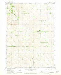 1963 Closter1964 Print · USGSAntelope and Boone Counties in the early sixties reveal a landscape of family farms and rural school districts. Genealogists and local historians can trace family-named landmarks like Star Church, Closter, and several historic schoolhouses including Star School.2 unique versions available
Showing maps 1-25 of 124
Top cities of Boone County
- Albion historical maps
- Cedar Rapids historical maps
- Petersburg historical maps
- Loretto historical maps
- Raeville historical maps
Frequently asked questions
- What are the different types of historical maps available for Boone County?
- What is the oldest map of Boone County?
- Where can I purchase historical maps of Boone County for my home or office?
- Where can I download high-res historical maps of Boone County?
- Are there historical topographic maps available for Boone County?
- Is there historical aerial imagery available for Boone County?
- Where are historical maps of Boone County sourced from?