1960s Maps of Boone County, Nebraska
Explore 11 historic maps of Boone County from the 1960s. These maps offer a rare glimpse into what life looked like during the 1960s — showing old roads, neighborhoods, homes, and landmarks that have changed or disappeared over time.
Whether you're researching your family's past, planning a metal detecting trip, or studying how Boone County's landscape evolved across the 1960s, these high-resolution maps are a powerful tool for exploring the history of this region.
- Focus on a specific era: All maps on this page are from the 1960s, giving you a focused view of this time period.
- See what’s changed: Compare century-old streets, trails, and buildings to today's modern landscape using overlays and satellite layers.
- Research with precision: Use these maps for genealogy, historical research, land use analysis, or educational projects.
- View, download, or print: Maps are fully viewable online in high resolution, and can be downloaded or printed for your own records.
Start exploring Boone County's history through authentic maps from the 1960s. This is your window into the past.
Boone County, NE maps
(11)- 1960 Map of Spalding 2 NE, 1962 Print
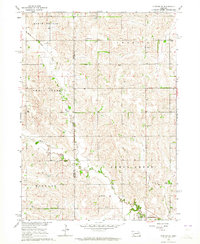
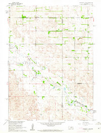 1960 Spalding 2 NE1962 Print · USGSThe rural borderlands of Wheeler and Antelope counties appear here as they were in the early 1960s, prior to widespread school consolidation. Genealogists can trace early landmarks like Park Ch and several district schools, such as Sunnyside Sch and School No 27.3 unique versions available
 - 1960 Map of Spalding 2 SE, 1962 Print
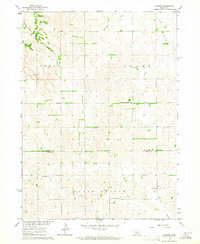
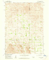 1960 Spalding 2 SE1962 Print · USGSWheeler and Boone counties in the early sixties reveal a landscape of dispersed ranching townships and rural school districts. Genealogists and local historians can trace the locations of School No 39, School No 19, and the small Cem near the banks of Mud Creek.3 unique versions available
 - 1963 Map of Petersburg, 1964 Print
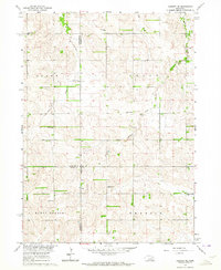
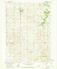
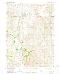 1963 Petersburg1964 Print · USGSBoone County agricultural life is captured in the early sixties as the rail-and-river economy centered on Petersburg remained vital. Researchers can trace family roots at St Johns Cem, locate rural School No 56, or follow the Chicago and North Western rail line to Loretto.2 unique versions available
 - 1963 Map of Closter SW, 1964 Print
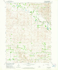
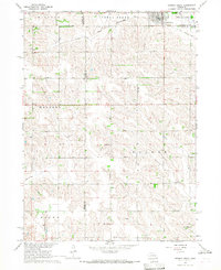
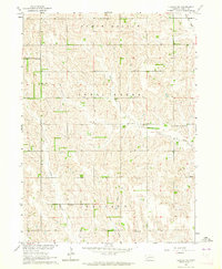 1963 Closter SW1964 Print · USGSBoone County ranchland in the early sixties reveals a landscape shaped by the O'Neil Valley and winding creek beds. Genealogists can locate numerous rural schoolhouses like School No. 78 and the South Branch Immanuel Ch.2 unique versions available
 - 1963 Map of Closter SE, 1964 Print
 1963 Closter SE1964 Print · USGSMadison and Boone counties are captured in the early sixties, showing a landscape of rural schoolhouses and creek-side settlements. Trace family roots at Shell Creek Cem, Trinity Cem, and several numbered schools like School No 38.2 unique versions available
 - 1963 Map of Elgin NW, 1964 Print
 1963 Elgin NW1964 Print · USGSAntelope County agriculture and township boundaries are clearly defined in this mid-century Nebraska survey. Genealogists and local historians can trace property lines through Lincoln and Logan, or locate local hubs like Townhall and School No 91.3 unique versions available
 - 1963 Map of Closter, 1964 Print
 1963 Closter1964 Print · USGSAntelope and Boone Counties in the early sixties reveal a landscape of family farms and rural school districts. Genealogists and local historians can trace family-named landmarks like Star Church, Closter, and several historic schoolhouses including Star School.2 unique versions available
 - 1963 Map of Closter NE, 1964 Print
 1963 Closter NE1964 Print · USGSMadison and Antelope counties appear here in the early sixties as a landscape defined by traditional rural school districts and family farms. Researchers can trace historic locations like St Pauls Ch, Bunker Hill Sch, and Rolling Prairie Sch.2 unique versions available
 - 1963 Map of Elgin SW, 1964 Print
 1963 Elgin SW1964 Print · USGSBoone County farm country is captured here in the early sixties, showing the rural township structure of the Nebraska plains. You can trace early education sites like Beaver Valley Sch and School No 89 along the winding path of Beaver Creek.2 unique versions available
 - 1963 Map of Elgin, 1964 Print
 1963 Elgin1964 Print · USGSElgin and the surrounding Antelope County plains are captured in the early sixties as a thriving railroad and farming community. Genealogists and researchers can trace the Chicago and North Western line as it connects Elgin to the southern settlement of Raeville.2 unique versions available
 - 1966 Map of Newman Grove, 1967 Print
 1966 Newman Grove1967 Print · USGSNewman Grove and the surrounding farmsteads of Madison and Platte counties are captured here in the mid-1960s. Researchers can trace the Chicago and North Western line, locate the Happy Hill Sch, or find family roots at Salem Ch.2 unique versions available
End of results
Showing maps 1-11 of 11
Top cities of Boone County
- Albion historical maps
- Cedar Rapids historical maps
- Petersburg historical maps
- Loretto historical maps
- Raeville historical maps
Frequently asked questions
- What are the different types of historical maps available for Boone County?
- What is the oldest map of Boone County?
- Where can I purchase historical maps of Boone County for my home or office?
- Where can I download high-res historical maps of Boone County?
- Are there historical topographic maps available for Boone County?
- Is there historical aerial imagery available for Boone County?
- Where are historical maps of Boone County sourced from?