Old Maps of Kearney, Nebraska for Metal Detecting
Plan your next treasure hunt with 16 historic maps of Kearney. Find old homesites, ghost towns, trails, and gathering spots that may be lost to time — perfect for identifying promising metal detecting locations.
- Locate forgotten sites: Uncover places like long-lost settlements, abandoned rail lines, or gathering spots.
- Plan better hunts: Use map overlays combined with LiDAR or satellite views to narrow in on historically rich areas.
- Made for detectorists: Thousands of hobbyists use these maps to discover relics, coins, and hidden history.
Use these historic maps to boost your research and find new opportunities beneath the surface of Kearney.
Kearney, NE maps
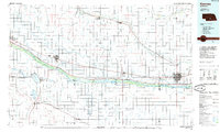
(16)- 1894 Map of Kearney
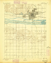 1894 Kearney1894 Print · USGSKearney and the Platte River valley are captured in the late nineteenth century as a vital railroad junction and irrigation center. Genealogists and local historians can trace early settlements like Odessa and West Kearney, or study the complex river channels around Long Island and Evarts Island.2 unique versions available
 - 1896 Map of Kearney
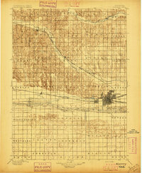 1896 Kearney1896 Print · USGSBuffalo County and the Platte River valley are captured in the late 1890s as the railroad network cemented the region's growth. Genealogists can locate family lands across townships like Williamsburg or trace the early paths of the Union Pacific R. R. and Kearney Canal.7 unique versions available
 - 1955 Map of Grand Island, 1967 Print
 1955 Grand Island1967 Print · USGSCentral Nebraska is seen here during a period of industrial and agricultural growth, centered on the vital Platte River corridor. Researchers can trace the mid-century footprints of the U S Naval Ammunition Depot and the Cornhusker Ordnance Plant.3 unique versions available
 - 1957 Map of Grand Island
 1957 Grand Island1957 Print · USGSCentral Nebraska and Northern Kansas are shown here during a period of massive hydraulic and military expansion in the mid-fifties. Researchers can trace the development of the Harlan County Reservoir and the massive wartime legacy of the Cornhusker Ordnance Plant.
 - 1958 Map of Grand Island
 1958 Grand Island1958 Print · USGSSouth-central Nebraska thrived as a rail and industrial hub during the late fifties, shaped by the braided Platte River. Genealogists and historians can trace rail lines like the Union Pacific RR through towns such as Kearney or locate the sprawling Cornhusker Ordnance Plant.
 - 1962 Map of Kearney, 1964 Print
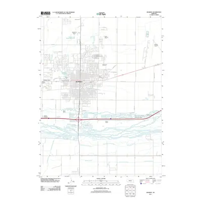
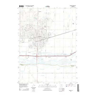
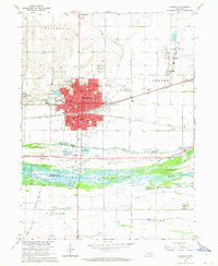 1962 Kearney1964 Print · USGSKearney and the braided Platte River are captured here in the early sixties during a period of infrastructure growth. Researchers can trace the legacy of Nebraska State Teachers College, locate the Old Fort Kearney Military Reservation, or find family ties near Glenwood Park and Buda.4 unique versions available
 - 1962 Map of Alfalfa Center, 1964 Print
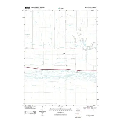
 1962 Alfalfa Center1964 Print · USGSBuffalo County is shown during the early 1960s as a landscape in transition, where new highway construction began to parallel the historic rail lines. Researchers can trace rural school districts like School No 114 and family landmarks near Dove Hill Cem and Alfalfa Center.2 unique versions available
 - 1985 Map of Kearney
 1985 Kearney1985 Print · USGSMid-1980s Nebraska life centers on the fertile Platte River valley during a period of significant agricultural and hydraulic development. Researchers can trace irrigation networks like the Phelps County Canal and find regional landmarks from Johnson Lake to the Union Pacific rail lines.2 unique versions available
 - 2011 Map of Alfalfa Center, 2011 Print
 2011 Alfalfa Center2011 Print · USGSCovers Kearney, including Sheens Trailer Court, Cottonmill Mobile Home Court, and other nearby areas
 - 2011 Map of Kearney, 2011 Print
 2011 Kearney2011 Print · USGSCovers Kearney, including R-Villa Courts, East Lawn Mobile Home Estates, and other nearby areas
 - 2014 Map of Kearney, 2014 Print
 2014 Kearney2014 Print · USGSCovers Kearney, including R-Villa Courts, East Lawn Mobile Home Estates, and other nearby areas
 - 2014 Map of Alfalfa Center, 2014 Print
 2014 Alfalfa Center2014 Print · USGSCovers Kearney, including Sheens Trailer Court, Cottonmill Mobile Home Court, and other nearby areas
 - 2017 Map of Alfalfa Center, 2017 Print
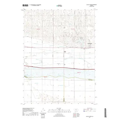 2017 Alfalfa Center2017 Print · USGSCovers Kearney, including Sheens Trailer Court, Cottonmill Mobile Home Court, and other nearby areas
 - 2017 Map of Kearney, 2017 Print
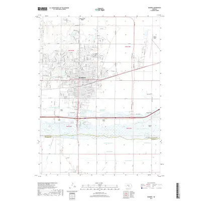 2017 Kearney2017 Print · USGSCovers Kearney, including R-Villa Courts, East Lawn Mobile Home Estates, and other nearby areas
 - 2021 Map of Kearney, 2021 Print
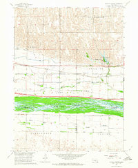
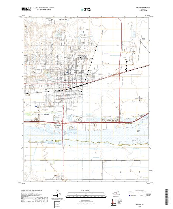 2021 Kearney2021 Print · USGSKearney and its surrounding river islands are shown here in the early 2020s, detailing a landscape defined by the Platte River. Researchers can locate civic and educational hubs like the Buffalo County Courthouse and the University of Nebraska at Kearney, or trace the complex channels around Governor Island and Killgore Island.
 - 2021 Map of Alfalfa Center, 2021 Print
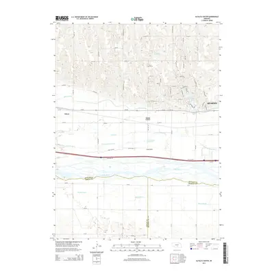
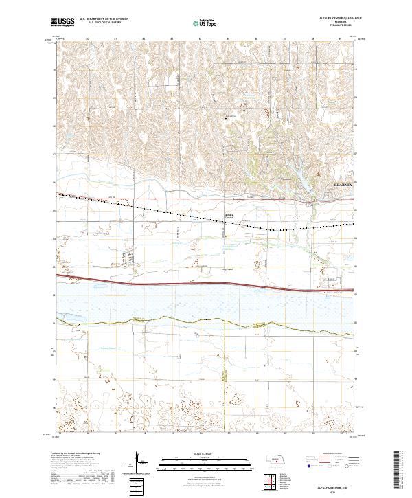 2021 Alfalfa Center2021 Print · USGSBuffalo County agriculture meets the Platte River valley in the early 2020s as the suburbs of the region's hub begin to expand. Genealogists and local historians can trace family plots at Dove Hill Cem and explore the complex hydrology of Long Island and the Kearney Canal.
End of results
Showing maps 1-16 of 16
Top cities near Kearney
- Minden historical maps
- Gibbon historical maps
- Axtell historical maps
- Odessa historical maps
- Amherst historical maps
- Newark historical maps
See more
Top neighborhoods of Kearney
- East Lawn Mobile Home Estates historical maps
- Riverside Mobile Home Court historical maps
- Valley View Trailer Court historical maps
- R-Villa Courts historical maps
Frequently asked questions
- What are the different types of historical maps available for Kearney?
- What is the oldest map of Kearney?
- Where can I purchase historical maps of Kearney for my home or office?
- Where can I download high-res historical maps of Kearney?
- Are there historical topographic maps available for Kearney?
- Is there historical aerial imagery available for Kearney?
- Where are historical maps of Kearney sourced from?